Alness
ALNESS: Flying boat station (Known as RAF INVERGORDON until February 1943)
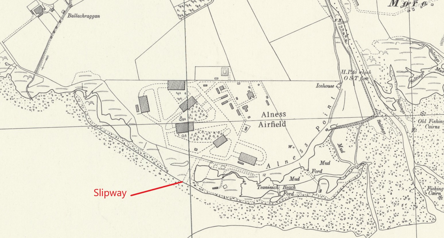
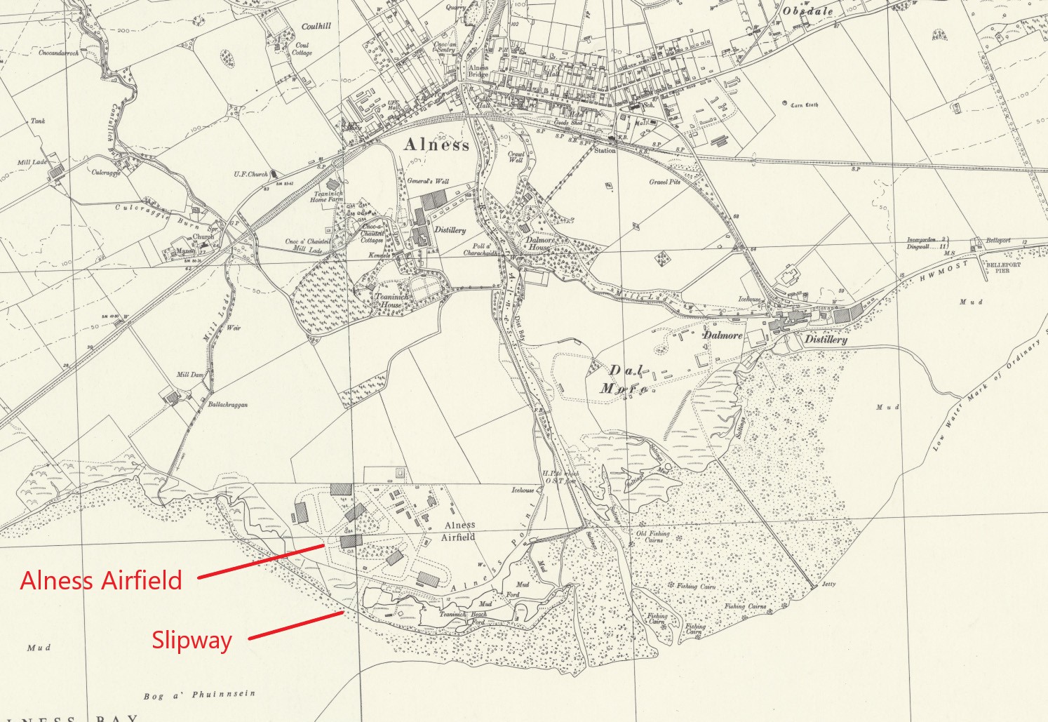
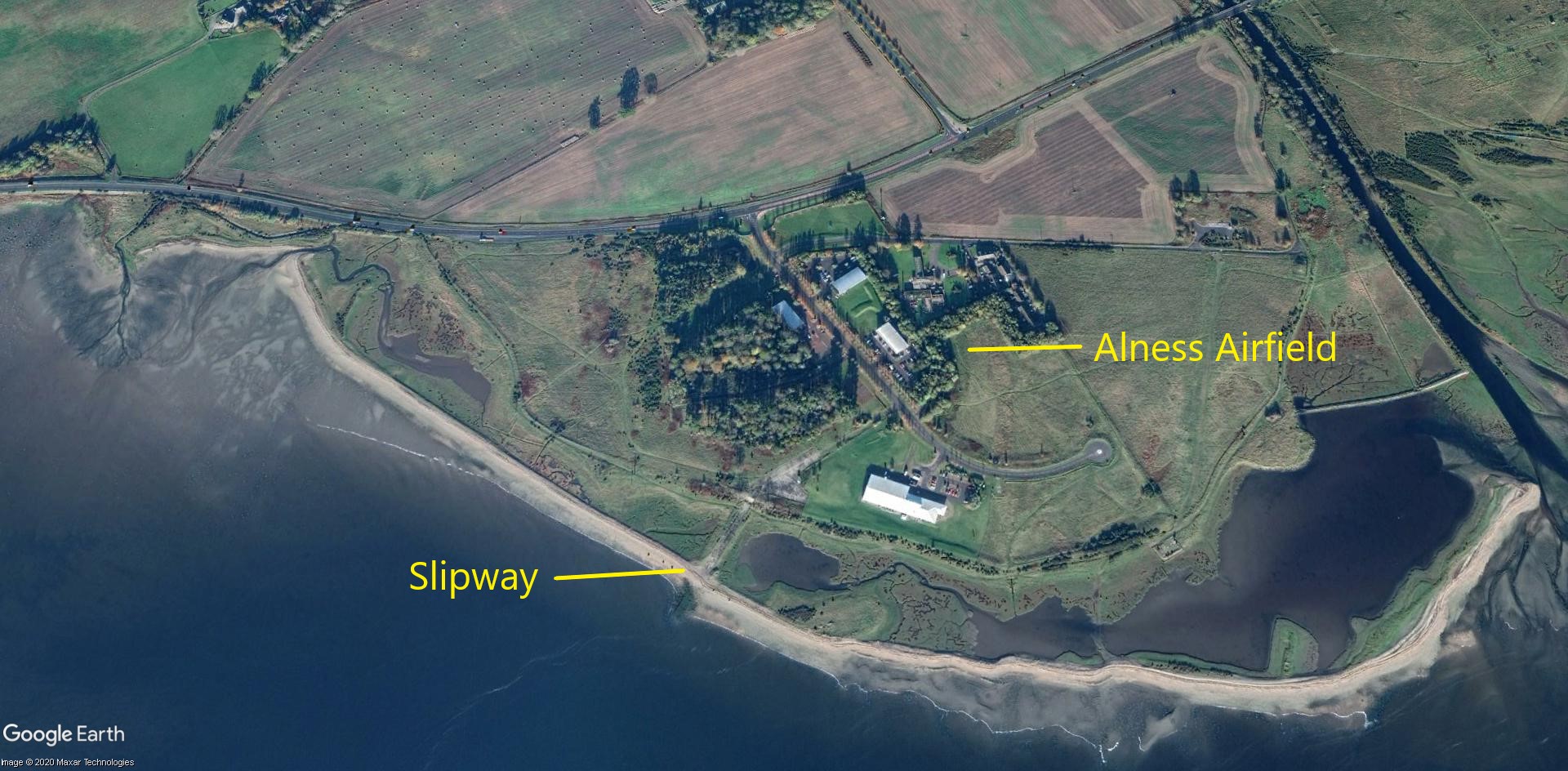
Note: All four of these maps and the picture were kindly provided by Mr Michael T Holder
Operated by: RAF Coastal Command (Possibly from Nov 1938?)
209 Sqdn (Supermarine Stranraers)
WW2:
209 Sqdn (Supermarine Stranraers) Also, 201, 210, 228 & 240 Sqdns*
No.4 (Coastal) Operation Training Unit (OTU)
No.6 Air/Sea Rescue Training Unit
No.302 Ferry Training Unit
No.1100 Marine Craft Unit
Coastal Command Flying Instructors School
Flying Boat Development Flight
Seaplane Training Squadron
Location: 1nm SE of Alness
Period of operation: 1920 to 1957
Alighting area: In Cromarty Firth starting west of Invergordon approx. 6 miles west to east and 1 to 3 miles north to south
NOTES: The probably unique semi-submersible floating dock vessel for flying-boat repairs was towed from PEMBROKE DOCKS for use here in 1938.
*At the start of WW2 201 & 240 Sqdns was operating Saro Londons. 210 & 228 Sqdns later operated Short Sunderlands.
There is also evidence of an airfield attached to this flying boat base, as seen marked on the area map above. Possibly only used in the early years by communications types such as DH9s perhaps? If anybody can kindly offer advice, this will be most welcome.
We'd love to hear from you, so please scroll down to leave a comment!
Leave a comment ...
Copyright (c) UK Airfield Guide


