


Bogton
BOGTON: RNAS Air Station

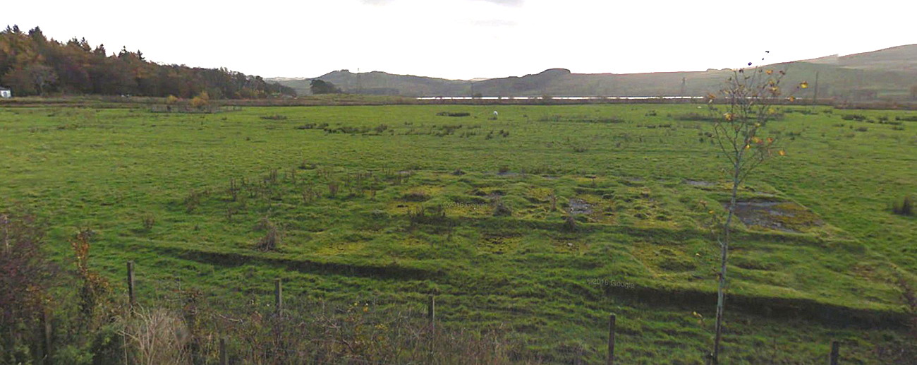

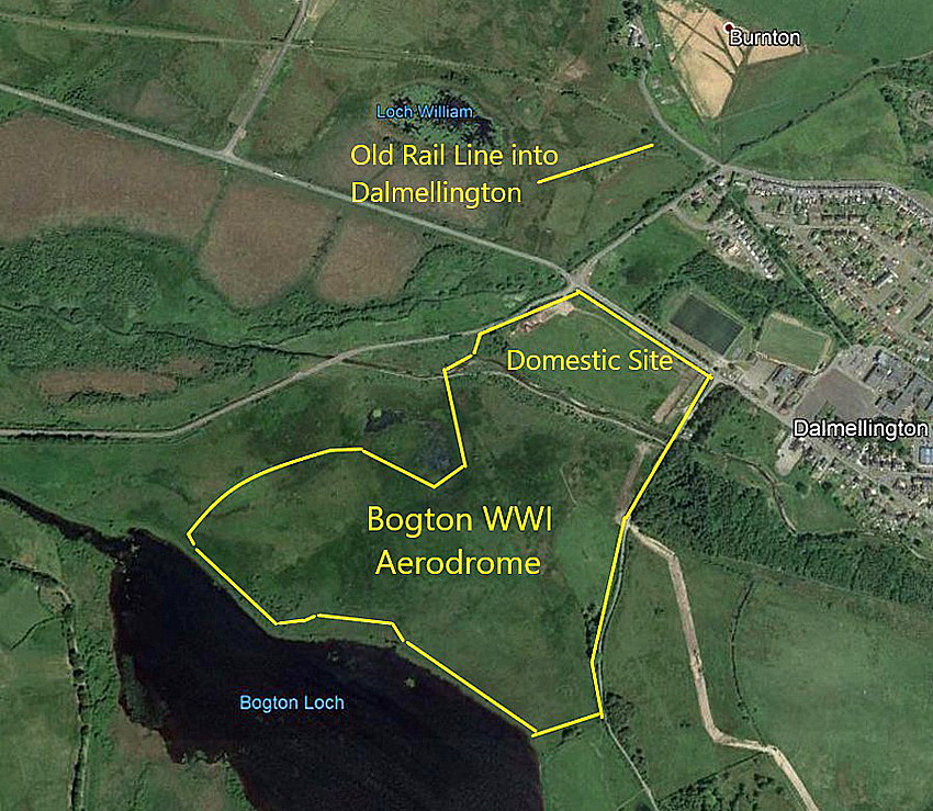
Note: These maps and pictures were kindly provided by Mr Michael T Holder who is a great friend of this 'Guide'. As he points out, in the second picture taken from the A713 looking south, clear evidence of the foundations for some of the WW1 buildings can still be seen.
Location: Close to Bogton Loch, just W of Dalmellington, on the A713
Period of operation: 1917 to ?
NOTES: After the dismal failure to establish a RNAS airfield close to LOCH DOON it was decided to attempt creating an airfield here. It wasn’t easy, but perhaps the name gave a clue - BOG TOWN? Needless to say the level of intelligence required of many senior military people at that time, they probably couldn’t make this connection.
COVERED IN CONFUSION
The reason I have two listings here (see below) is simply because I cannot find out if they were on two seperate sites, possibly co-located. I suspect the two were in fact the same site, which would make sense, but experience has taught me to be very wary of making this assumption. If anybody can kindly help to sort this out, such advice will be most welcome.
BOGTON LOCH: Used by the RNAS as a water flying site, possibly a RNAS Air Station?
(Also known simply as BOGTON?)
Location: About 1nm W to WSW of Dalmellington
Period of operation: 1917 to 1919?
NOTES: It sometimes seems hard to say whether or not BOGTON LOCH became an official RNAS Air Station. But it does appear that on 7th November 1917 Col. Gordon was appointed Commandant of BOGTON LOCH and on December 26th that year it was declared a prohibited area.
On the other hand one highly respected source reckons it was a Flying School site, (A sub-station for SAG LOCH DOON), and a Storage Station for the RFC/RAF from January 1917 to August 1918.
R .wallace
This comment was written on: 2019-05-30 13:03:38actually the air field was in on the edge of dalmellington . the bottom loch was nearby.the actual air school of gunnery was to be established at loch Doon a few miles away from the village of dalmellington.600 feet above sea level and surrounded by hills some nearly 2000 feet in height, exposed to strong rain bearing winds.before heeding the advice of local farmers ,land owners about the ground being unsuitable ,the air ministry went ahead with the project.then they decided on building the bottom air field and expecting the plane's to fly to loch doon.they had a large civilian work force,royal engineers,RFC(raf) and German prisoners of war at work at loch doon.after questions were asked in London about the escalating cost the project was abandoned.you will find more information in a book Scottish aerodromes of the first world war by Malcolm fife
We'd love to hear from you, so please scroll down to leave a comment!
Leave a comment ...
Copyright (c) UK Airfield Guide

