Cefnleisiog
CEFNLEISIOG: Ad hoc landing site
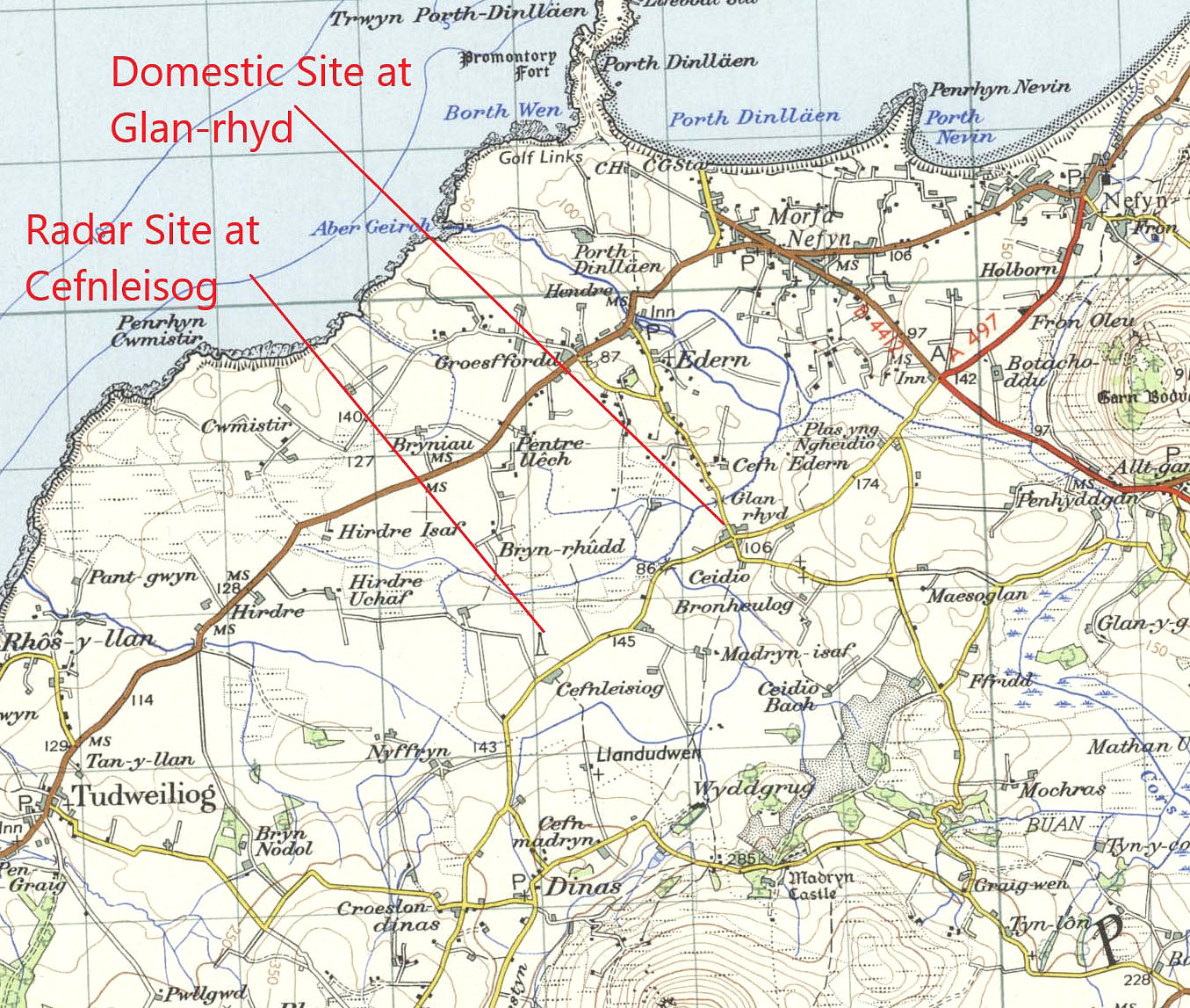
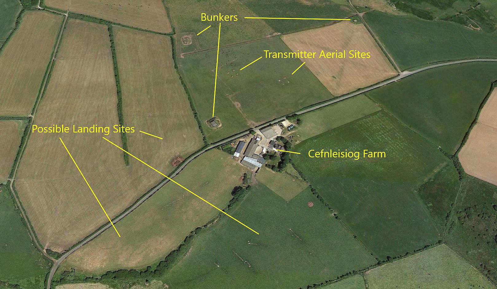
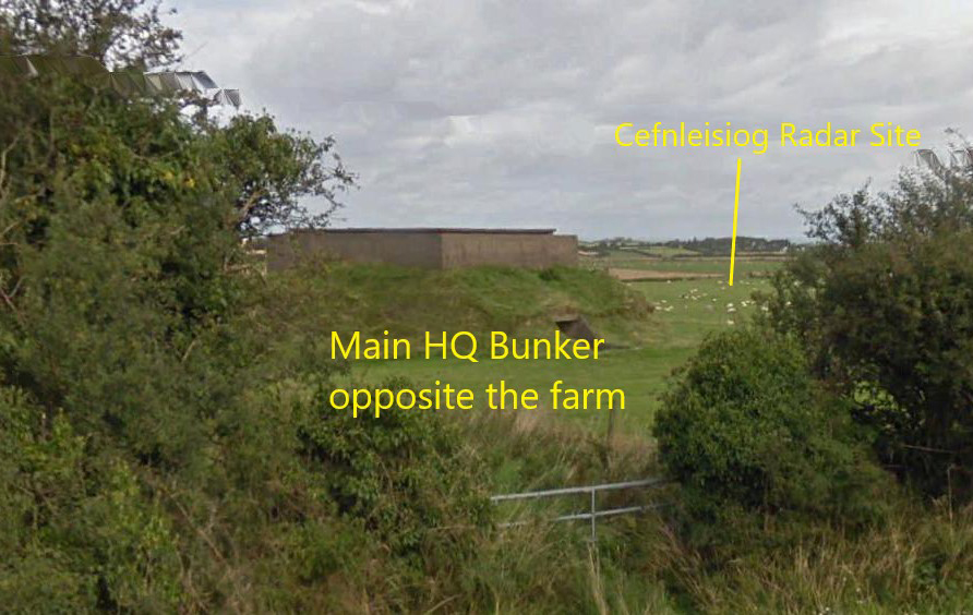
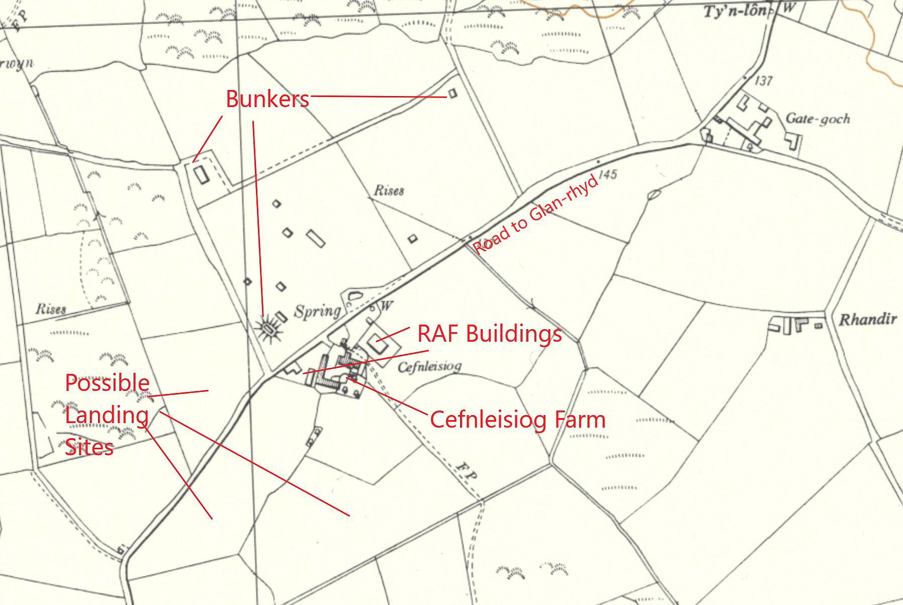
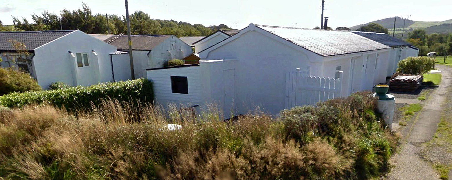
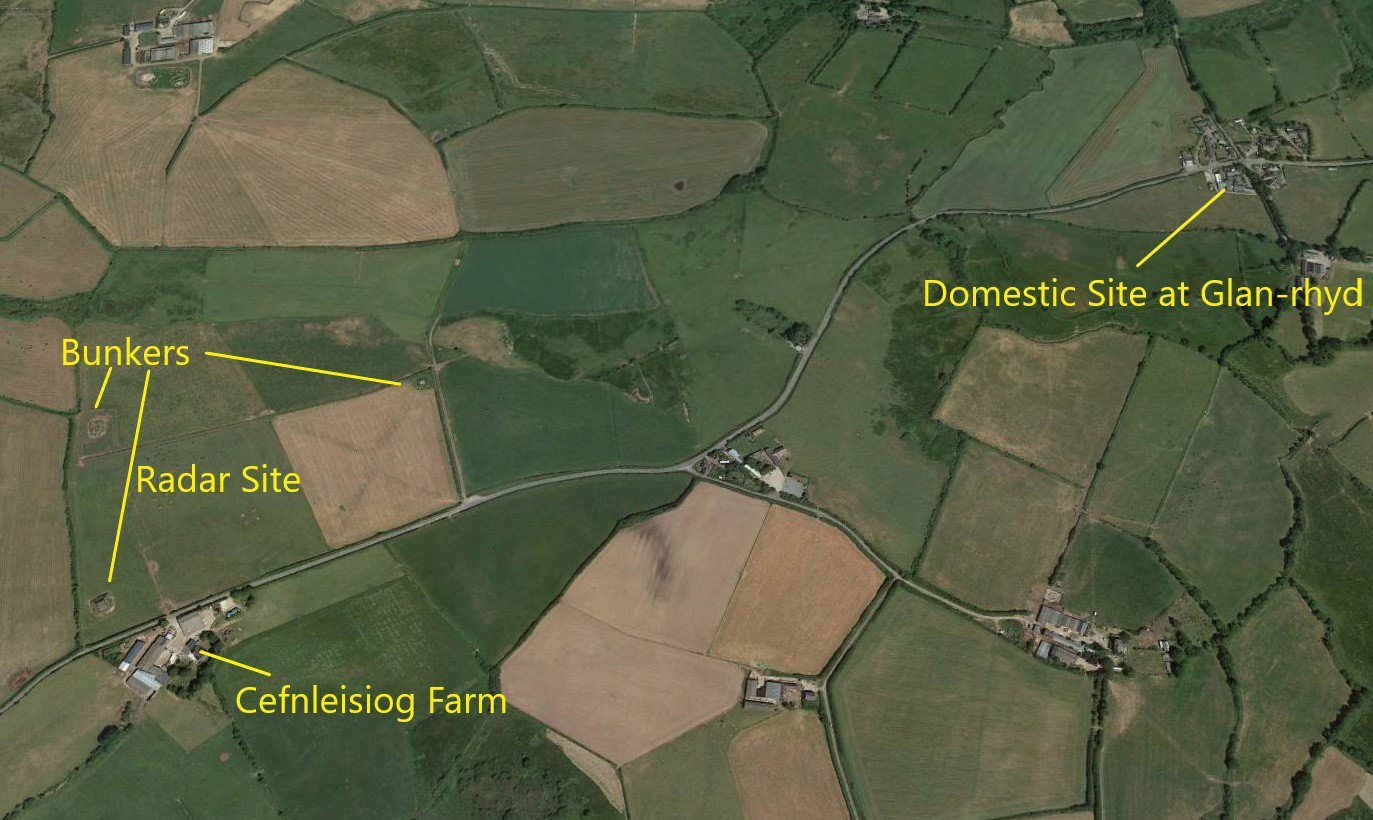
Note: These two maps and the four Google © pictures were kindly provided by Mr Michael T Holder
Location: Just NE of Tudweiliog, about 3nm SW of Nefyn and roughly 7.5nm W to WNW of Pwllheli town centre
Period of operation: WW2 only?
NOTES: Over the years I have received so many reports and information of flying sites from so many diverse sources. Often somebody just walking, cycling or driving by, spotting a windsock or an aircraft landing of taking off or landing. A picture in a family album, a mention in an inherited log-book - the permutations seem endless - and so much appreciated of course.
However, I very much doubt I have had a story quite as convoluted as this account sent to me by Mike Holder who is a great friend of this 'Guide'. In many ways quite extraordinary. I often think of Mike as a kind of aviation history Rottweiler, once he's got his teeth into something - he doesn't let go! Unlike the dog of course, we all end up benefitting as a result.
THE START OF THE STORY
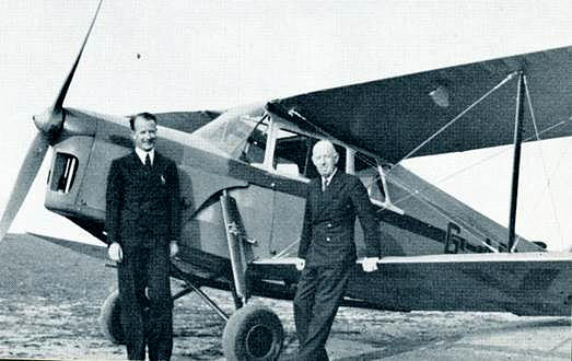
Just before and after WW2 his father worked for Pasolds Knitwear in Langley, Buckinghamshire. As Mike explained, all three Pasold brothers were keen aviators and learnt to fly at HESTON on the Avro 638 Club Cadet G-ACHN. They had their own aircraft, the DH87B Hornet Moth G-AEKS which was also based at HESTON and registered to Eric Walter Pasold from the 7th February 1938.
Note: Eric Pasold is standing on the left. Rolf Pasold went on to fly with the ATA (Air Transport Auxilliary) during WW2 ferrying fighters and other types. Ingo Pasold was a successful competitor in the British National Gliding Championships on 1938.
SO - WHAT HAPPENED TO G-AEKS?
On the 21st January 1940 it was requistioned by the RAF and allotted the serial number W5753. I am fond of saying - "Where there's a will, there's a relative," and in similar fashion: Where there's a crash there's a report. It may well be hidden somewhere, but it's there. As Mike tells us; "On a trip for 77 Wing (Signals) on 10 October 1941, from RAF Hawarden to Cefnleisiog, flown by Pilot Officer T M Calderwood with AcJ Noblett as passenger, the aircraft struck a hedge on overshoot and crashed - fortunately there were no fatalities. Eric Pasold's aircraft was written off."
ANOTHER ASPECT FOR THIS 'GUIDE'.
Although I have tracked down a great many landing sites used by light liaison aircraft, both RAF and USAAF, which were not in any way recognised airfields, without any doubt there are a great many more that were used. We always need to remember just how backward the UK road network was in those days, especially in a remote region such as this. Therefore if important spares, documents and indeed senior officers needed to travel at short notice, the only option as often as not, was to fly.
WHERE DID W5753 ACTUALLY CRASH?
The short answer is - we'll probably never know? As Mike points out; "If the report is correct - he crashed at Cefnleisiog and not near the domestic site at Glan-rhyd. The two fields SW and S of the farm are the strong candidates - well clear of buildings and aerials. But he could have used the field to the west of the Station, especially with a northerly wind. It will remain a mystery." Unless of course, somebody can kindly offer advice?
LAST BUT NOT LEAST
Both Mike and myself fail to understand why this radar station was built here. Mike thinks it could well have been constructed to detect Luftwaffe bombers heading for Belfast? Which led me to think about what route(s) did the Luftwaffe use to attack Belfast? And indeed, how often? It seems trawling the inter-web that Belfast was only bombed four times, between April and May 1941. Exactly the period when this 'accident' happened.
The routes the Luftwaffe bombers used remains a mystery. This said, if I was planning such raids, surely a route from northern France, crossing southern England well away from the best defended points, across southern Wales to the Nazi regime friendly shores of the Irish Republic, must surely be the preferred route?
We'd love to hear from you, so please scroll down to leave a comment!
Leave a comment ...
Copyright (c) UK Airfield Guide


