Chestnut Farm
CHESTNUT FARM: Temporary aerodrome
Operated by: Alan Cobham’s 1932 National Aviation Day UK Display Tour
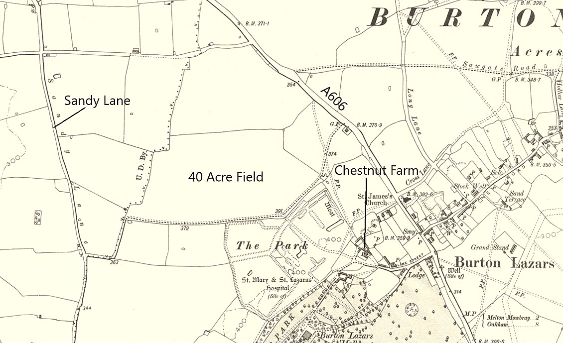
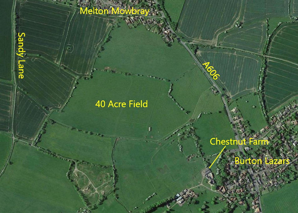
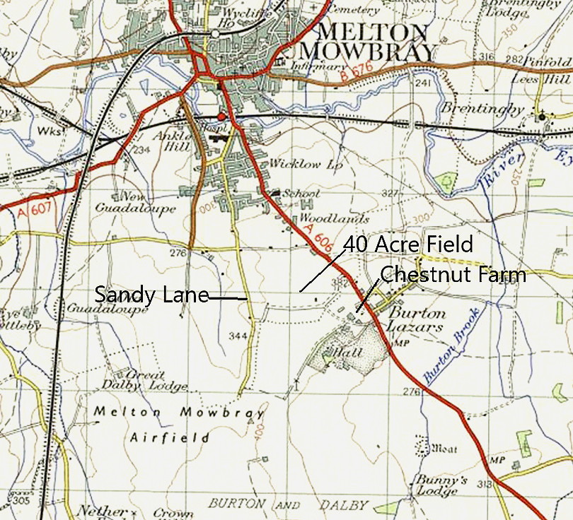
Location: E of Sandy Lane, W of the A606, just NNW of Burton Lazars village, about 1.5nm SSE of Melton Mowbray town centre
Period of operation: 10th May 1932
A MICHAEL T HOLDER GALLERY
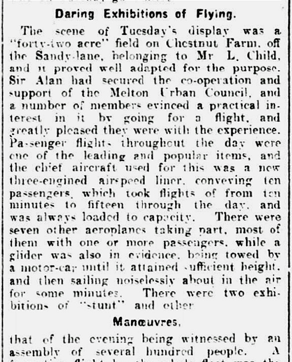
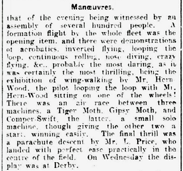
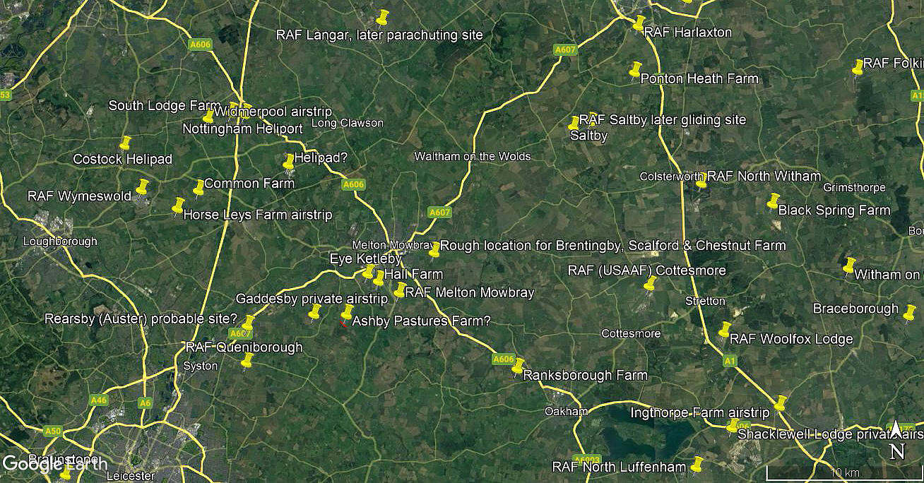
Note: The newspaper article was published in the Grantham Journal on the 14th May 1932. The area view is from my Google Earth © derived database.
NOTES: Was this the only time this location was used? The British Hospitals Air Pageant performed in/near Melton Mowbray on the 30th May 1933, but we have yet to find out where that venue was located.
JUST FOR THE RECORD
This location has been referred to, at the time, as "42 Acre" field, presumably known as such by the farmer Mr L Child who rented it out to the Cobham organisation, and quoted as such in the article above. Mike Holder, such a good friend of this 'Guide', and a retired RAF navigator, who takes nothing for granted, decided to check this out using an Ordnance Survey map, and has deduced that it was actually 40.180 acres. Hence his contribution showing "40 acres".
ANOTHER ASPECT
This exercise does of course help illustrate just how much navigation and mapping techniques have advanced over the years. During the 1920s and 1930s, virtually all major advances in aerial navigation resulted from the requirements of commercial airline operations. The RAF were nigh in useless, aircrews often gettig lost on quite easy daytime cross-country sorties.
World War Two soon changed that of course, but it did take two or three years. When the war started, some crews, (only a few admittedly), couldn't even find the country, let alone the target! Even if they did get close to the target, most bombs fell miles away. Something had to be done as a matter of some urgency, and the boffins came up with a radio based system, following a beam. Maps, in effect, only being required when flying beyond the range of the radio signals and below cloud levels, plus of course at night, astral navigation techniques.....if you were above cloud.
JUST A NOTE
It is feasible if not probable (?) that this site is exactly the same site as the SANDY LANE location? See seperate entry.
We'd love to hear from you, so please scroll down to leave a comment!
Leave a comment ...
Copyright (c) UK Airfield Guide


