Now having 7,000 + listed!

Probably becoming the most extensive British flying sites guide online...?

portfolio1 portfolio2 portfolio3 portfolio4

Heading 1

This is an example of the content for a specific image in the Nivo slider. Provide a short description of the image here....

Heading 2

This is an example of the content for a specific image in the Nivo slider. Provide a short description of the image here....

Heading 3

This is an example of the content for a specific image in the Nivo slider. Provide a short description of the image here....

Heading 4

This is an example of the content for a specific image in the Nivo slider. Provide a short description of the image here....

small portfolio1 small portfolio2 small portfolio3 small portfolio4
themed object
A Guide to the history of British flying sites within the United Kingdom
get in touch

Church Inn Field


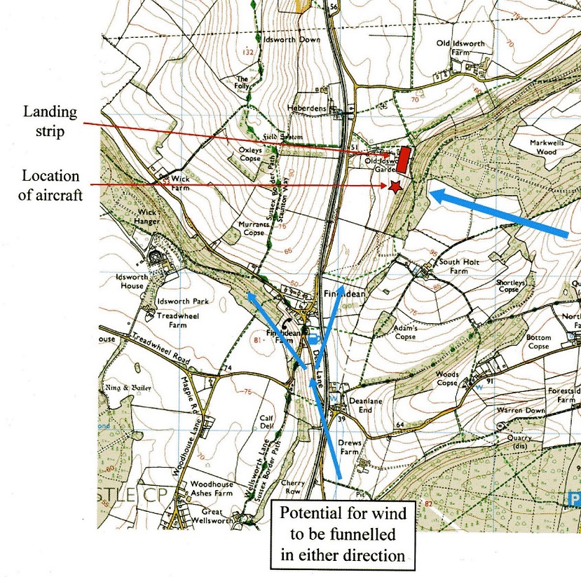
CHURCH INN FIELD: Private airstrip


Map of Church Inn Field location

Note: This map is reproduced from the AAIB Bulletin who used the Ordnance Survey map; © Crown copyright 2008.

Location: About 0.5nm NNE of Finchdean, roughly 4nm NE of Havant town centre and about 10nm NW of Chichester
 

Runway: SW/NE  Probably around 02/20 (about 400? - looks longer)    grass


NOTES:  Initial info source was the AAIB report EW/G2008/05/01. A look at the site on Google Earth in 2017 shows no obvious runway. Can anybody kindly advise if this was a 'one off' visit, or is the field used more regularly by microlights?

I originally had this strip listed as being in SUSSEX but as Finchdean village is in HAMPSHIRE I have decided to put it in this County.


We'd love to hear from you, so please scroll down to leave a comment!


Leave a comment ...


Name
 
Email:
 
Message:


Copyright (c) UK Airfield Guide


slide up button