Cippenham
CIPPENHAM: Private airfield (Aka EVERETT'S CORNER)
Operated by: Aerial Message Service
Location: Just S of the A4 Bath Road, about 2nm WNW of Slough town centre, and just SW of Slough Trading Estate
Period of operation: 1930s only?
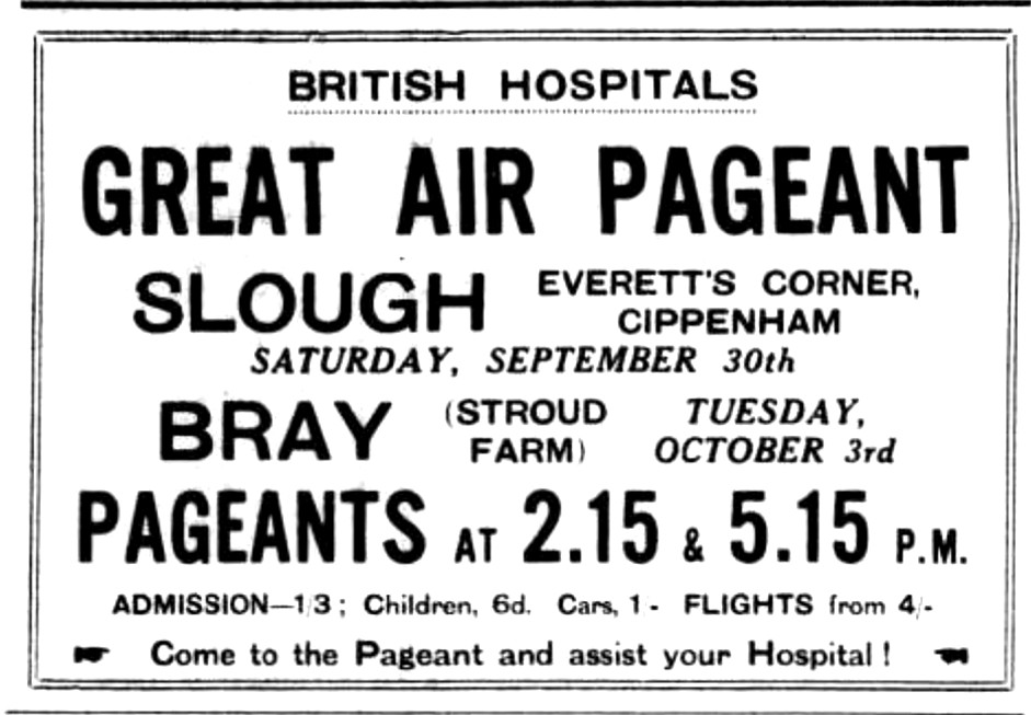
Flying Circus venue: British Hospitals Air Pageant, 30th September 1933
NOTES: What was and/or who were the Aerial Message Service? So far (by 2016) I have been unable to unearth any information. Was it perhaps a banner-towing operation?
A MICHAEL T HOLDER GALLERY
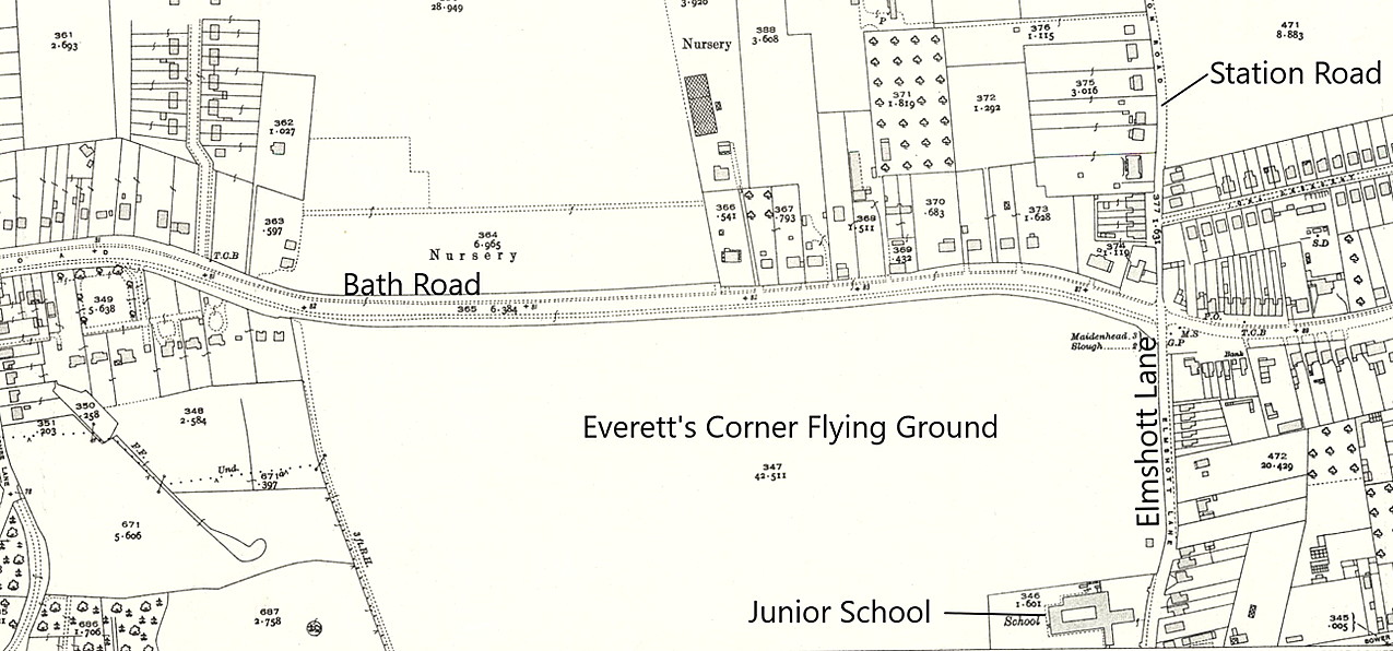
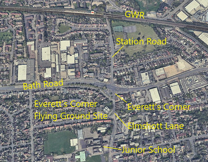
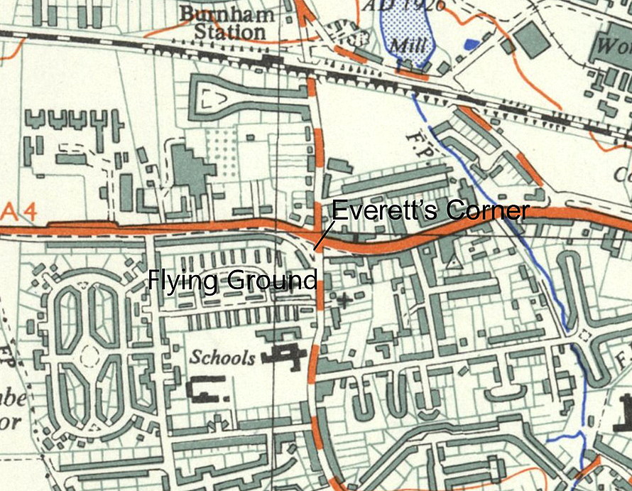
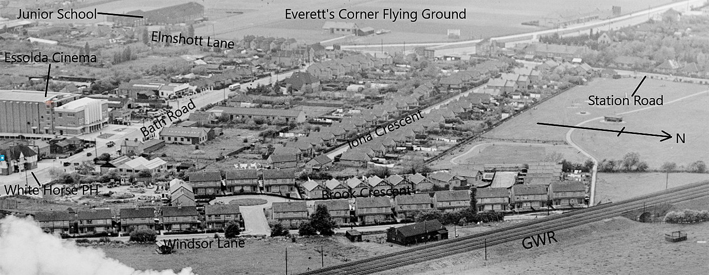
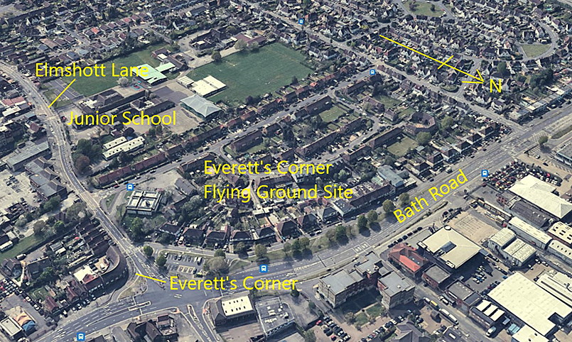
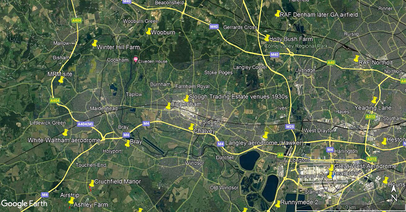
Although listed previously, we have Mike Holder, a great friend of this 'Guide', to thank for delving into this location in late 2022 and providing us with the following maps etc, regarding this barely remembered flying site. If anybody can kindly offer more advice and information, this will be most welcome.
Note: The advert was published in the Windsor, Slough & Eton Express on the 29th September 1933.
Note: The local area view is from my Google Earth © derived database. It is perhaps worth mentioning that this illustration does not show, even in this area, all the flying sites listed in the 'Guide'. And, even after over twenty years of research into the subject, not only are there many hundreds of flying sites still to be added, new flying sites are still being discovered virtually every week! This note being made in October 2022, and, I fully expect the trend may well continue for years to come - and indeed - long after my tenure on our planet has ceased.
A FABULOUS HISTORY
I had absolutely no idea when starting this project as to how it would develop. I started it thinking I knew a thing or two about our aviation history - and was totally correct - I did indeed know a thing or two. But that was all I knew! As the project progressed, almost from the start, I soon realised just how little I knew, so nothing much has changed in that respect.
What has become abundantly clear is that we have, in the U.K., a quite astonishing and indeed unique aviation heritage, especially regarding the sheer amount of locations. This being measured of course by the area of the U.K. and population. We got a head start from the rest of the world in the 19th century when, during the industrial revolution the production of coal gas resulted in towns being lit by this means. Those involved with ballooning soon realised that coal gas, although far less efficient as a 'lifting agent', was much cheaper, and increasingly becoming available. In those days a balloon launch drew crowds of thousands, and a great many towns agreed to host a launch.
We'd love to hear from you, so please scroll down to leave a comment!
Leave a comment ...
Copyright (c) UK Airfield Guide


