Now having 7,000 + listed!

Probably becoming the most extensive British flying sites guide online...?

portfolio1 portfolio2 portfolio3 portfolio4

Heading 1

This is an example of the content for a specific image in the Nivo slider. Provide a short description of the image here....

Heading 2

This is an example of the content for a specific image in the Nivo slider. Provide a short description of the image here....

Heading 3

This is an example of the content for a specific image in the Nivo slider. Provide a short description of the image here....

Heading 4

This is an example of the content for a specific image in the Nivo slider. Provide a short description of the image here....

small portfolio1 small portfolio2 small portfolio3 small portfolio4
themed object
A Guide to the history of British flying sites within the United Kingdom
get in touch

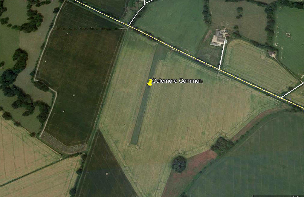
Colemore Common


COLEMORE COMMON:  Microlight strip     (also known as HOME FIELD)

Aerial view
Aerial view

Note:  This picture (2018) was obtained from Google Earth ©


Operated by:                Hampshire Microlight Club


Location:   About 1nm SSW of Colemore hamlet, E of the A32 and about 4 or 5 nm NW of Petersfield

Period of operation:    From the 1990s (?) to -


Runway:     02/20   450x18  grass    


NOTES: One account says this strip is 5 miles NW of Alton which is obviously a mistake, but time and time again in producing this 'Guide' I have had to deal with so many similar situations whereby so many people trying to compile serious records simply failed to look at a map!

Oddly, a look at Google Earth in 2018 (and back to 1999) clearly shows the airstrip, but with no apparent infrastructure such as a hangar or clubhouse.


We'd love to hear from you, so please scroll down to leave a comment!


Leave a comment ...


Name
 
Email:
 
Message:


Copyright (c) UK Airfield Guide


slide up button