Cumminess
CUMMINESS: Regional airport (Aka STROMNESS AIRPORT)
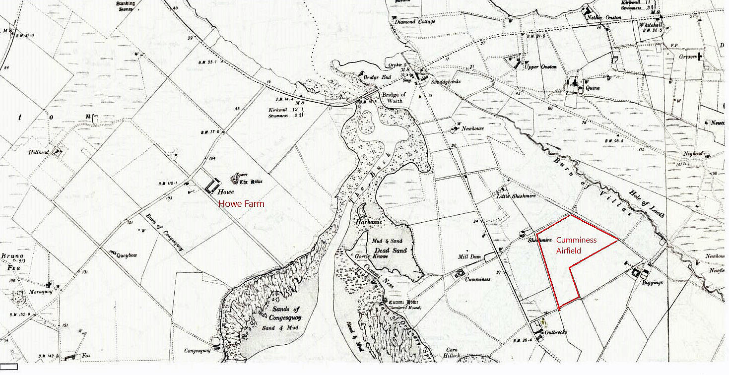
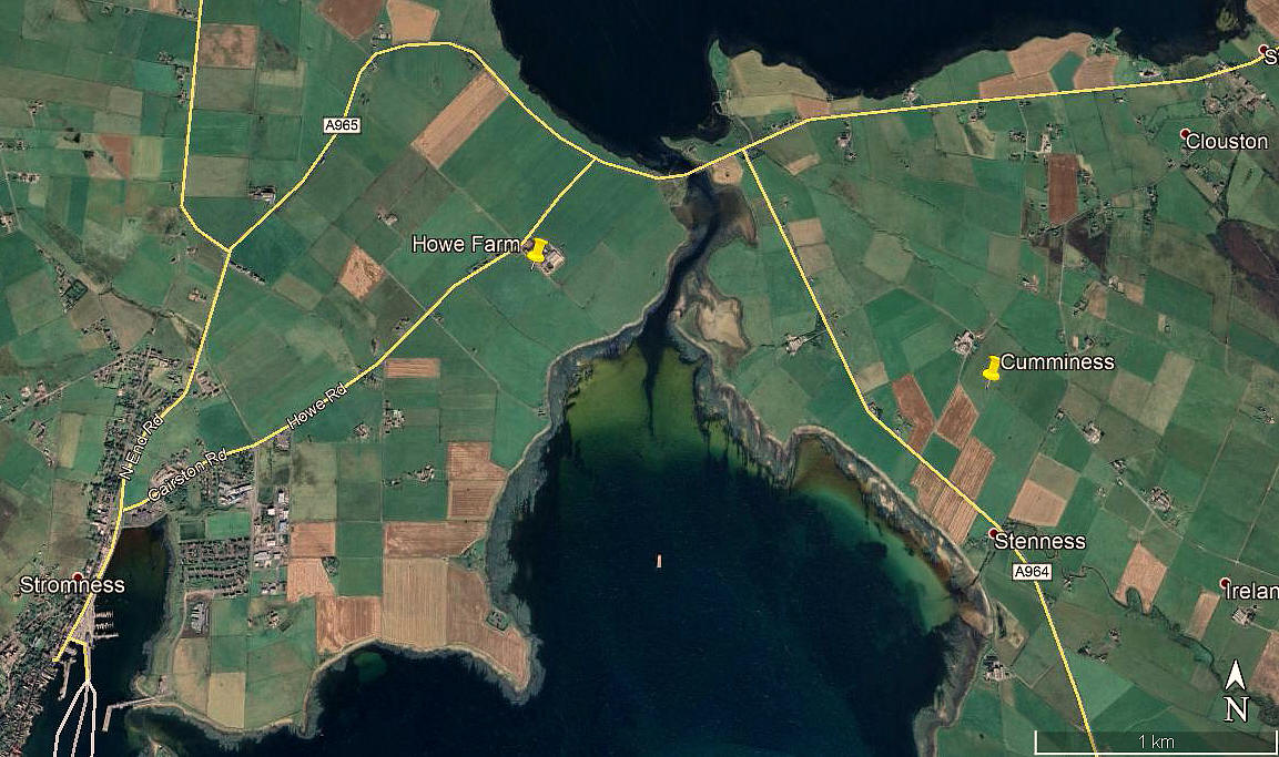
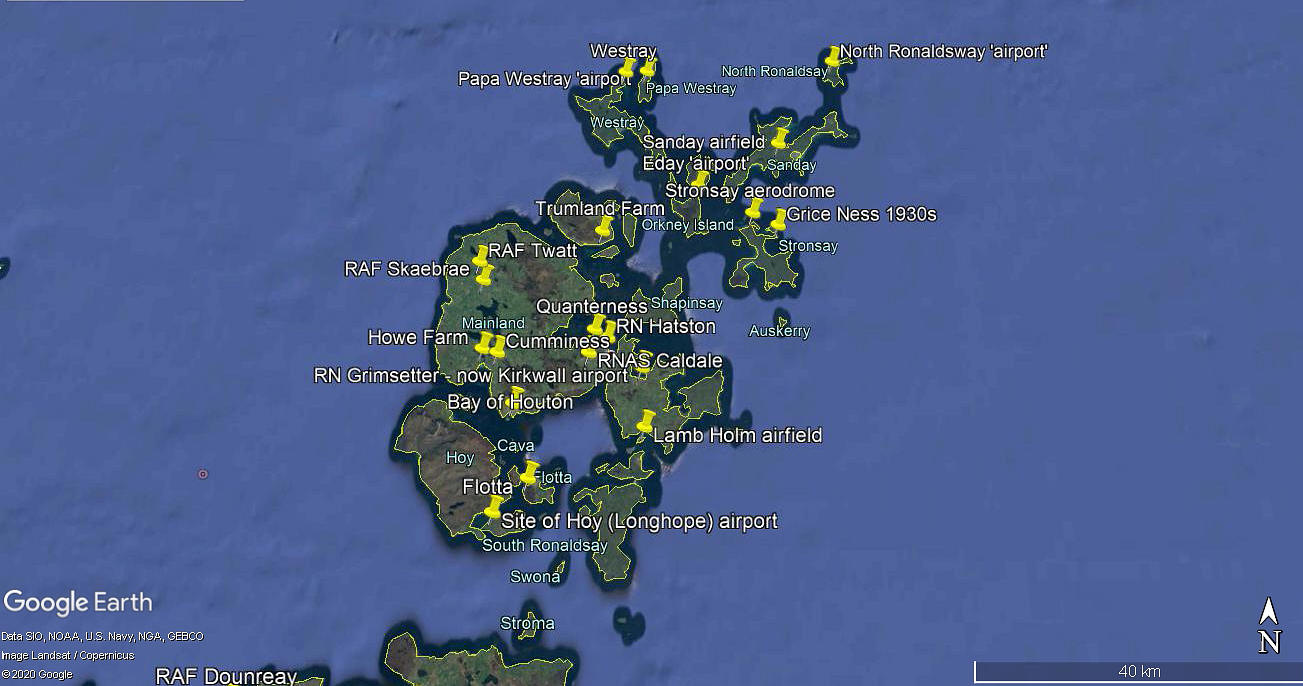
Note: The map was kindly provided by Mr Michael T Holder. The other two pictures were obtained from Google Earth ©
Operated by: Aberdeen Airways, Allied Airways
Note: Aberdeen Airways changed its name to Allied Airways in 1937.
Location: 2.5nm ENE of Stromness town centre
Period of operation: Possibly 1935 (?) to -
Note: The problem here is that it appears that Aberdeen Airways also operated from HOWE FARM from May 1935. To date it seems that the logical answer is that HOWE FARM was used initially but that CUMMINESS later proved a more suitable site, and this is where the company erected a hangar.
NOTES: It appears a photograph exists of the DH.84 Dragon operated by Aberdeen Airways from 1935 which “used to land” at CUMMINESS near Brig o’Waithe. Some investigation by Mike Holder reveals this was probably G-ADFI.
Mike also found this account from the Western Mail dated Monday 31st January 1938.
"MISSING" PLANE FOUND ON SMALL ISLAND AFTER ORKNEY'S SEARCH
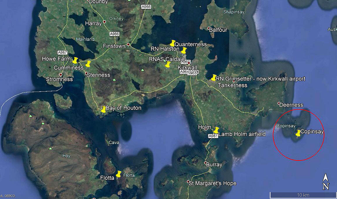
"Anxiety on Sunday for an air-liner that disappeared in the Orkneys was relieved after several hours' search by the discovery of the aeroplane and its pilot safe on Capansay Island."
"The air-liner, belonged to Allied Airways Gandar Dower, Ltd, and piloted by Capt. "Bill" Bailley, had landed passengers from Thurso at Quanyterness Aerodrome, Kirkwall. It then took off in the dusk, with snow falling, for its hangar at Stromness Aerodrome, 10 miles away, and also on the Island of Orkney. It failed to arrive and search parties of police and civilians set out."
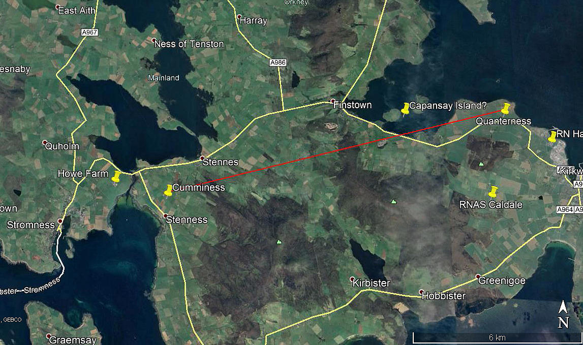
Note: This picture was obtained from Google Earth ©
HOW WRONG CAN YOU BE?
Having read this report I jumped to the conclusion that this pilot would have flown in pretty much a straight line. And wrote this, asking Mike Holder to give it the once over.
"Efforts to find Capansay Island failed miserably, but not much time can be spent with, in 2020, at least another 500 flying sites to add. However, as the Google Earth picture shows, islands along this route are few and far between. Just two in fact, and the western isle has a causeway link, is looking inhabited today, so probably was then. No doubt Capt. Bailley was fully aware of this, and quite likely expected to be fed together with a wee dram."
Mike, bless him, having spent many years as a navigator on Vulcans, Comets and latterly Nimrods in northern Scotland - especially pertinent in this case, sent me a highly detailed explanation as to why a direct line flight would not have been possible in these circumstances. The pilots only option would have been to follow the coast at very low level, flying clockwise around to Stromness. So therefore, the island he landed on, without much if any doubt, would have been COPINSAY - not CAPANSAY as the report states. Which indeed, also explains why I could find no trace whatsover of a Capansay Island in the Orkney Islands.
Note: This picture was obtained from Google Earth ©
I trust you will find Mike's account as fascinating as I did.
"Dick, from days of search and rescue on Nimrods this is how I see it:"
"This was an accident waiting to happen; up here in January - and especially Orkney which is further north - the sun doesn't get much above 15º in January. It's permanently dusk up here and he was reported to have taken off at "dusk" to fly the short leg from Kirkwall to Howe. Snow was falling so the ceiling was low and the viz was poor; also I'm sure the de-icing capabilities of the aircraft were limited."
My note: They were none existent.
"This was press-on-itis at its worst! Even in good weather he was probably going to make a near night landing on a dark field - lovely! (Fresson was adept at this - he would open his window and poke his torch out to glimpse the ground - bonkers! My daughter had a book on him for a school project.)"
"So once airborne, had he climbed too high (above 300ft ish), he would have gone IMC - so he would have wanted to remain visual with the deck. (There are hills over 800ft close to his direct track between the airfields and a 700ft hill one mile south of the airfield. There is a narrow gap at Finstown to get through the hills - dodgy in those conditions). I guess he took off in a NW/N direction - snow showers indicate a northerly air flow - and stayed over the sea probably turning right on a south easterly heading towards the gap between Shapinsay and Mainland Orkney, and into the Shapinsay Sound. He was probably hoping to cut across to Scapa Flow near where Kirkwall Aerodrome is, but the cloud base was probably down to 300ft and the ground is 300ft plus south of Kirkwall."
"He would then have kept over the sea to go round Mull Head and head south to follow the coast round to Scapa Flow and enter via Lamb Holm and Glims Holm. By the time he got abeam Copinsay, the weather was probably deteriorating with constant snow showers - and being bloody because of the time of day (thick cloud would have made it worse) - with an outbreak of common sense - he put it on the deck at Copinsay. Live to fight another day!"
"No weather radar or satellite pictures in those days - the met man probably had a piece of seaweed. It was seat of the pants and local experience that got them through."
Which just goes to show how much effort goes into logging a forced landing site, which won't appear as a seperate listing in this 'Guide'.
We'd love to hear from you, so please scroll down to leave a comment!
Leave a comment ...
Copyright (c) UK Airfield Guide


