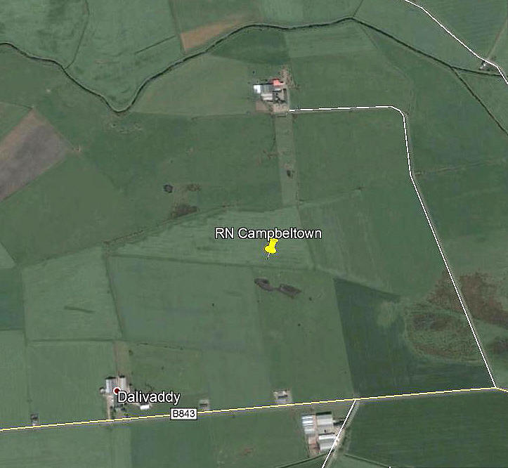
Dalivaddy
DALIVADDY: Civil regional airport (Aka STRATH FARM - which has a seperate entry)
Note: Without much doubt at all this site became RN CAMPELTOWN in WW2.
NOTE: Please see the listing for CAMPBELTOWN when it should all become clear.
Note: This picture (2007) was obtained from Google Earth ©
Location: S of Machrihanish airfield (now Campbeltown airport) on the B843. Isle of Kintyre.
NOTES: The first point to make, as pointed out many times elsewhere in this ‘Guide’ is that during the 1930s and into WW2 a regional airport could comprise nothing more than a suitable field with a windsock. And, possibly only the better equipped ‘airports’ had a windsock!
In his book Air Ambulance Iain Hutchison provides, (although I suspect he didn’t fully realise it?), some invaluable information regarding flying sites from the late 1930s and into WW2 regarding the area surrounding Campbeltown and indeed all of Scotland. Which clearly illustrates that the new military airfield of MACHRIHANISH, (operational from 1941), was not allowing any civil flights to land, not even air ambulance flights.
HELEN SUTTON
He tells the story of Helen Sutton, and notes the aircraft had their windows masked so passengers couldn’t spy on military activities. “It was January 1943 when I was taken on an emergency air ambulance for the birth of my first baby.” – “In those days the plane was using an airstrip on a field at Strath Farm or at Dalivaddy. It was a very foggy day and the plane had to be diverted from its usual landing place but we got to Glasgow eventually.”
We'd love to hear from you, so please scroll down to leave a comment!
Leave a comment ...
Copyright (c) UK Airfield Guide


