Devonshire Park
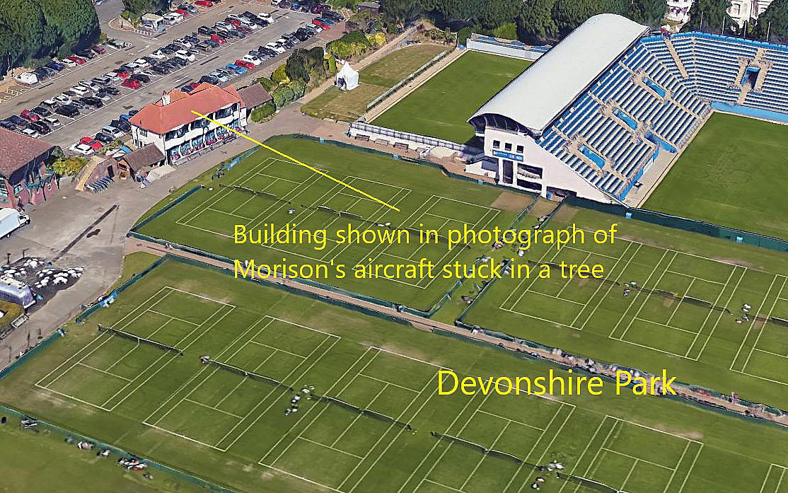
DEVONSHIRE PARK: Crash site at a proposed temporary Landing Ground
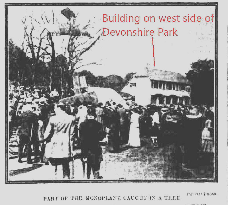
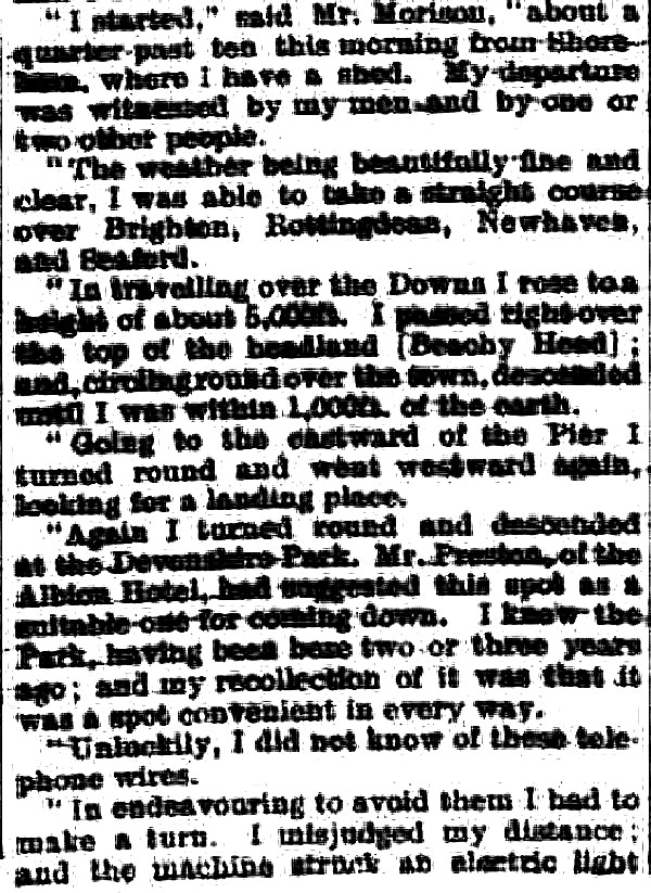
Note: All six of these images were kindly provided by Mr Michael T Holder. The newspaper excerpt is from the Eastbourne Gazette, published on the 19th April 1911.
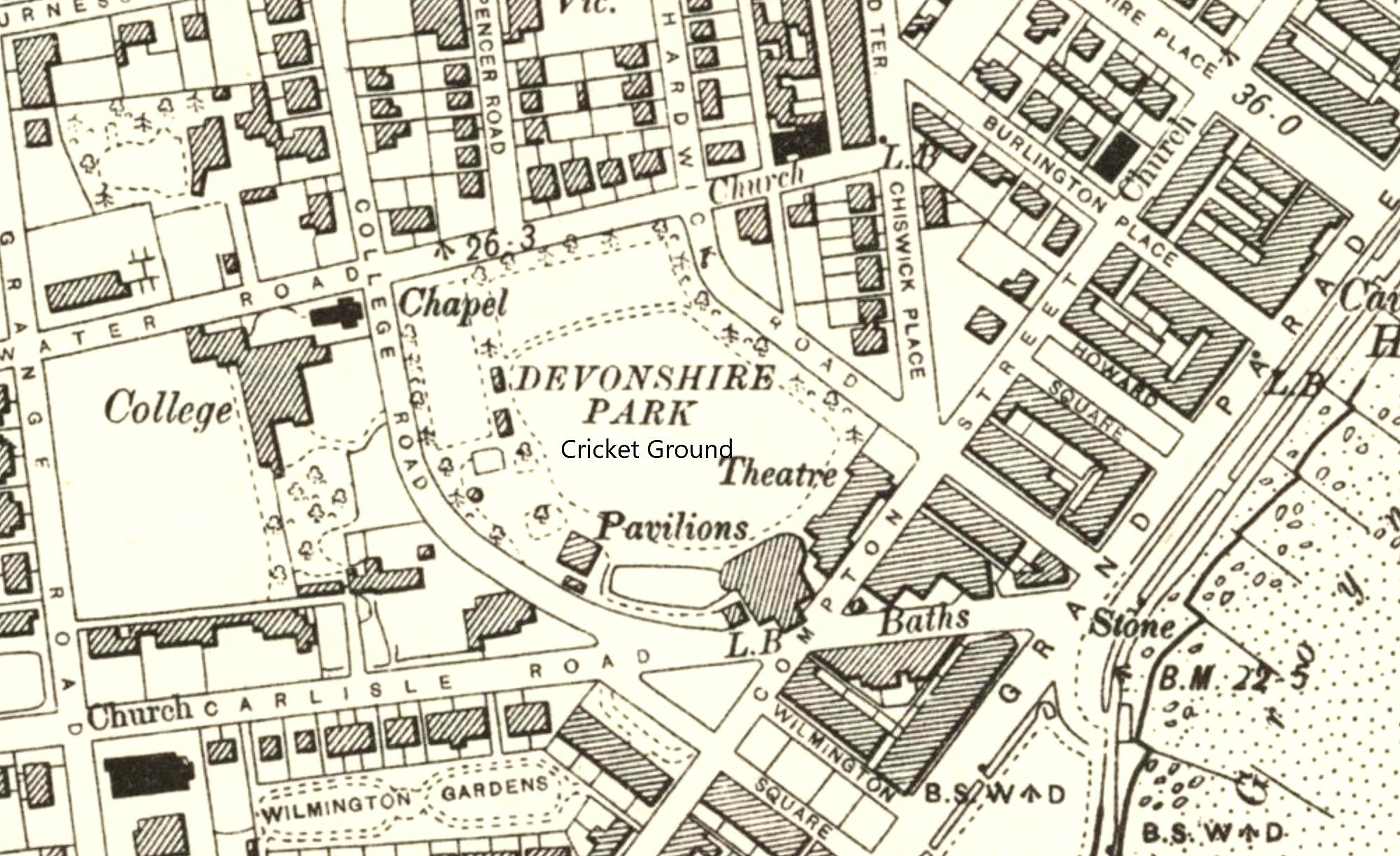
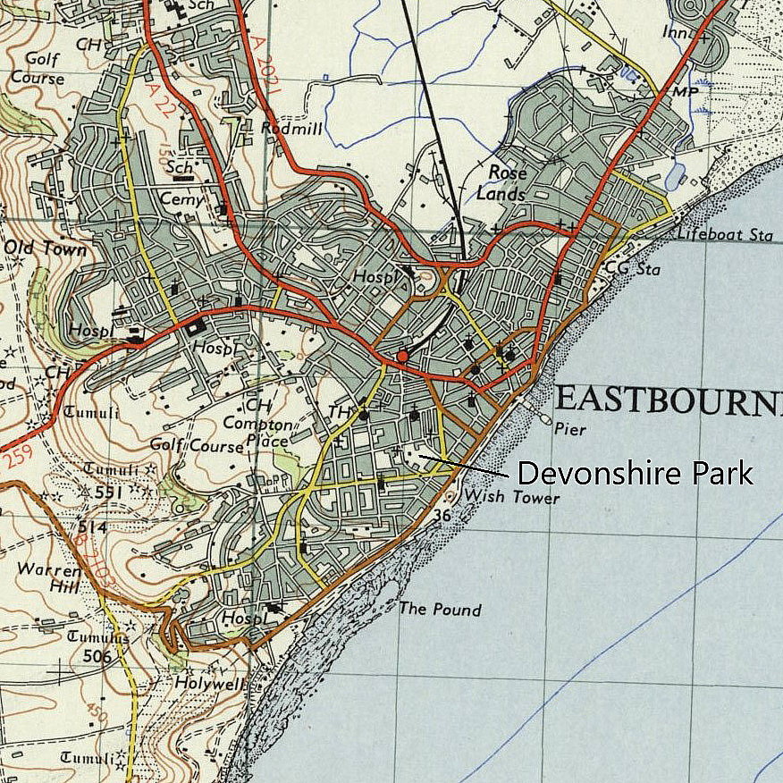
Location: Devonshire Park is in the centre of Eastbourne, roughly W of the pier.
Date of crash: 15th April 1911
NOTES: Mr Michael T Holder, a great friend of this 'Guide' unearthed this rare event. It appears that Mr Oscar C Morison, (1884 - 1966), who had a shed, (which today we'd call a hangar), at SHOREHAM. On his Blériot 50hp monoplane he decided to fly across to Eastbourne - and land in Devonshire Park. He had been advised by somebody who had no idea about the size of site required that DEVONSHIRE PARK would be most suitable. He also states that he had seen the venue previously, and agreed with this assessment.
The basic rudimentary techniques required for piloting were still being developed, a very much hit and miss affair, with a lot of 'hits' (crashes), along the way. Also the untutored human eye is very poor at gauging distance. Added to this, our perception of distance available, standing on the ground, is invariably highly misleading.
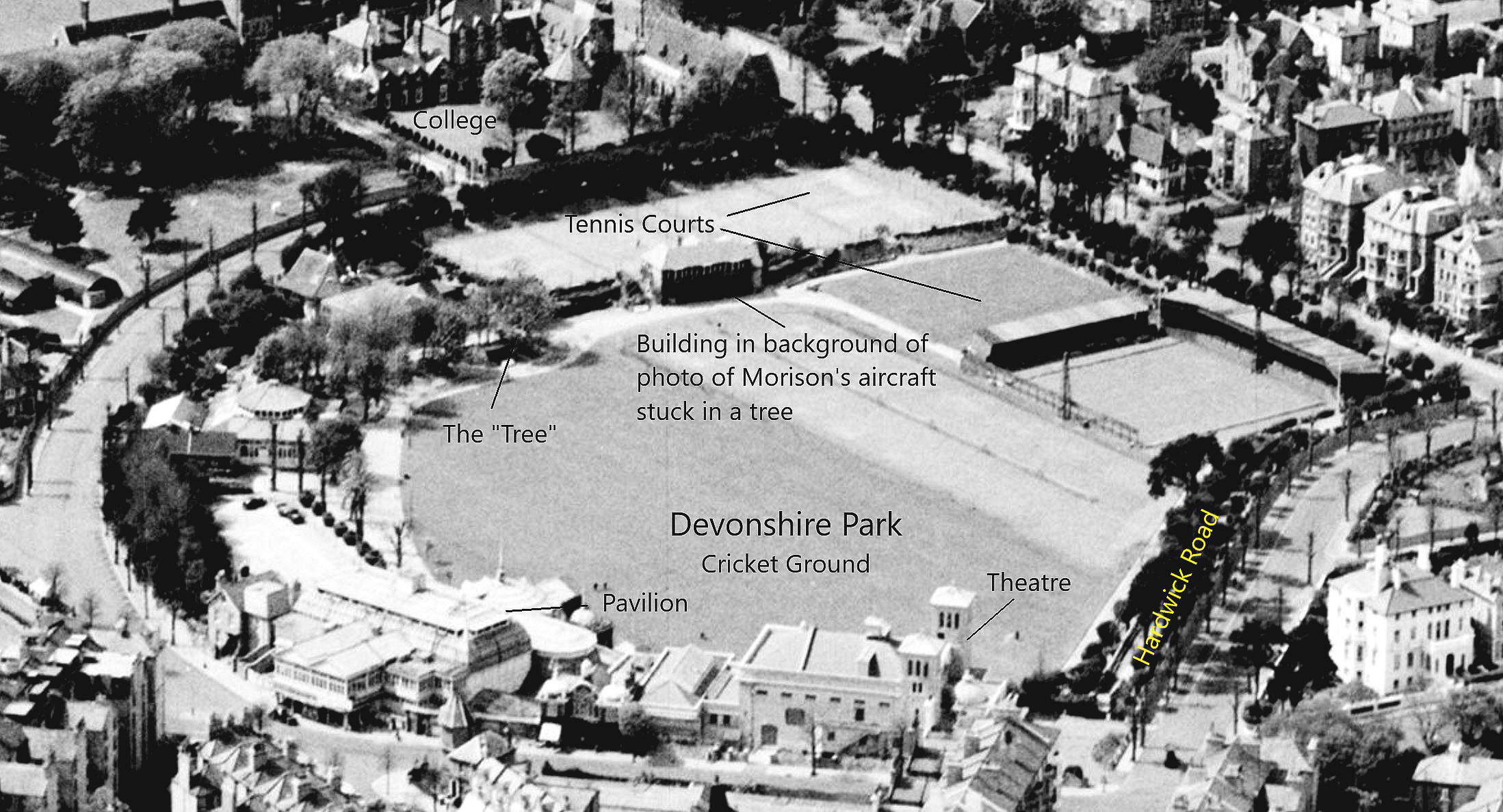
As the aerial oblique B&W photo shows, it was an act of utter folly to even attempt landing here. This said, a very capable pilot in those days could probably have landed here safely? But, there was no way he could have taken-off? Except of course with a howling headwind, and in those days they mostly sought to sensibly fly in calm conditions. Also, in high winds, the turbulence from the nearby buildings would be horrendous.
In effect, it was an accident waiting to happen. Control in roll was by means of wing warping, which gave rather slow responses. Also, the rate of climb with 50hp, (at best), was minimal too. Plus, was the aircraft perfectly rigged, the engine and propeller in tip-top condition, etc, etc?
As an aside, the favoured means for gauging the thrust being developed was to drive a stout stake into the ground, and attach a set of scales on a rope link to the aircraft stern-post. Did Mr Morison use this means to ensure that his engine/propeller combination was in peak condition? Probably not? Also, his estimate that he climbed to around 5,000ft whilst en route is very questionable indeed. How would he know?
It appears that it was Paul Kollsman who invented the first practical aircraft altimeter, in 1928 in the U.S.A. It took me several years of flying, guessing the altlitude first, then checking the altimeter, before I became reasonably proficient - and, this only applied at fairly low levels - say up to around 3000ft. The higher you fly the more difficult it becomes. Just try guessing your altitude in the cruise in a modern airliner, just by looking out of the window - quite impossible within a +/- of several thousand feet.
We'd love to hear from you, so please scroll down to leave a comment!
Leave a comment ...
Copyright (c) UK Airfield Guide


