Eday
EDAY: Civil public airport
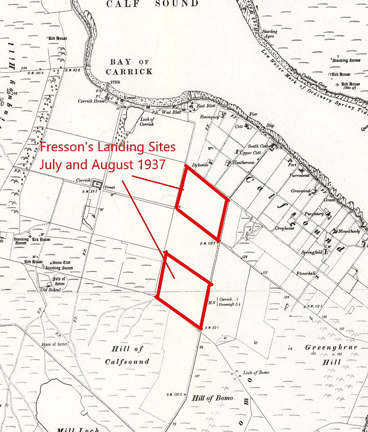
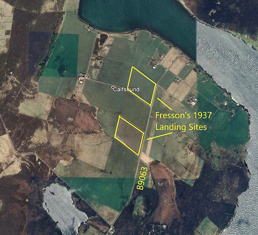
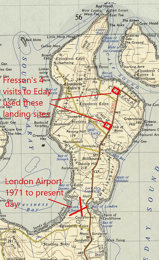
Note: The first three items were kindly provided by Mr Michael T Holder and relate to E E Fressons visits in July and August 1937. The fourth picture (2009) was obtained from Google Earth © and added by the author.
Operated by: 1980s to 2000: Orkney Islands Council
Activities: Mostly regional airline and air ambulance operations (?)
Location: W of B9063, on Isle of Eday, between the Loch of Doomy and Bay of London
Period of operation: (?) to present day
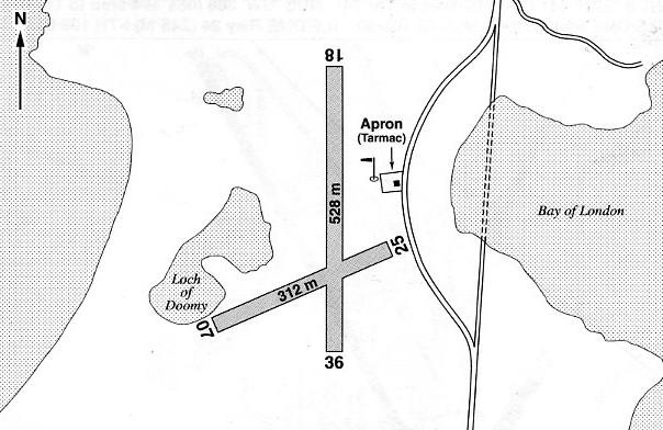
Note: This map is reproduced with the kind permission of Pooleys Flight Equipment Ltd. Copyright Robert Pooley 2014.
Runways: 1990: 02/20 549x30 grass 07/25 366x30 grass
2000: 18/36 528x30 grass 07/25 312x30 grass
2001: 18/36 518x30 grass 07/25 467x18 graded hardcore
NOTES: Mike Holder tells us that on the 27th July 1937 Fresson, (of Highland Airways based at Inverness), flew from TRUMLAND on ROUSAY to EDAY to survey a new airfield. He repeated the exercise on the 25th and 28th August 1937 with a party of nine Air Ministry officials. He flew around the islands making nine landings and allowing the party to make a survey of the islands' facilities and how to defend them in the almost inevitable war that was coming.
Quite how he went about this is not known as, although Highland Airways had at least one DH89A Dragon Rapide at that time, it could only seat eight passengers at most. Hence, I assume, the need to make two flights.
We'd love to hear from you, so please scroll down to leave a comment!
Leave a comment ...
Copyright (c) UK Airfield Guide


