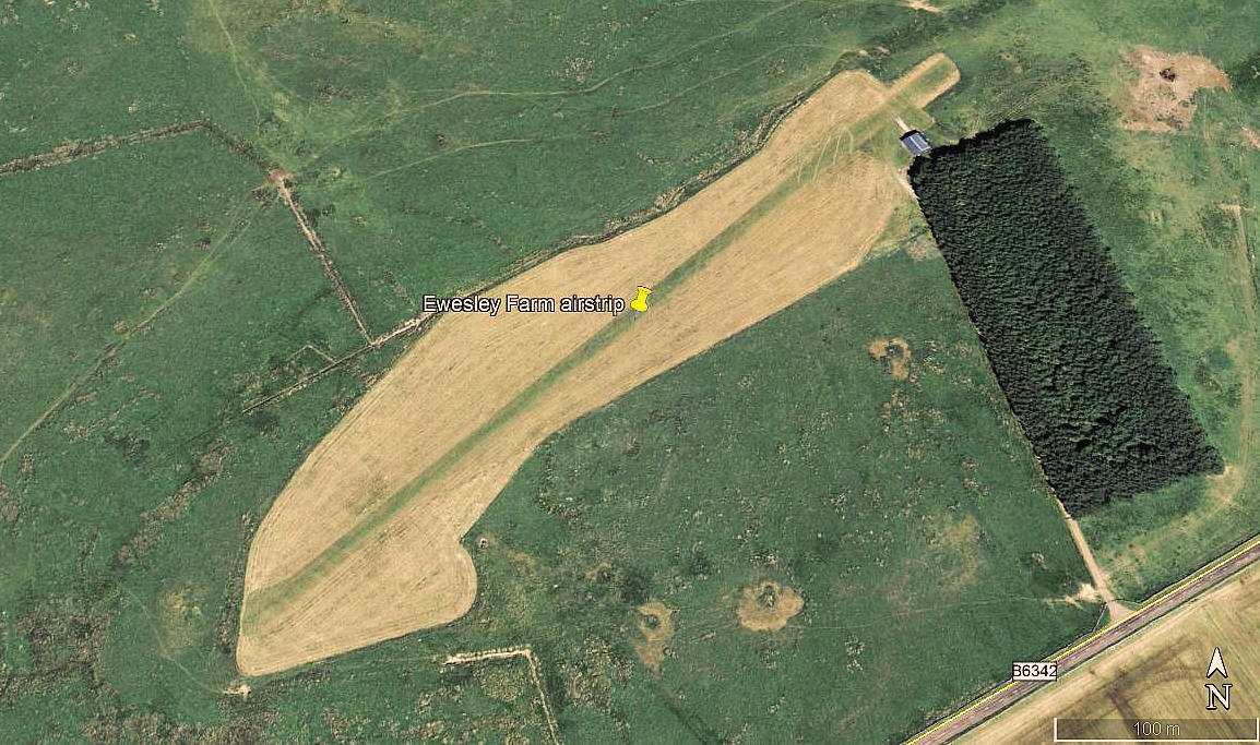
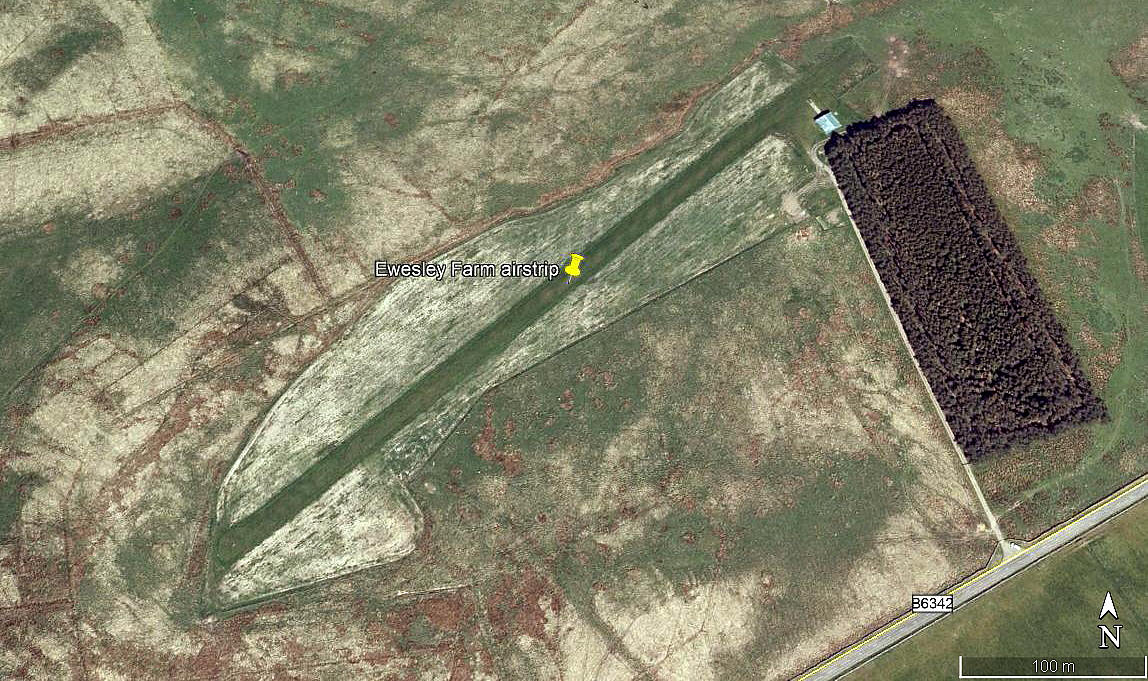
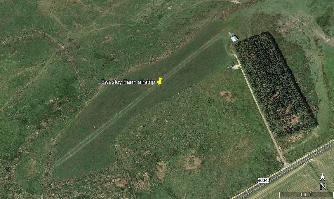
Ewesley Fell
EWESLEY FELL: Private airstrip (Aka EWESLEY FARM)
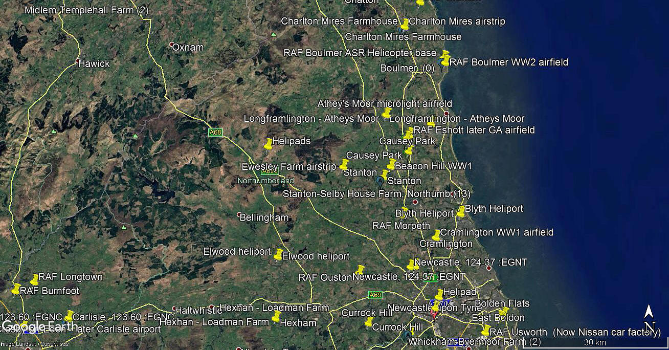
Note: All four of these pictures were obtained from Google Earth ©
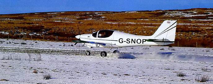
Note: This great picture by Peter Herzberg was scanned from the April 2018 edition of Light Aviation magazine. It was taken of the first flight by G-SNOP after being rejuvenated.
Location: N of the B6342, about 6nm SSW of Rothbury and roughly 8nm SW of ESHOTT airfield
Period of operation: Early 2000s to -
Runway: 06/24 530 grass
NOTES: There is other information about this airstrip, but my attention was initially drawn to it by the AAIB report EW/G2016/08/28.
In the report it states that the runway is orientated 06/24, and yet on Google Earth (image 2015) and other info it is 05/23. As pointed out elsewhere, magnetic North does slowly move over many years and runways have to be redesignated.
We'd love to hear from you, so please scroll down to leave a comment!
Leave a comment ...
Copyright (c) UK Airfield Guide


