Forres
FORRES: Military aerodrome (Aka as BALNAGEITH & WATERSIDE)
Later private airstrip* known as MUNDOLE (see seperate listing)
Military users: RAF Bomber Command
19 OTU [Operational Training Unit] (Armstrong-Whitworth Whitleys)
Location: SW of Forres, NE of Mundole, N to NW of A940 & 12nm WSW of Elgin
Period of operation: 1940 to 1946
Runways: NE/SW 1554 grass NW/SE 1006 grass
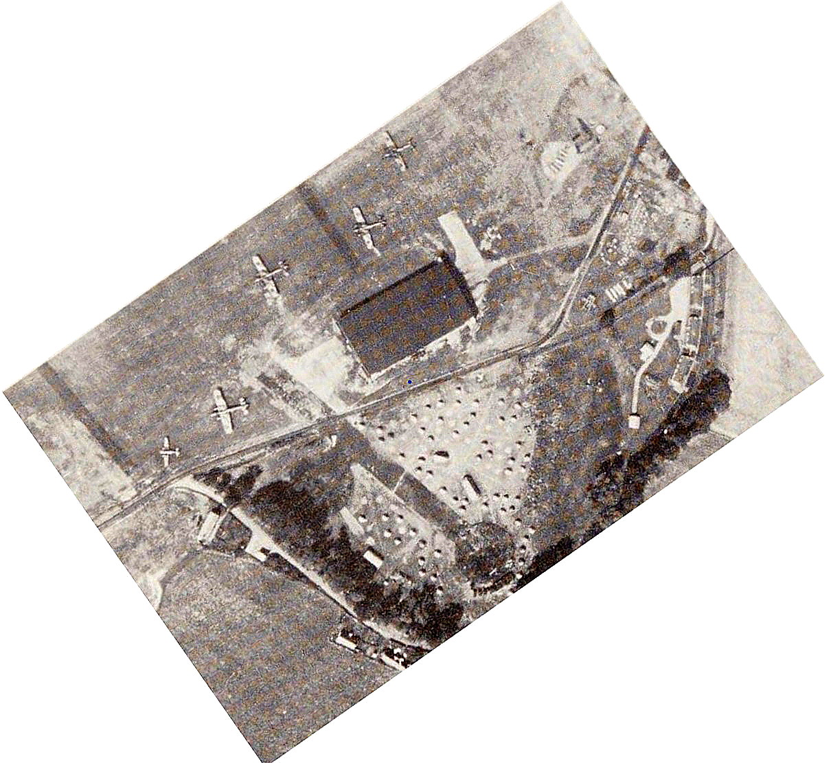
NOTES: Twenty two ‘Fryingpan’ hardstandings were provided plus, (I find this a very curious note), two more being listed as being too close to the railway for safety. So why were they constructed and under whose orders?
A MICHAEL T HOLDER GALLERY
We have Mike Holder, a great friend of this 'Guide', to thank for invesigating this location and providing the maps, pictures and information.
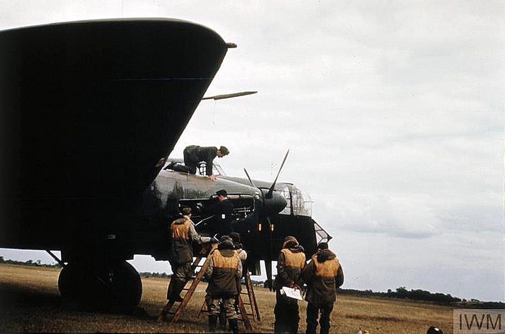
The picture, taken at Forres, (from the Imperial War Museum), shows an Armstrong Whitworth A.W.38 Whitley. It was being operated by No.19 OTU (Operational Training Unit).
The first flight of the type was from the Armstrong Whitworth works aerodrome, Whitley Abbey, Coventry, on the 17th March 1936. (The bomber was named after this location). Although pretty much obsolescent by the outbreak of war in 1939, it did take part in early bombing raids, the results of these raids were very unsatisfactory, most bombs dropped failing to hit the target.
It was common practice for OTUs to be given, throughout the war, aircraft that were no longer fit for operations. Understandable under the circumstances I suppose, but mostly knackered and generally unreliable. Far from being ideal for training purposes with rooky aircrews. Indeed, it is often claimed that the amount of aircrews who perished during training, got close to those who died on operations.
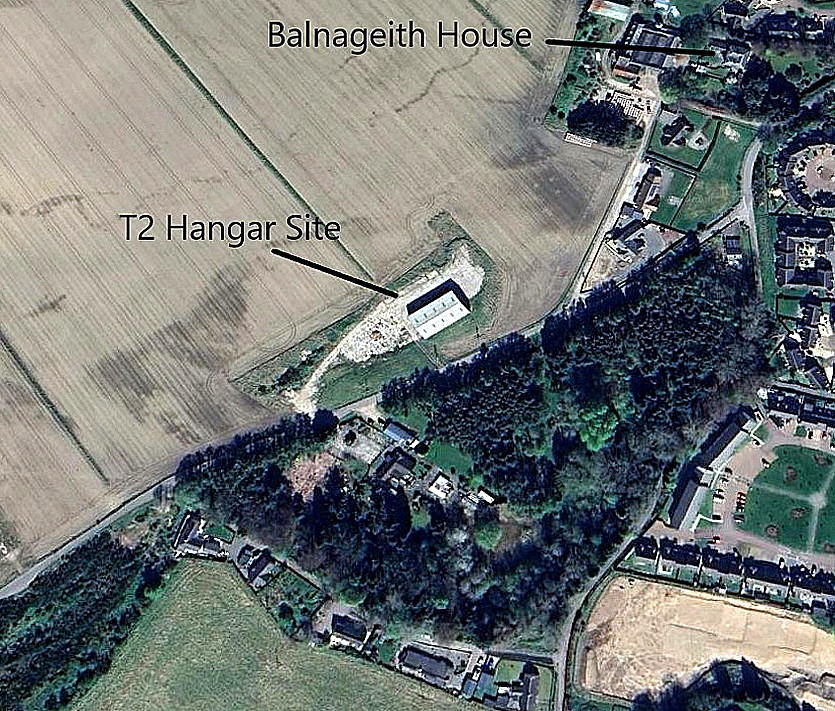
The article in two parts, are excerpts from Action Stations, a series of books often regarded as being the 'bible' for those interested in this period of history. At the end it is claimed that the T2 hangar has been demolished. It wasn't, and has served as a granary - still is - at least by 2024.
The local area view is from my Google Earth © derived database. The local map detail and Google Earth © detail shows the T2 hangar.
THE MUNDOLE AIRSTRIP
The local map, c.1966, shows the proximity, at the eastern end, of the RAF Station to Forres town centre. The MUNDOLE airstrip was at the far western end.
AND FINALLY
The Google Street View shows the modern Health Centre built on the old WW2 domestic site. The area view is also from my Google Earth © derived database.
SOMETHING TO CONSIDER
Many years ago I found that it was said a director of United Biscuits used a 'private airstrip' alongside a dispersal/taxiway alongside the River Findhorn in the 1960s to late 1970s. Compiling this 'Guide' has been a constant and usually very steep learning curve, not least in this case. (See 'Comments' below).
I probably don't mention it often enough. This 'Guide' has been compiled with the help of so many generous people, seemingly quite happy to assist and encourage. Indeed, very many people from around the world offer congratulations too. When launching this web-site, I must confess, this was not at all what I had anticipated - people by and large known to be eager to complain, carp and criticise.
BUT - it has to be made quite clear, that if compared to the animal kingdom, my role is often that of a bi-valve creature. Clinging to its rock and sifting the nutrients that arrive with each tide. Trouble is, and I am certainly not complaining, my selected rock turned out to be facing an ocean just where huge swells break into rollers.
Brian Warrender
This comment was written on: 2016-08-25 20:00:28I can confirm United Biscuits had a strip (extended piece of per-track) as I landed here in mid-1975 in a King-Air, when I was an ATCO Cadet at Inverness Airport. I think it was G-BCUB.
Gary Brindle
This comment was written on: 2016-11-09 16:26:44same location for strip as Mundole,no longer in use.
Reply from Dick Flute:
Hi Gary, Many thanks for this info. Regards Dick
We'd love to hear from you, so please scroll down to leave a comment!
Leave a comment ...
Copyright (c) UK Airfield Guide


