Hereford flying sites
Note: This map only shows the position of Hereford within the UK.
HEREFORD see also LOWER LUGG FLATS
HEREFORD see also HEREFORD RACECOURSE
HEREFORD: Civil Landing Ground (Aka KING’S ACRE, KING'S ACRE HALT and OLDFIELD)
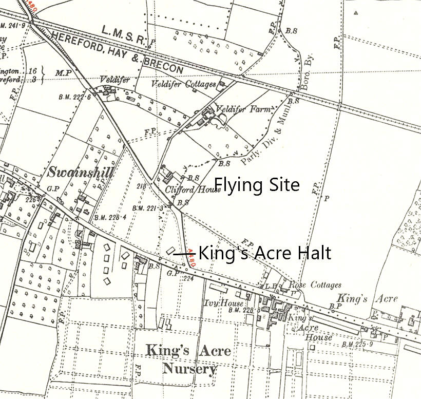
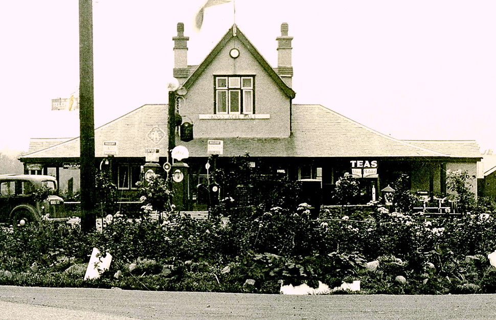
Note: The KING'S ACRE HALT name came from the garage and tea rooms - not a railway halt.
Operated by: Mr C F & J Murch, Huntingdon Court, Hereford
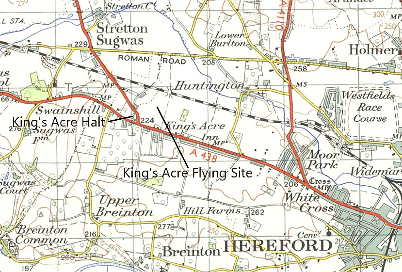
Location: “2.5m WNW Hereford, imm NE jnct A438 and A480” Just WNW of Kings Acre village
Period of operation: 1926 at least (?) to - (WW2 perhaps?)
Runway(s): Max landing run: 457 grass
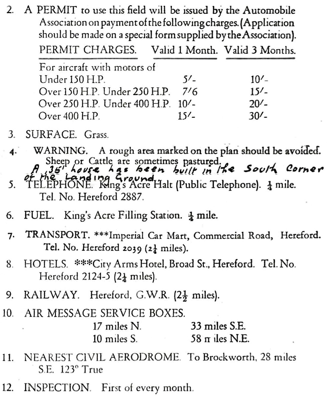
NOTES: Info source ‘AA Landing Grounds’ publication, 1930s. This was one of seventy-four AA (Automobile Association) approved Landing Grounds on mainland Britain. Fuel was available from King’s Acre Filling Station, transport (typically a taxi service) from Imperial Car Mart, Commercial Road (presumably in Hereford?) and the nearest telephone was at King’s Acre Halt garage and tea rooms. In 1933 at least, no hangar was on the site.
Before pinning this site down as an AA approved Landing Ground I already had the following listed several years before:
Sir Alan Cobham’s 1932 National Aviation Day UK Display Tour on the 30th May, and the 1933 No.2 Tour on the 20th & 21st May.
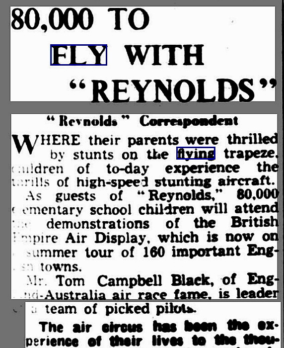
Also the British Empire Air Display 1936 Tour of the UK on the 1st May 1936.
FURTHER INFORMATION & GALLERY
Mike Holder, a great friend of this 'Guide' has traced newspaper articles mentioning this location, plus the maps and pictures.
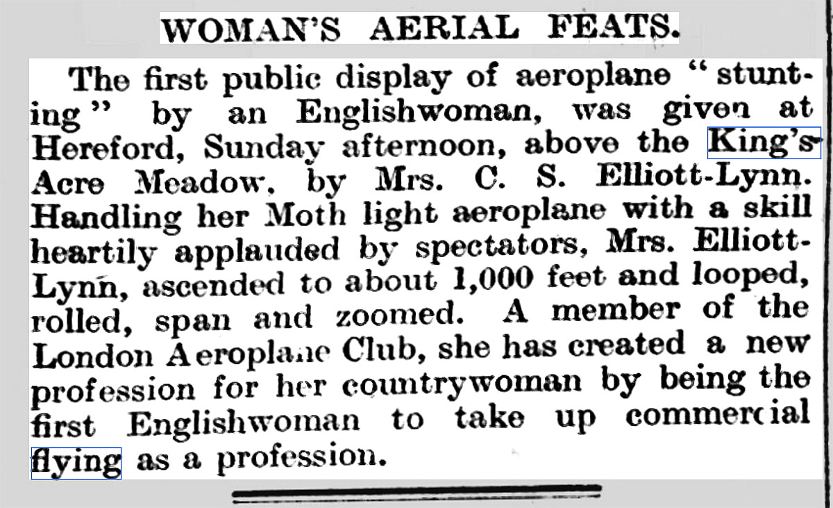
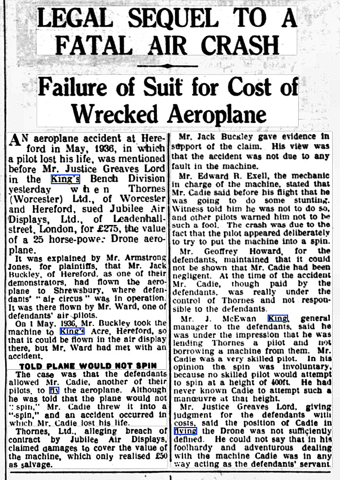
Note: The first item, concerning a display on the 26th March 1926, was published in the Shepton Mallet Journal on the 2nd April 1926. The second article, divided into two parts, was published in Reynold's Newspaper on the 26th April 1936, and refers to the forthcoming event by the British Empire Air Display on the 1st May 1936. The forth newspaper article was published in the Birmingham Daily Gazette on the 18th November 1937. and concerns the inquest into a fatal accident during the British Empire Air Display on the 1st May 1936.
BONUS PICTURES
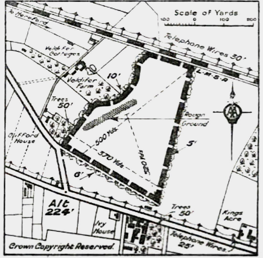
The King's Acre Halt site is still in business today as a garage and for car sales. The site information and map is from the A.A. Approved Landing Grounds guide.
Location: Oldfield, King’s Acre Road, Hereford
Period of operation: From 1926?
NOTES: Some years ago I added the note: "Did the Cobham 1934 Tour use this site when they displayed in/near Hereford on the 24th September?:
I then added: “It would seem likely this was either LOWER LUGG FLATS or OLDFIELD as the ‘Flying Circus’ operators did often use existing Landing Grounds…but not always. I can’t tie this matter down to date." Can anybody kindly assist with advice?”
When starting this research I would have assumed that the KING’S ACRE and OLDFIELD sites must surely have been the same but sometimes, as stated, this wasn’t always the case. Sometimes for example, if a much better deal could be struck – especially from a financial aspect, these operators would operate from a site virtually next door, and this included operating from a field alongside established licensed aerodromes.
In those days there was no such thing as an ATZ (Aerodrome Traffic Zone), and very few areas were prohibited from flying over. In fact the first example of Controlled Airspace occurred when CROYDON (LONDON) established such a zone in 1933. I may well be mistaken but this may well have been the only example of Controlled Airspace around a British airport before WW2?
HEREFORD: Temporary aerodrome?
Operated by: Berkshire Aviation Co
Location: Hay Road, Hereford
Period of operation: 10th to 24th September 1921
HEREFORD: Military Landing Ground
Military users: WW2: USAAF?
Post 1945: Army AAC 8 Flight
Location: On the racecourse it seems.
Period of operation: Possibly civil use in the 1920s and 1930s? Military 1940 then 1943/5?
NOTES: Used by NAC aircraft for army co-operation flying in November 1940 it seems. Was this location also the same as used by the Berkshire Aviation Co in 1921 as listed above? Or perhaps the OLDFIELD site used by the Cobham tour several times in the 1930s. If anybody can kindly offer advice, this will be much appreciated.
Terry Clark
This comment was written on: 2018-09-30 18:26:26The ARG website has a photo of the racecourse clearly showing 2 runways at right angles in the middle of Hereford Racecourse. Date of the photo was 'the 1950s' and there was a remark that this airfield was in use until the early '60s by the Herefordshire Aero Club until they moved to Shobdon.
We'd love to hear from you, so please scroll down to leave a comment!
Leave a comment ...
Copyright (c) UK Airfield Guide


