Holt Farm
Note: Today the Holt Farm is remembered by having a school named after it. If anybody can kindly provide an exact location for the venue used by the Cobham Tours, (and others), this advice will much appreciated.
HOLT FARM: Temporary aerodrome (see nearby ROCHFORD for military activities)
Operated by: Sir Alan Cobham’s 1933 No.2 Tour of the UK, Cobham’s 1934 Tour of the UK
Location: Ashingdon Road, Rochford NNW of Southend
Period of operation: 14th & 15th April 1933, and later 22nd August the same year. Also on the 28th August 1934
A SMALL GALLERY
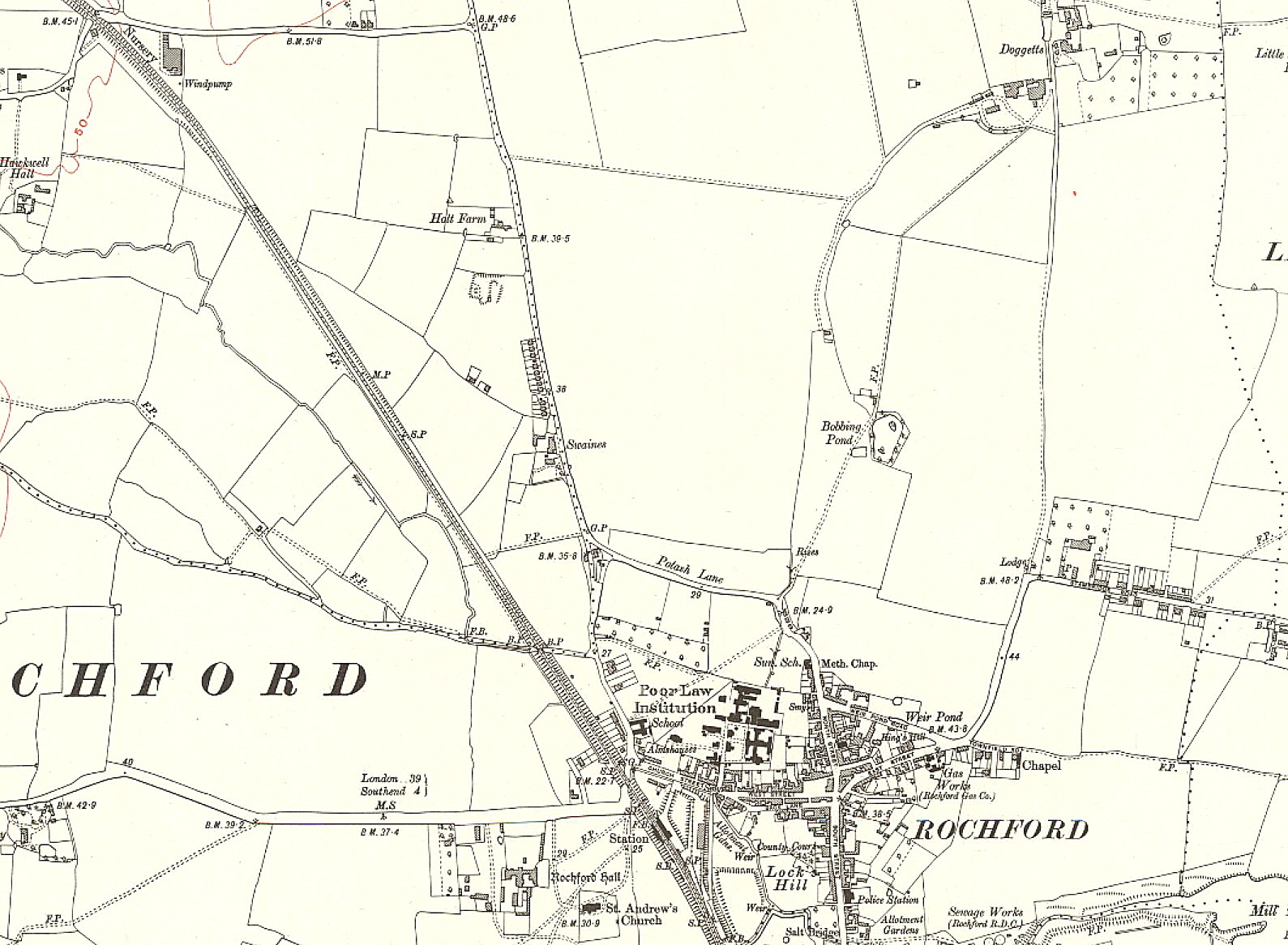
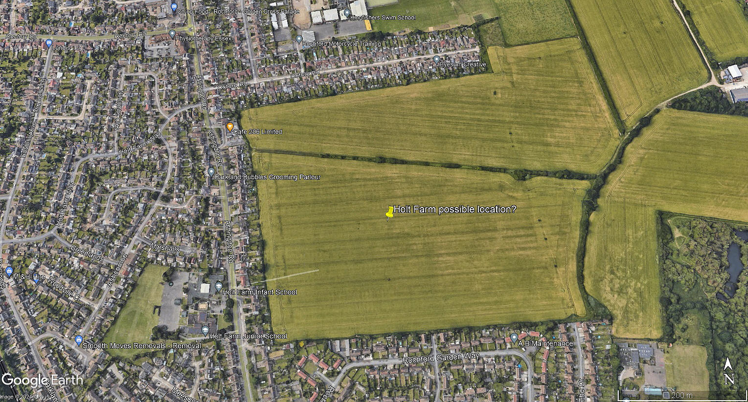
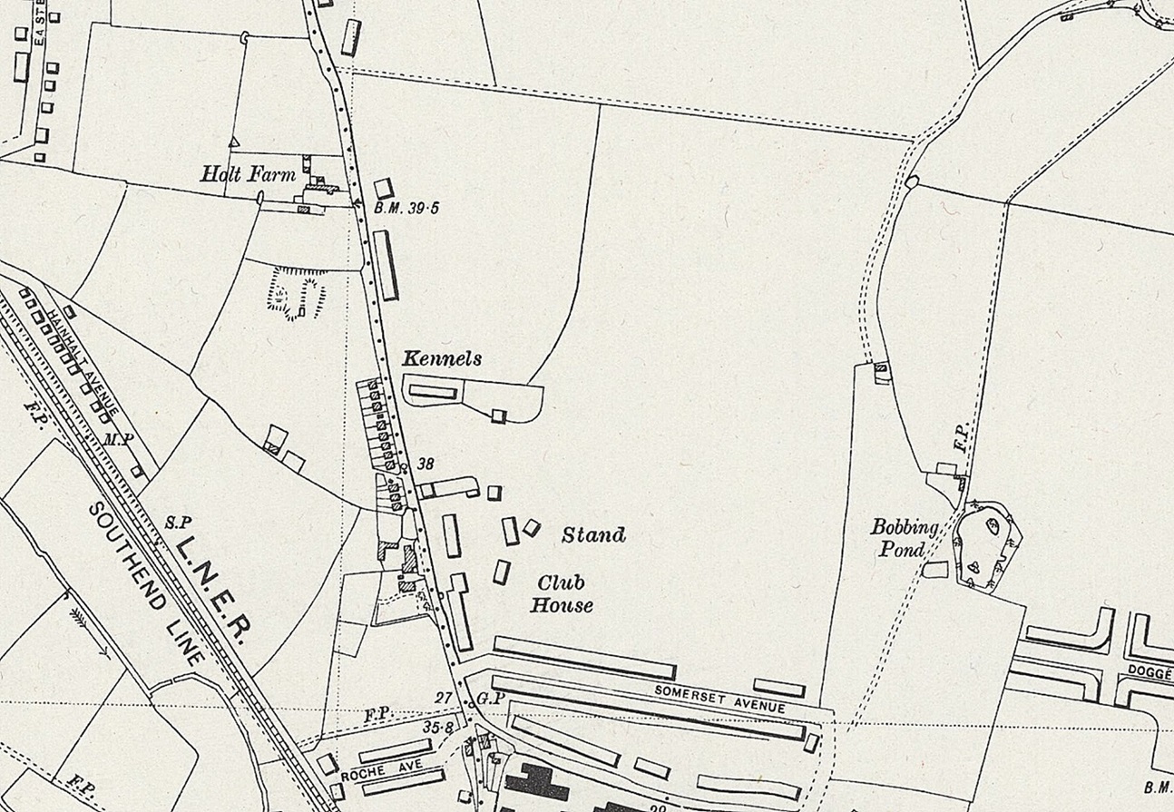
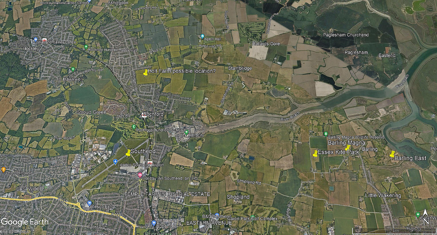
Mike Holder and myself have compiled these items. As mentioned we do not know with any degree of certainty exactly which field was used. This said we both strongly suspect it was the large field just to the east/south east of Holt farm. A possible clue is shown in the 1938 map in as much as further developments are seen. Supporting this, (perhaps?), is that Southend Municipal Airport opened in 1935.
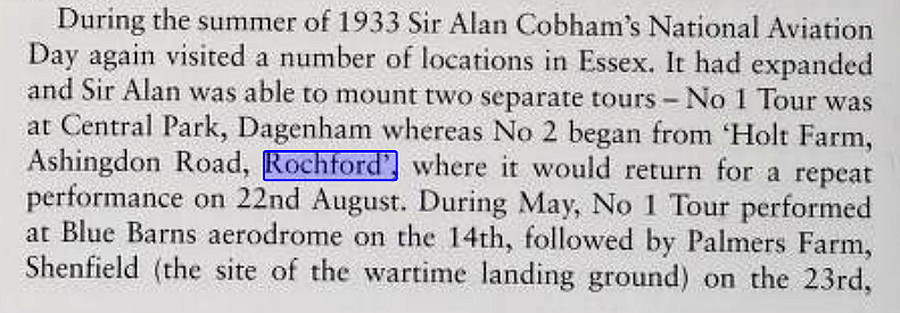
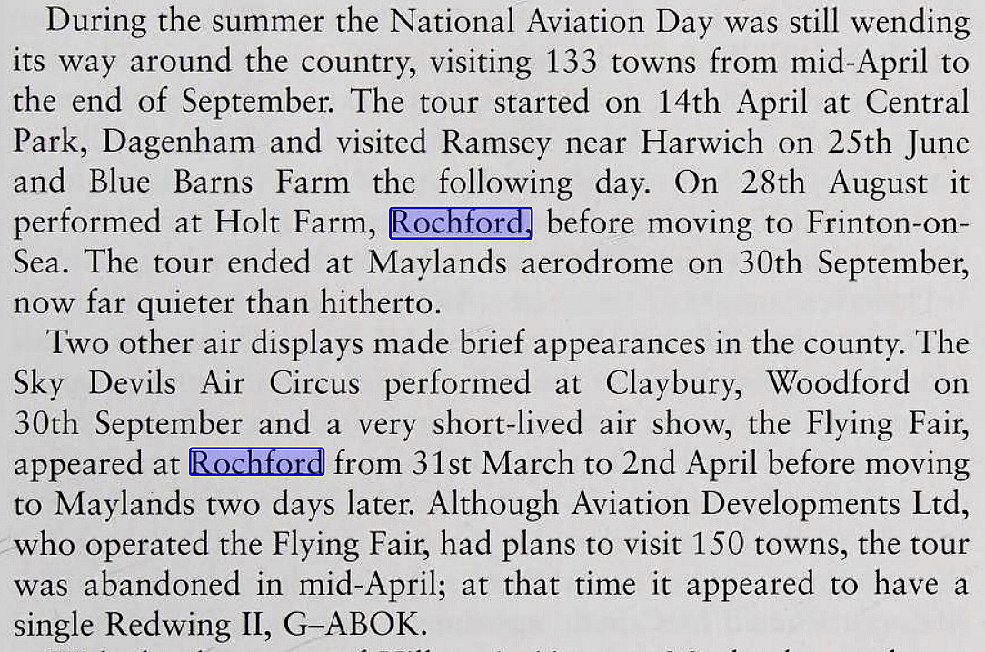
The two excerpts are from Essex And Its Race For The Skies by Graham Smith.
The aerial view was obtained from Google Earth ©. The local area view is from my Google Earth © derived database.
NOTES: At certain points in the last twenty five years, (2024), I have found a limited amount of confusion regarding this location. Some people thinking it would have been on the ROCHFORD later SOUTHEND airport site. However, I have found records that state that the location was known as HOLT FARM and that site is both clearly identified, (and still recognised locally), as being roughly north of Rochford.
Another aspect is that, although it is clear that flying was taking place on the location that later became Southend Municipal Airport in 1935, most of the 'Flying Circus' operators, including Sir Alan Cobham, much preferred to operate from a site over which they had total control for the displays. I have found a couple of examples when they operated from a field across the road from an already established aerodrome! In those days the concept of establishing an ATZ, (Aerodrome Traffic Zone), was still to be implemented.
We'd love to hear from you, so please scroll down to leave a comment!
Leave a comment ...
Copyright (c) UK Airfield Guide


