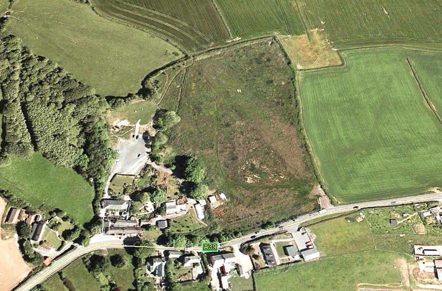
Hoops Inn and Hotel
HOOPS INN & HOTEL: Private helipad
Note: This picture (2005) was obtained from Google Earth ©
Although clearly seen in this picture, it appears the helipad facility was withdrawn fairly soon after.
Location: Lot’s more fun here as in one flight guide this is listed as CLOVELLY which is a lovely little place right on the coast 8nm on a heading just WSW of Bideford. The listing I used for reference states the site being 2nm SE of Clovelly close to the A39 which places it between Clovelly Cross and Buck’s Cross.
But,the address given is Horns Cross also on the A39 which is about 4nm E of Clovelly Cross and well to the E of Buck’s Cross!
All this makes me really feel for the unfortunate helicopter pilot trying to actually find it from the air for the first time and makes me wonder about the information given in many flight guides. Does anybody do any basic error checks for these publications?
THE ANSWER
I started research for this 'Guide' at least seventeen years ago. Since then the world has changed beyond recognition. With 'Sat Nav' and facilities such as Google Maps and Google Earth the entire picture has been changed. But, this said, for many historical sites, the old fashioned map can be hard to beat.
So, how did I get the location used? Google maps.
Landing area: 61x61m short grass square pad in a 6 acre grass field
We'd love to hear from you, so please scroll down to leave a comment!
Leave a comment ...
Copyright (c) UK Airfield Guide


