Isle of Skye
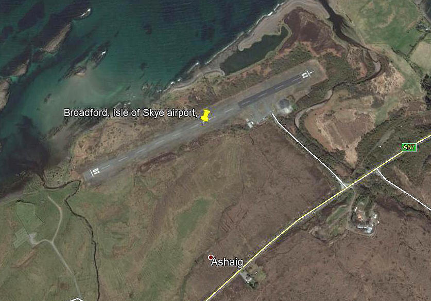
ISLE of SKYE: Civil regional airport (also known as ASHAIG and BROADFORD)
Note: The first picture is reproduced from the November 2016 edition of Light Aviation magazine. The second picture is from a postcard and kindly sent by Mike Charlton.The third picture (2015) was obtained from Google Earth ©
Operated by: 1980s/1990s: Highland Regional Council
2000: Highland Council, Transport Services
Airline user: Loganair
Flying club and school: Skye Flying Club (Microlights - 2000s only?)
Location: N of A850, 3nm E of Broadford
Period of operation: ? (Since the 1930s possibly?)
Note: This map is reproduced with the kind permission of Pooleys Flight Equipment Ltd. Copyright Robert Pooley 2014.
Runway: 1990/2000: 07/25 771x23 hard
NOTES: A news report in the November edition of Light Aviation magazine tells us that the hard runway was built by Army engineers in the 1970s.
However, the really good news is that a report published in 2016 is very positive about the benefits to the Isle of Skye of developing this site, including the reintroduction of scheduled flights.
We'd love to hear from you, so please scroll down to leave a comment!
Leave a comment ...
Copyright (c) UK Airfield Guide


