


Langham
Note: This map only shows the position of Langham village within the UK.
LANGHAM: Private airstrip (Also model flying site?)


Note:All six of these pictures were obtained from Google Earth ©


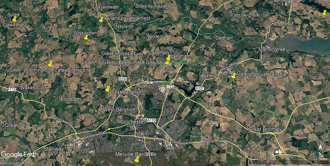
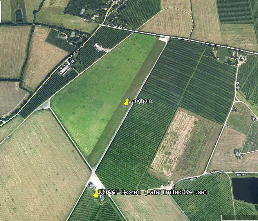
Location: Close to Langham / Langham Moor, 4nm NNE of Colchester town centre. And, part of the north end of BOXTED WW2 aerodrome.
Runway: 06/24 600 grass?
Note: The only evidence of this airstrip I can find, shows that the runway is: 03/21 640 grass
NOTES: The initial information came from the AAIB report EW/G2003/08/52 which states LANGHAM is close to Colchester. Which it is, the village being just W of the A12 and roughly 4nm NNE of Colchester town centre.
I had made this comment some time ago: "However, searching through Google Earth I can find no sign of a 600 metre runway orientated 06/24. But of course, some farm strips are only laid out for a year or two. If anybody can kindly offer advice, this will be much appreciated."
In 2021, see 'Comment' below, Mr Glyn Hall kindly offered advice, and it all seemed to become clear. There are many examples of private airstrips being laid out on the remains of WW2 aerodromes, but then being known by different names. This seems a good example.
Glyn Hall
This comment was written on: 2021-06-05 07:49:07Not sure when you last looked, but it's clear to see on google sattelite, SBM UK LTD have a marker there, you can even see where the perimeter road crosses into the field to the north and loops back, currently a ploughed field but very defined.
We'd love to hear from you, so please scroll down to leave a comment!
Leave a comment ...
Copyright (c) UK Airfield Guide

