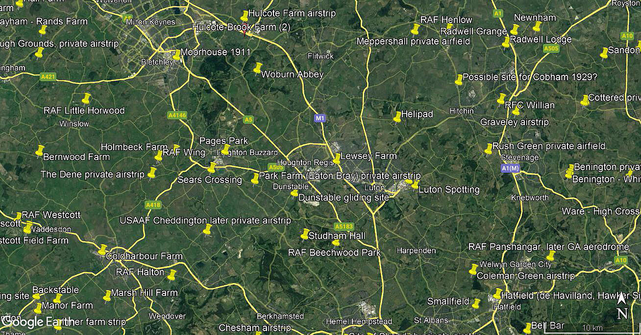
Lewsey Farm
Note: Many years ago I made this comment: "This map shows only my estimation of where this site was. If anybody can either confirm this, or provide a more accurate location, this advice will be most welcome."
In May 2020 Mr Michael Holder very kindly contacted me, (see 'Comment' below), with an exact location. This map has now been amended.
LEWSEY FARM: Civil Landing Ground (Aka DUNSTABLE and LUTON)
Operated by: Mr G E Sheriff, Lewsey Farm, Luton
Location: Between Luton and Dunstable, see gallery below
Period of operation: 1930s only?
THE FIRST RECORDED USE?
This was the 86th venue for Sir Alan Cobham during his 1929 Municipal Aerodrome Campaign, and he stayed here for two days - the 21st and 22nd September. His original plan had been to visit 107 venues, all in England except for two in South Wales and eight in Scotland. In the end, due to a couple of crashes and other setbacks, he managed to visit 96 venues - which was of course still a magnificent achievement.
Without too much doubt, the roaring success of this visit encouraged the land owner, Mr Sheriff, to establish an aerodrome here. Sir Alan's Tour no doubt helped to inspire the construction of several more aerodromes/regional airports in the early 1930s. As a general rule most of Cobham's visits were one-day affairs, this being a rare exception. It is of course quite possible, due to the costs of staging this Tour, that the second day, devoted to carrying fare paying passengers, was an attempt to offset the costs of the Tour.
The aircraft he mostly used was the ten-seater de Havilland DH61 Giant Moth G-AAEV, named 'Youth of Britain'. Note that the advert below describes it by its engine, not its manufacturer, and, that it is said to be a 12-seater. Designed to be a six to eight seat regional airliner, only around ten were made, (one built in Canada), and all for export it seems, except for this example. Intended to be used by Cobham for flights of very short duration when carrying passengers, this probably explains how he managed to shoe-horn ten seats into the rather small cabin.
A MICHAEL T HOLDER GALLERY
The second item was published in the Beds and Herts Pictorial on the 17th September 1929.
The last item, the area view, is from my Google Earth © derived database.
NOTES: Although listed as an AA (Automobile Association) approved Landing Ground this location did seem at first rather difficult to pin down, but obviously between Luton and Dunstable. Years later another web search revealed that the Lewsey Farm is the now residential area on the boundary between Luton and Dunstable, E of Poynters Road and W of the NHS hospital. Which is N of the A505 and WNW of junction 11 on the M.1 motorway. So, many thanks indeed to Mike Holder for his diligent research. (See above).
Venue on the 19th April 1933 for Alan Cobham’s 1933 No.2 Tour of the UK?
Michael Holder
This comment was written on: 2020-05-09 17:30:06Lewsey Farm - 51 53 57"N 000 28 51"W - is just to the west of Leagrave, a small village to the NW of Luton. It does not exist having been swallowed up by the environs of Luton. It does show in the 1951 Ordnance Survey map.
We'd love to hear from you, so please scroll down to leave a comment!
Leave a comment ...
Copyright (c) UK Airfield Guide


