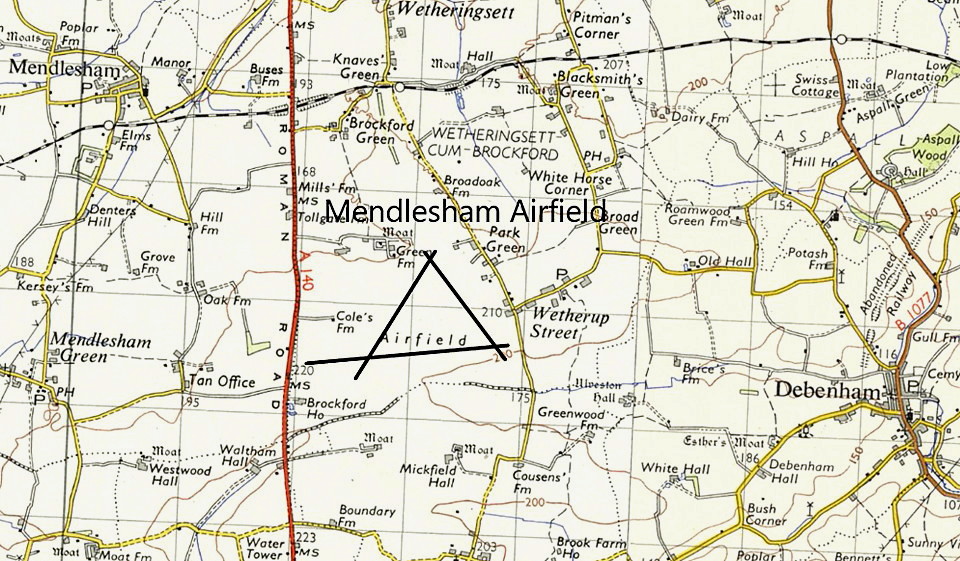
Mendlesham
MENDLESHAM: Military aerodrome later private airstrip
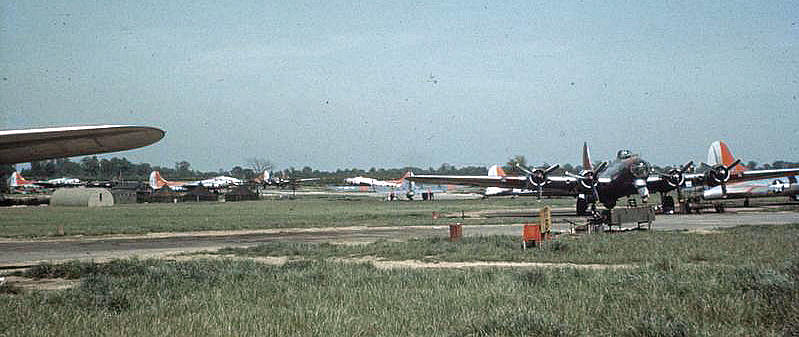
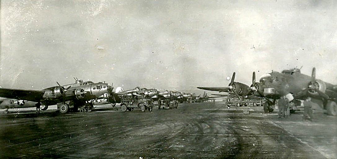
Note: The first picture is from the Roger Freeman Collection, American Air Museum in Britain, and part of the Imperial War Museum. It shows Boeing B-17 Flying Fortresses of the 34th Bomb Group dispersed around the airfield. Trawling through all the terms and conditions, I think I am liberty to show it in this 'Guide'.
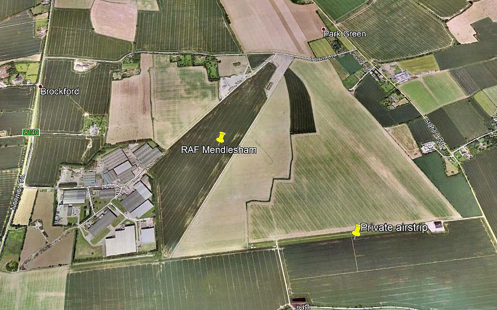
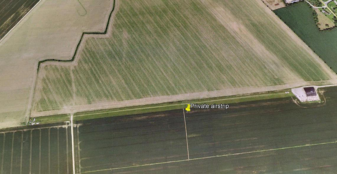
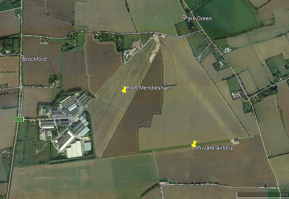
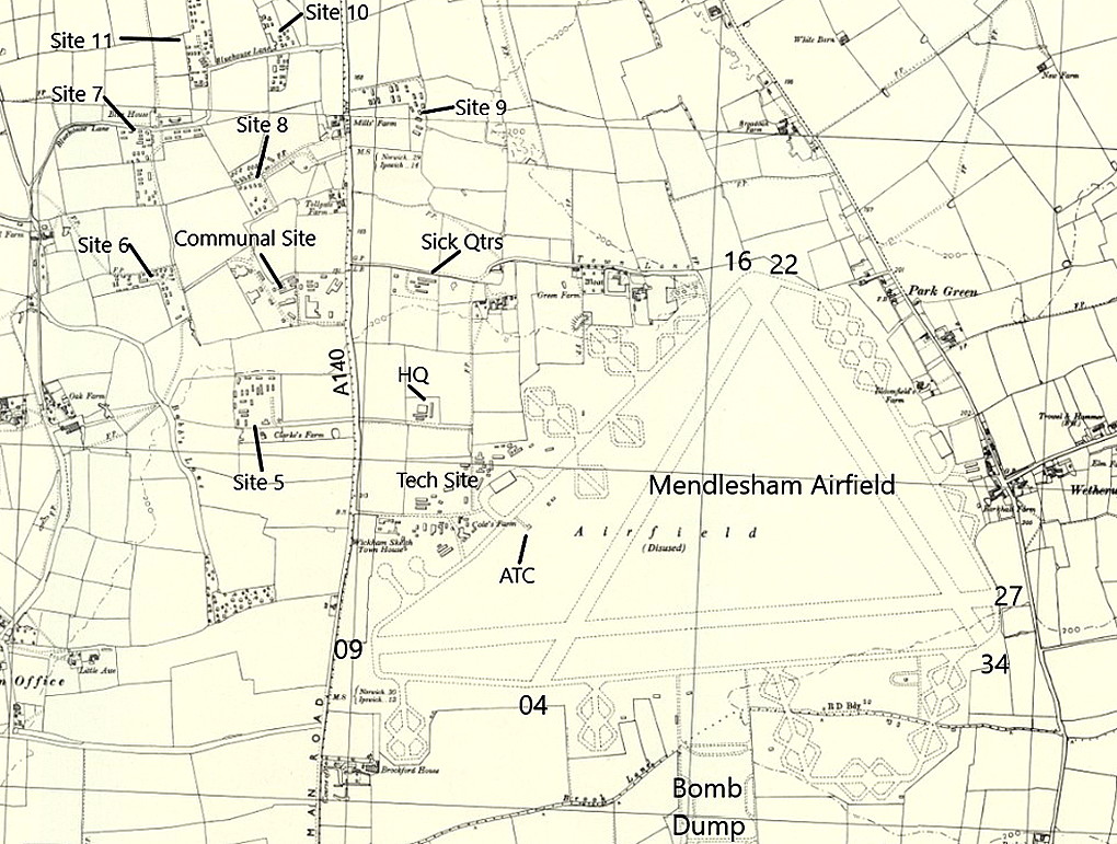
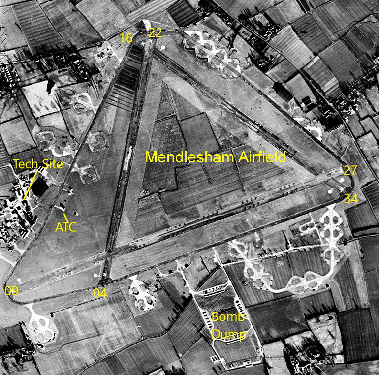
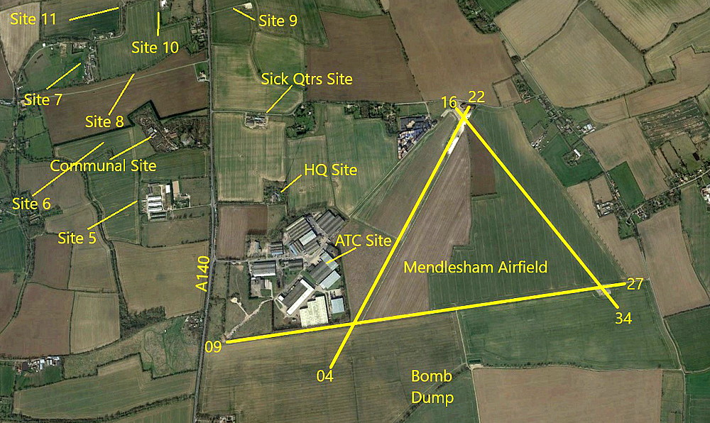
The next three pictures were obtained from Google Earth ©
The layout of the WW2 runways can be quite clearly discerned in the second and fourth pictures. Rather oddly perhaps, no signs remain of the airfield infrastructure to the south of the E/W runway.
Military users: WW2: 8th USAAF 93rd Bombardment Wing 34th Bomb Group
4, 7, 18 & 391 Sqdns (Boeing B-17 Fortresses)
Location: E of A140, W of Wetherup Street village, 5nm NE of Stowmarket
Period of operation: 1943 to 1954
Runways: WW2: 01/19 1829x46 hard 16/34 1280x46 hard
04/22 1280x46 hard
A MICHAEL T HOLDER GALLERY
Note: The Boeing B-17 Flying Fortresses on the ramp are of No.7 Squadron.
Note: The sixth item is derived from a Google Earth © view.
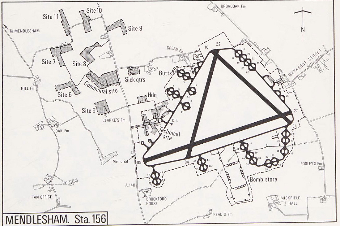
NOTES: With 2972 USAAF personnel on station and hard-standings for at least 50 bombers this aerodrome was another big USAAF bomber base in late 1944.
In the mid 1970s the Tipsy Nipper T.66 Srs.3 G-AVXC was apparently based at MENDLESHAM but was this on the WW2 airfield as seems most likely?
Another report in the AAIB Bulletin (EW/G2014/06/21) involving the Escapade G-DIZI, also indicates possible use from this WW2 airfield. It appears the strip was orientated E/W and 650 metres long. Also, a look at 'Google Earth' seems to clearly indicate an airstrip in the SE corner of the WW2 airfield of these dimensions and orientation.
We'd love to hear from you, so please scroll down to leave a comment!
Leave a comment ...
Copyright (c) UK Airfield Guide


