Newport Pagnell flying sites
Note: This map only gives the position of Newport Pagnell town within the UK.
NEWPORT PAGNELL: Temporary Landing Ground - not used in 1929
NOTES:
For Sir Alan Cobham, Newport Pagnell was the planned 101st venue for the 1929 Tour. Starting in May and ending in October he intended to visit one hundred and seven venues. Mostly in England but with two in South Wales and eight in Scotland. Due to a couple of crashes and other setbacks he eventually managed to visit 96 venues - still a magnificent achievement.
He did however visit nearby WOLVERTON in 1929. (Stoney Stratford was also in the original schedule). Clearly he and his team thought there was potential in this area, but why seems unclear today.
The aircraft Cobham mostly used for this Tour was the ten-seater de Havilland DH61 'Giant Moth' G-AAEV, named 'Youth of Britain'. The punishing schedule he set himself seems astonishing today. Highly recommended reading are his memoirs in 'A Time To Fly'.
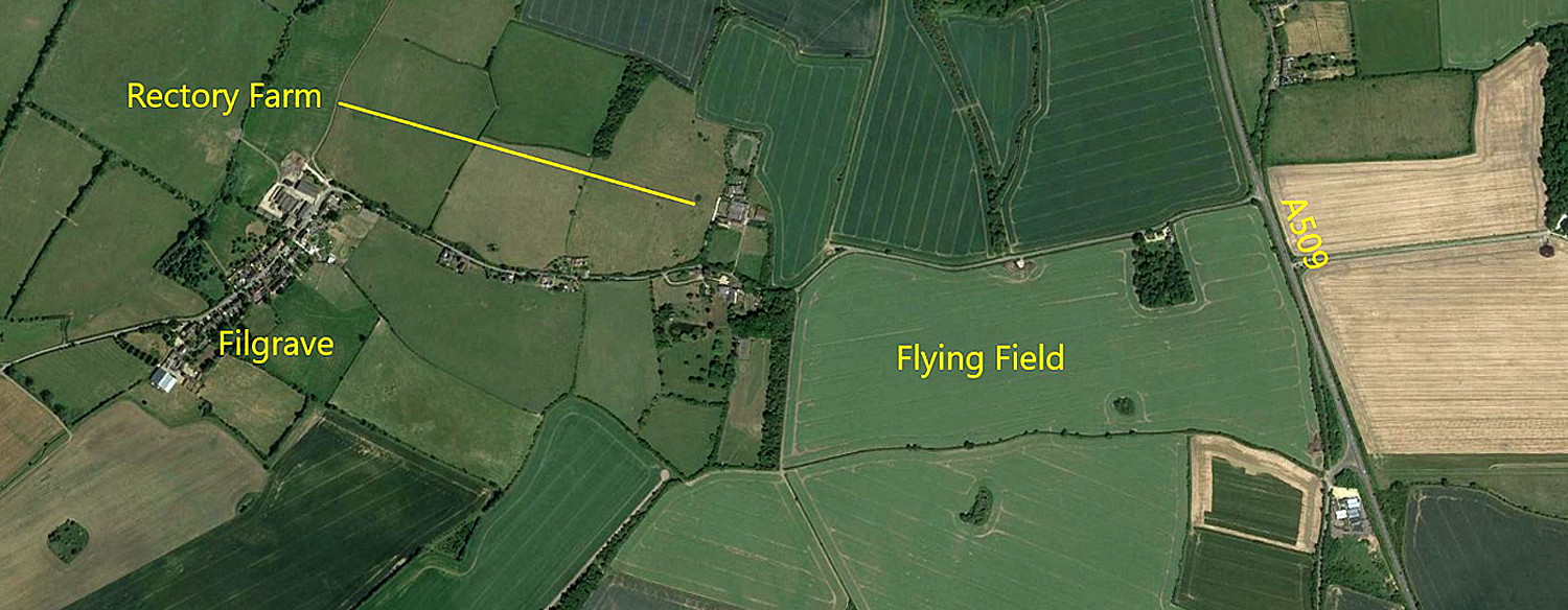
A FLYING CIRCUS VENUE - FILGRAVE
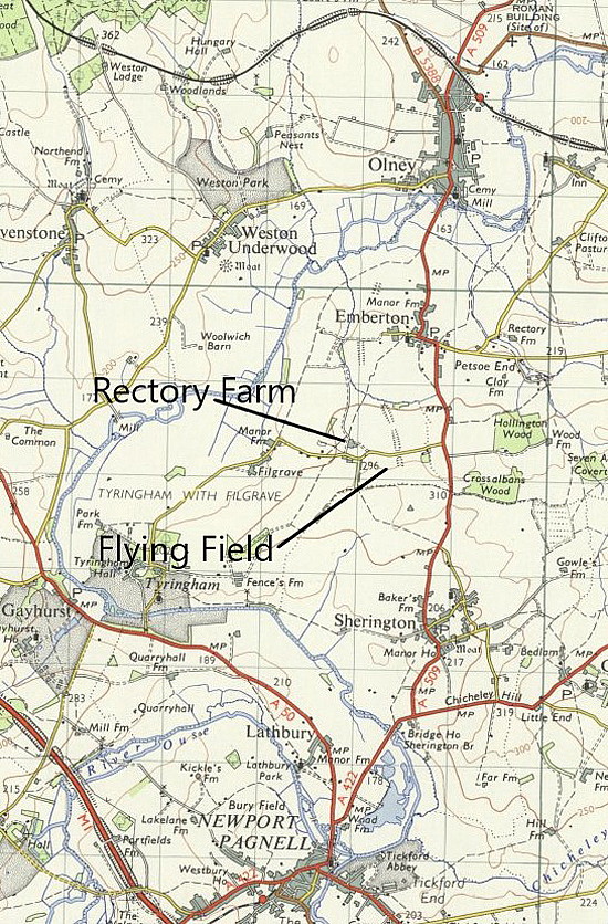
Location: Just W of the A509, about 3nm NNE of Newport Pagnell town centre
NOTE: Some years ago I made this note: "On the 16th June 1933 Cobham’s No.2 Tour displayed in/near Newport Pagnell. These events were invariably high profile and significant local occasions so presumbly some record still exists as to exactly where it took place? Today Newport Pagnell is part of the MILTON KEYNES development area."
I have found one mention of BURY FIELD near Newport Pagnell being an airfield at one point. Can anybody kindly offer advice?
A MICHAEL T HOLDER GALLERY
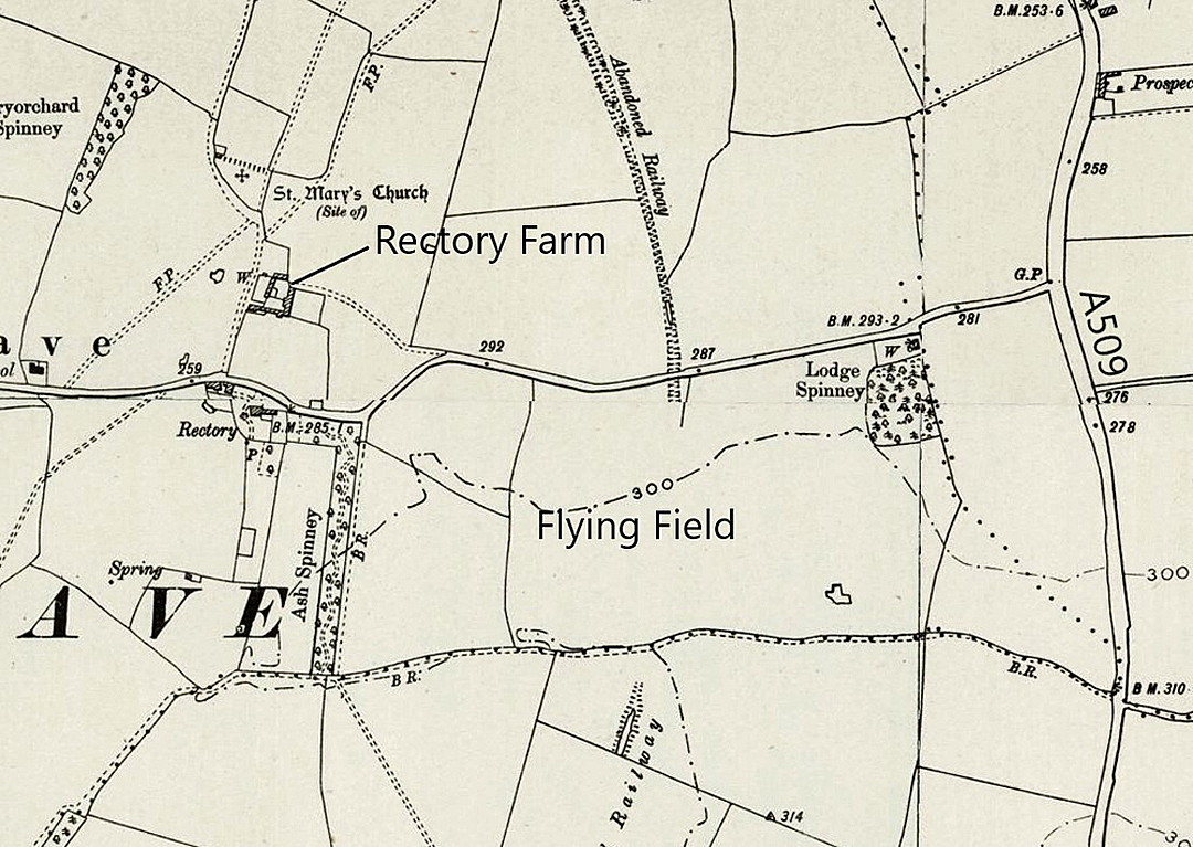
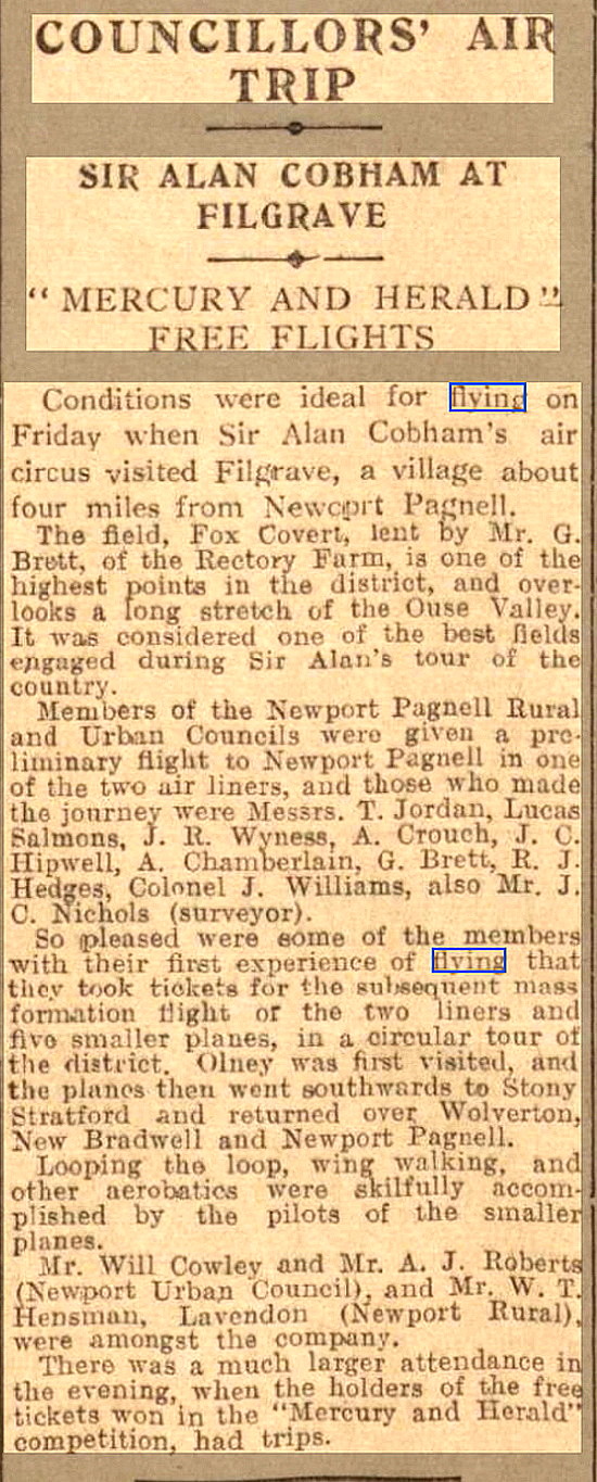
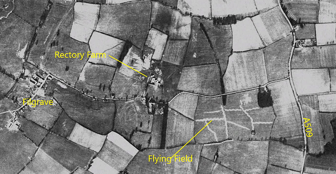
In 2022, Mike Holder, a great friend of this 'Guide', took it upon himself to investigate what evidence might exist of this event. And, exactly where it was held.
The article was published in the Northampton Mercury on the 23rd June 1933.
NOTES: In the article above, it mentions two airliners being used. For that year the two National Aviation Day Tours had five airliners, mostly using just two for each tour. We do not know which were used here. These were the two Airspeed AS.4 Ferrys, G-ABSI and G-ABSJ, and two Handley Page W.10s, G-EBMM and G-EBMR. Also used was the Handley Page HP.35 Clive, (some records say HP.33), G-ABYX. Think I am correct in thinking the three Handley Page examples were ex Imperial Airways?
Terry Clark
This comment was written on: 2018-01-11 05:24:01In the late 60s and early 70s, I used to go to watch drag racing at Santa Pod, Bedfordshire. I enjoyed this and an added attraction was the fact it took place on the disused Podington airfield. My route there was via the M1, leaving at Newport Pagnell then via Sherrington Road and Olney. Just after passing through`Newport Pagnell on the B526, it was necessary to turn right onto Sherrington Road and I noticed in a field on the right (Riversmeet Stables?)there was a windsock on view. The field didn't look very large so I assumed it was just a helipad however one day I saw a Dove parked in clear view from the road. I've now looked at satellite images and the field is substantially bigger than I thought.
Michael Holder
This comment was written on: 2020-05-12 15:28:25Bury Field looks a good candidate - fairly flat - there is an abandoned railway line cutting across it.
We'd love to hear from you, so please scroll down to leave a comment!
Leave a comment ...
Copyright (c) UK Airfield Guide


