Newquay flying sites
Note: This map only shows the position of Newquay town, within the UK.
NEWQUAY see also St MAWGAN (NEWQUAY AIRPORT and NEWQUAY CORNWALL AIRPORT)
NEWQUAY see also TREBELZUE
NEWQUAY: Early flying site
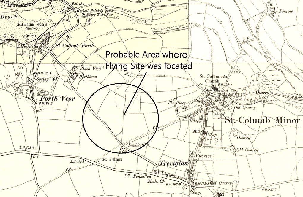
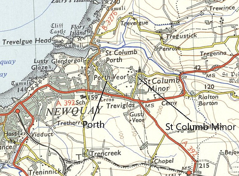
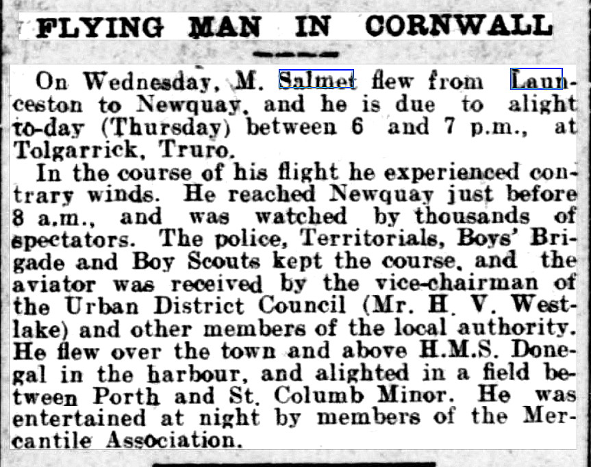
NOTES: The earliest mention of flying I have found in Newquay, was in June 1912 when the French pilot Henri Salmet was commissioned by the Daily Mail newspaper to fly his 50hp Blériot monoplane on a tour of much of the UK, including the 'West Country'. Departing from west London he visited several places and displayed before reaching the 'West Country'. It appears that having reached the 'West Country' he made 'displays of flying' at, for example, Tiverton, Northam Burrows near Bideford - plus Ilfracombe, Fowey, Bude and Launceston before reaching Newquay. And it seems, he had to make a forced landing at Bodmin along the way. It appears the furthest west he went was to Falmouth.
Mike Holder, a great friend of this 'Guide', has researched this Tour in detail. The full schedule can be found in my article - 'The 1912 tour by Henri Salmet'. MIke has also kindly provided the four items shown below.
Note: The newspaper article was published in the West Briton and Cornwall Advertiser on the 13th June 1912.
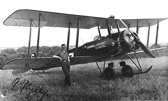
1924 & 1925 JOY RIDES
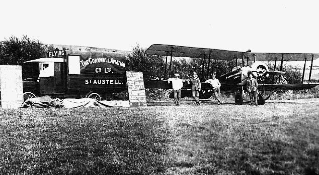
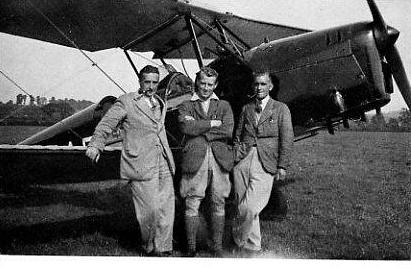
Note: All three of these pictures were scanned from Cornwall Aviation Company by Ted Chapman, published in 1979.
The first picture from T. Bounsall is captioned, "Autographed photographs were popular with passengers. This one was taken at Newquay, c. 1924."
The second picture from the Phillips family is captioned: "The body of this van was built at Hill & Philips garage on to a 1909 Argyll chassis. It had a two cylinder engine and solid tyres. The picture was probably taken at Newquay in early 1925 and shows (left to right) Mike Crocker, Percival Phillips, Gerry Draycott and A.J. Adams." I suspect, as Capt. Phillips is in the picture, that the aircraft is most probably G-EBIZ?
The third picture from Mrs C. Poole is captioned: "PP's Spartan G-ACAF was flown by Captain E.E. Jordan (left) in the 1934 season, and included a spell at Newquay, Cornwall, where this photograph was taken. Cyril Poole is on the right and the person in the centre is probably Jim Martin."
In his excellent book, Cornwall Aviation Company published in 1979, author Ted Chapman features this signed picture of Capt. Percival Philips with his then sole Avro 504K G-EBIZ. "Following the formation of the company, Avro G-EBIZ could be seen in the summer of 1924 at Newquay, Fowey and other Cornish resorts giving short flights at 5 shillings per passenger, many of whom had not been close to an aeroplane before, and much public interest was aroused."
The main problem is invariably trying to ascertain exactly where they flew from, and I suspect that in many cases this will probably never be known? As a general rule A J Adams, the Licensed Ground Engineer, had to spend quite a lot of time looking for suitable landing fields and arranging for the Air Ministry to inspect the site and issue a license for its use. It appears that most farmers were quite happy to be paid £1 per day for the use of a field.
"When the company became well known an application for an aerodrome license was often passed on the basis of a six inch scale map and PP's signature, without a site inspection by an Air Ministry official. As well as being suitable for the Avro, the field had to be accessible to intending passengers and not likely to arouse local opposition, but if this did develop, the company would usually move to another place."
It is fairly tempting to think that these pictures might well have taken at TREBELZUE (see seperate listing), but I cannot find evidence of that site being used before the 1930s. Also, from memory, after landing at St MAWGAN/NEWQUAY I cannot recall seing a hill this large so close to the airfield - in which TREBELZUE was partly located. If anybody can kindly offer advice, this will be most welcome.
We'd love to hear from you, so please scroll down to leave a comment!
Leave a comment ...
Copyright (c) UK Airfield Guide


