North Moor
NORTH MOOR: Private airfield and model flying site (Aka LOW HILL FARM)
Now known as: NORTH MOOR AERO CLUB and MODEL AIRCRAFT CLUB
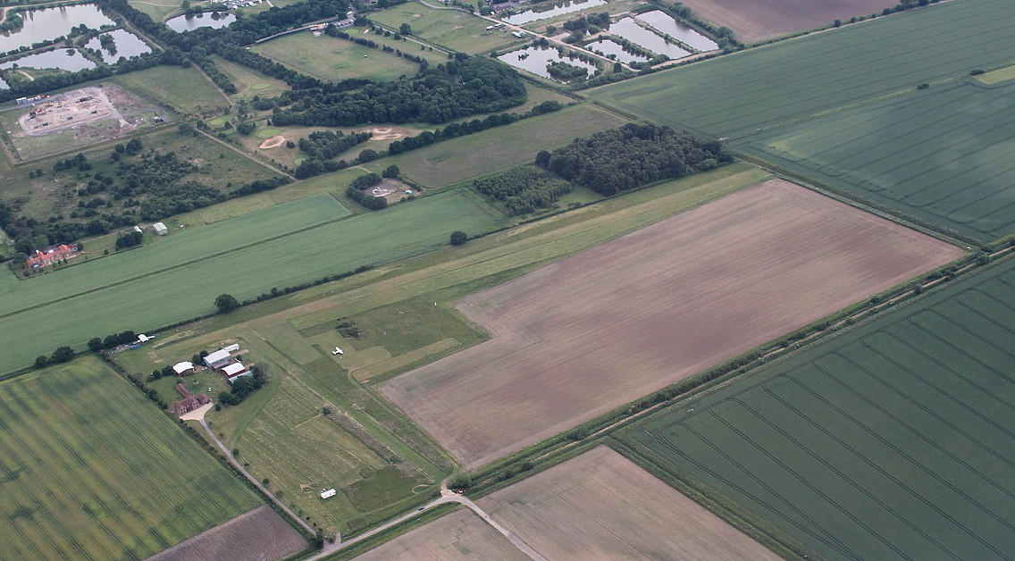
Note: The first picture is by the author.
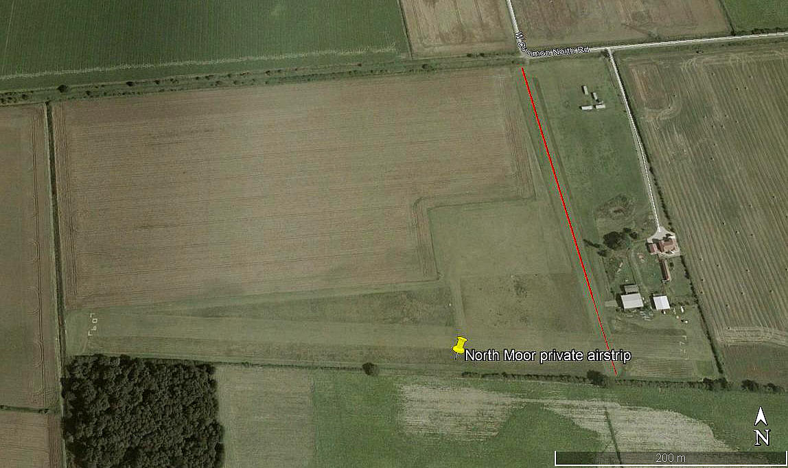
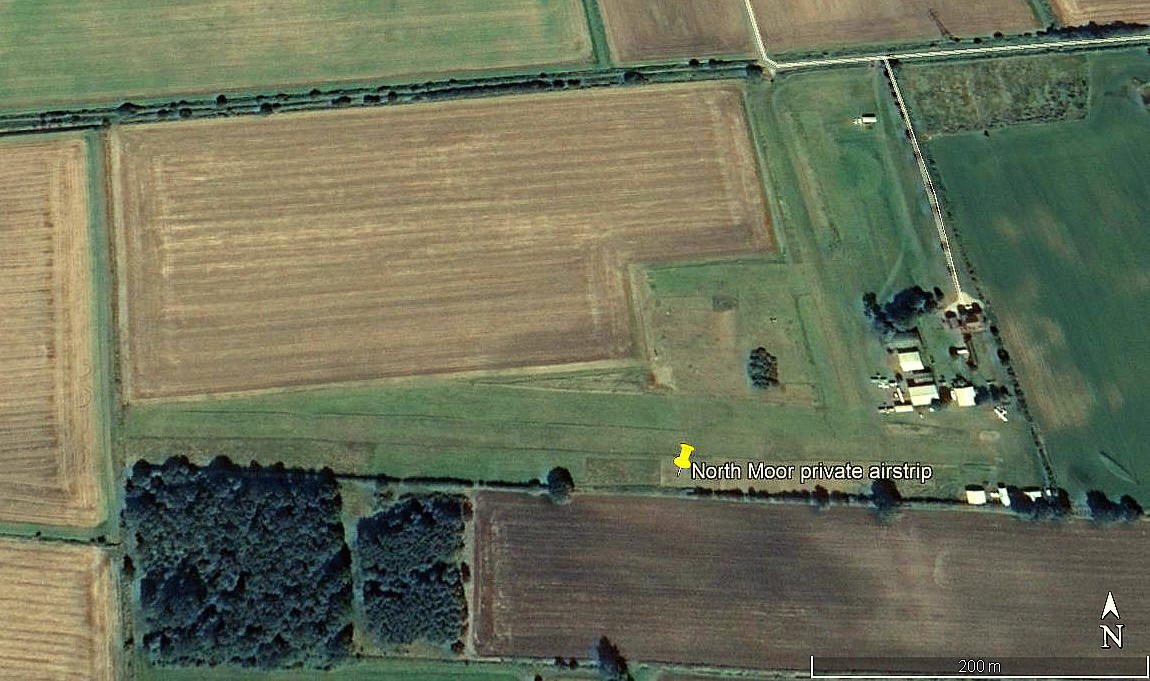
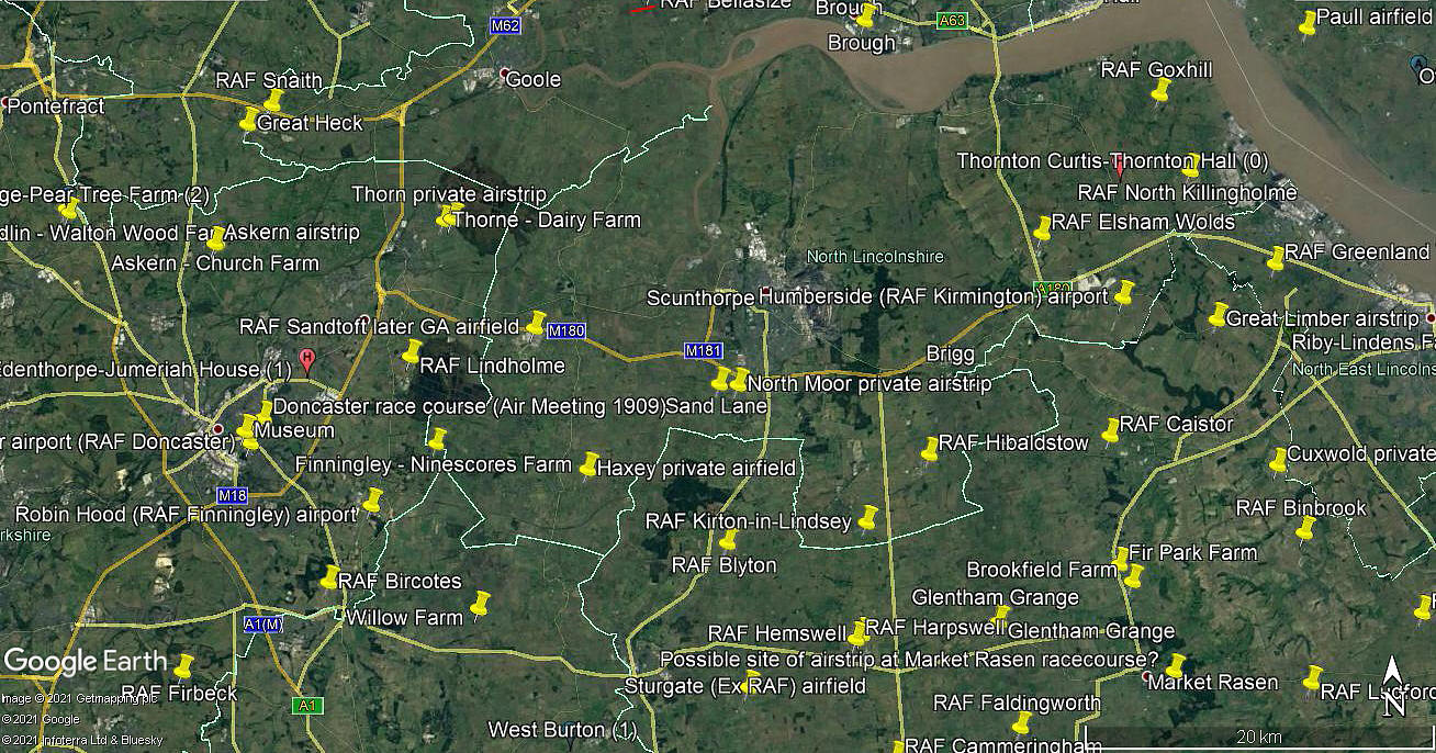
The next three were obtained from Google Earth ©
Operated by: Mr Eric Chapman
From 2022: Mr Darren Haley and wife. Operations: Ms Bethan Haley
Flying Club: North Moor Aero Club
Location: About 1.5nm WNW of Messingham, roughly 4nm SSW of Scunthorpe town centre
Period of operation: From 2002/3 (?) to –
Runway: 09/27 550x22 (?) grass
Note: Mr Graham Frost, a great friend of this 'Guide' has pointed out that another unmarked runway; 17/35 320 grass, has been available for use for many years, and the pictures above certainly seem to bear this out.
NOTES: I have come across a few accounts relating to NORTH MOOR including one which reckons the runway is possibly orientated 06/24. The reason I opted for 09/27 is because that is the direction given in the AAIB report EW/G2005/08/23. So presumably the AAIB have got it correct (?), although they were relying on an accident report filed by the pilot. Another accident near here also listed in a AAIB report EW/G2007/08/11 states the runway is 09/27 and this is confirmed by AAIB reports EW/G2009/08/08 and EW/G2014/07/15. Flying over it in July 2015 and then looking at Google Earth it is without any doubt a runway 09/27 550 metres long.
It is often quite astonishing just how much misleading information is around - in this 'so called' age of easy access information. For example I have found accounts of this runway being both 600 and 700 metres long. A look at the location on Google Earth seems to clearly indicate that 550 metres has always been the correct runway length? Indeed, one web-site linked to this location incorrectly states the runway is 600 metres long - information that can prove to be potentially dangerous for visitors with aircraft needing longer landing runs.
We'd love to hear from you, so please scroll down to leave a comment!
Leave a comment ...
Copyright (c) UK Airfield Guide


