


Plough Corner
PLOUGH CORNER: Military Landing Ground later civil aerodrome
Military users: RFC/RAF 38 (Home Defence) Sqdn
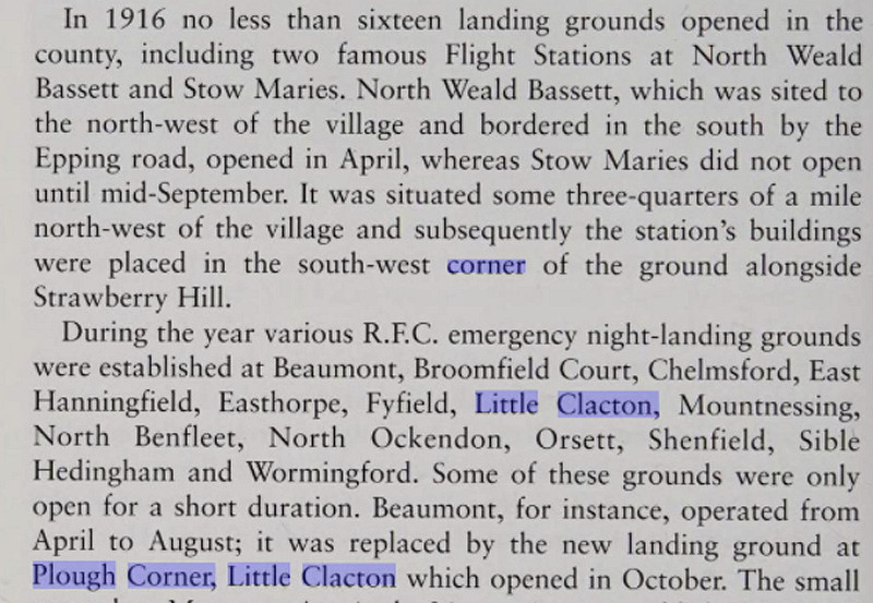
Note: Originally it appears, in 1916, an ELG (Emergency Landing Ground) for night operations
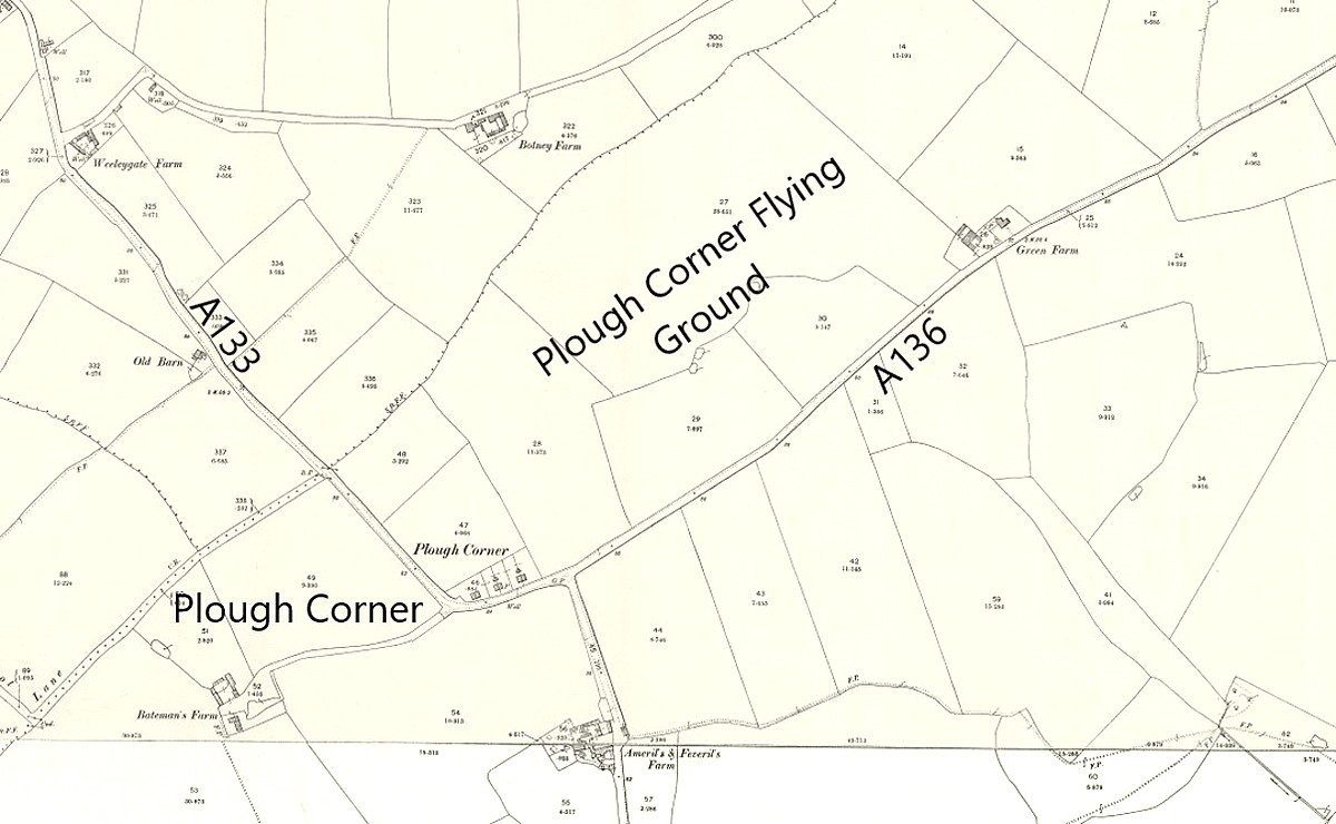
Location: About 2nm W of Thorpe-le-Soken, N of the B1414, roughly 3nm N of Clacton town centre
Period of operation: Military WW1: 1916 to 1919 Civil: 1921 certainly to 1939?
Site area: WW1: 53 acres 594 x 384
NOTES: The 1931 itinerary for the 1931 ‘Tour of Britain’ by the North British Aviation Co lists a venue on the 26th August as ‘The Aerodrome’ Clacton. Presumably this was the location?
FEW RESTRICTIONS
In those days there were virtually no restrictions on where a pilot could land. Indeed, on most military aerodromes visiting private pilots were welcomed and, on the other hand, military pilots very often flew into civil aerodromes on an ad-hoc arrangement. This said, it must be remembered that the vast majority of private pilots were either from the gentry (even aristocracy) or major celebrities. It might surprise some people that, regarding military aerodromes, by and large, some arrangements exist even today whereby private pilots can arrange visits.
However, there were certainly restrictions concerning how you could fly. To quote from Neville Doyle’s The Triple Alliance: “On Saturday, August 13th 1932, Clacton was subjected to a “Bombardment with Handbills” and one witness said that the aircraft were flying below the hotel at a height of 40 to 50 feet. It was alleged that people on the pier scattered in all directions, terror-stricken, and an ex-RAF man said the first two were at 250 – 300 feet and the third at 30 – 40 feet.” A very dim view was taken by the town worthies and summons were issued resulting in fines and costs of £26.5s.2d imposed on twelve defendents who answered 32 summonses. As the average weekly UK wage in 1932 was reckoned to be around £18 this was not much of a savage retribution.
Quoting from Neville Doyle again: “Their numerous crimes included: dropping balloons etc from aircraft without permission of the Secretary of State, causing same to be dropped, permitting same to be dropped, flying at such an altitude as to be dangerous to persons and property, depositing handbills on certain open spaces without authority, aiding and abetting, etc, etc!” Interesting is it not, in todays terms, to notice that so many separate charges could arise from, in effect, one single act? Is it really much better today?
What we don't know, is where these publicity 'air raids' were operating from in the Clacton-on-Sea area.
A MICHAEL T HOLDER GALLERY


Note: The article in Flight magazine was published on the 2nd June 1921.
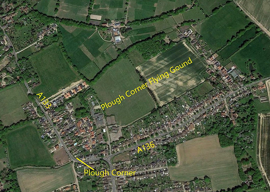

Note: The book excerpt is from Essex and its Race for the Skies by Graham Smith. The local area view is from my Google Earth © derived database.
ROAD NUMBERING
Always a constant problem when trying to provide a description of locations in a 'Guide' such as this. They keep on changing, it is a system in a state of constant flux. For example, in the fourth Google Earth picture above, Mike Holder has, quite rightly, put the road numbers in that applied at the tme. These are now, the A136 being the B1027, and the A133 being the B1441.
The first attempt to apply a numbering system to the roads in the UK goes back to 1913, and was delayed by the First World War. Work commenced again in 1919 and, it seems, the first definitive listing was published in 1923.
A FLYING CIRCUS VENUE
The 1932 itinerary of the Alan Cobham National Aviation Day UK Display Tour gives the venue, (26th July), as ‘The Flying Ground, Alton Park Road, Plough Corner, Clacton’. Clearly I was not the first person to get confused about the ALTON PARK ROAD and PLOUGH CORNER being entirely seperate locations!
We'd love to hear from you, so please scroll down to leave a comment!
Leave a comment ...
Copyright (c) UK Airfield Guide
