Pocklington
POCKLINGTON: Military Landing Ground then aerodrome, later gliding site….and civil aerodrome also?
(Known as BARMBY MOOR in WW1 and BARMBY)
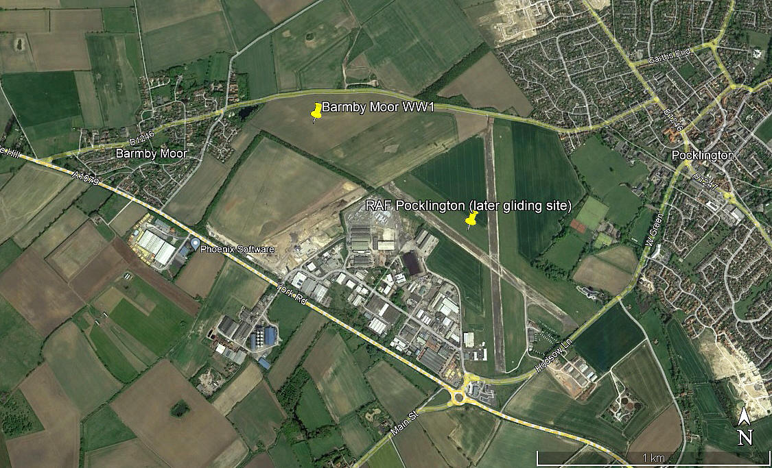
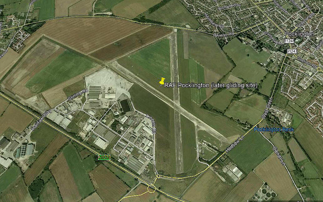
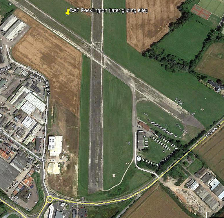
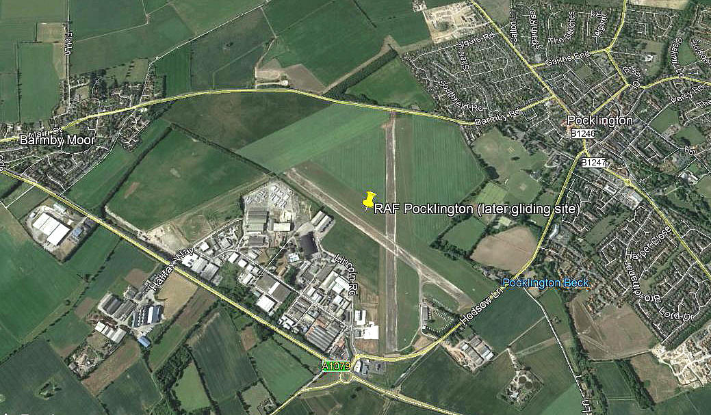
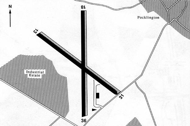
Note: These four pictures were obtained from Google Earth ©
Military users: WW1: RFC/RAF (Royal Flying Corps / Royal Air Force)
33 & 76 [Home Defence] Sqdns (Royal Aircraft Factory BE.2c & BE.12s)
WW2: RAF Bomber Command 4 Group
405 (RCAF) Sqdn (Vickers Wellingtons & later Handley Page Halifaxs)
10, 73 & 102 (Ceylon) Sqdns (Halifaxs)
Operated by: 1970s to 2000 and beyond: Wolds Gliding Club
Civil activities: GA private and gliding site (aero-tows?)
Location: S of B1246, N of A1079, SW of Pocklington, 10nm ESE of York
Period of operation: Military: WW1 1916 to 1919
WW2 1941 to 1946
Later civil to present day
Site area: WW1: 56 acres 530 x 393
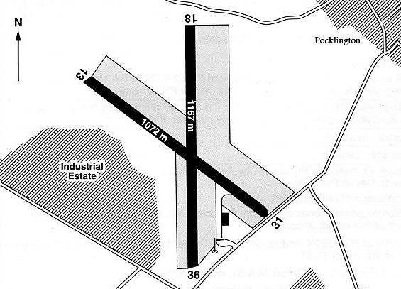
Note: These maps are reproduced with the kind permission of Pooleys Flight Equipment Ltd. Copyright Robert Pooley 2014.
Runways: WW2: 01/19 1189x46 hard 14/32 1646x46 hard
17/35 1189x46 hard
1990: 13/31 1128x46 hard 18/36 1128x46 hard
One later source: 13/31 1072x46 hard 18/36 1167x46 hard
13/31 1072x25 grass 18/36 1167x25 grass
Compare this to info in a 2000 Flight Guide:
13/31 1072x110 grass 18/36 1167x130 grass
13/31 1072x46 hard 18/36 1167x46 hard
NOTES: Apparently known as BARMBY MOOR and BARMBY in WW1 but why? Barmby Moor is just over 1nm W of Pocklington, (which is today a small town), and a much smaller entity, probably just a village. The relative importance of these two place names may have been quite opposite in WW1 of course. It seems there is an element of doubt regarding the exact locations of the WW1 Landing Grounds. To date this is the best guess.
Thankfully I am only producing a 'Guide'. Subjects like this are far too consuming to investigate, and anyway, far more knowledgeable people have already done their homework. The picture shows two sites, the one to the west being identified by the Airfields of Britain Conservation Trust UK. The second site, just NW of RAF POCKLINGTON has been identified by John Nottingham and Jeff Peck in their detailed account: Air Operations at Barmby Moor in World War One.
A QUERY?
Here again, although in 1944 the ‘set’ runway pattern for heavy bombers was one 2000 yard runway, (1829 metres) plus two 1400 yard runways, (1280 metres), this aerodrome differed from the norm. It was it seems laid out to be a heavy bomber base, (indeed Halifax heavy bombers operated from here), so why the shorter runways?
A BIT OF HISTORY
The degrees of success in bombing accuracy seemed to wax and wain during WW2. Initially the degree of accuracy in hitting the target was usually reasonably good, but at a truly dreadful cost to the crews. These raids were usually in daylight and at low level.
Once night bombing began hitting the target was very hit and miss….usually miss. To quote from Bomber Crew by John Sweetman referring to 1941: “In August came the unpalatable proof that, in spite of confident claims to the contrary, bombing accuracy was far from ideal. Mr D. M. Butt, a civil servant in the War Cabinet secretariat, produced an analysis of photographs taken during night operations over Germany. Only one in four of the aircraft which reported attacking their target had got within 5 miles (75 square miles) of it.
In the Ruhr in good weather the figure was one in ten, in bad visibility a depressing one in fifteen. Harris admitted that Butt revealed ‘the enormous possibilities of error in navigation at night’. The following month, he agreed that the thirty bombers which put 80 per cent of their bombs within two miles of the aiming point at Stettin were ‘exceptional’. Shaken by Butt’s revelations, Churchill lamented: ‘It is an awful thought that perhaps three quarters of our bombs go astray’.”
Needless to say, with the aid of boffins devising ever better navigation aids, and the introduction of ace 'Pathfinder' squadrons to 'light up' the targets, the accuracy of bombing soon improved.
A LITTLE KNOWN ASPECT
Within eight weeks if war with Germany being declared, the British government lifted the colour bar for men wishing to join the British military forces, although it seems that only the RAF implemented this, at least initially. As a consequence some six thousand men from the Caribbean and West Africa volunteered to serve in the RAF. Of these around four hundred were accepted as aircrew.
One such was John Blair from Jamaica and he served as a navigator with 102 (Ceylon) Squadron flying the Haifax II, the Halifax III and finally the Halifax VI. It appears that 102 (Ceylon) Squadron suffered the third heaviest losses of any Bomber Command squadron during WW2, losing 192 aircraft altogether.
If you are interested in this subject please look at my listing for ELSHAM WOLDS which gives more information.
SPOTTERS NOTES
In 1977 it seems only two aircraft were based here; Piper PA-30 Twin Commanche 160C G-AYSB of R M English & Son Ltd, and D.62B Condor G-AYZT belonging to the Wolds Gliding Club. But, was the Condor used for towing duties? It seems highly unlikely, but, if not - what was its purpose?
A PICTURE
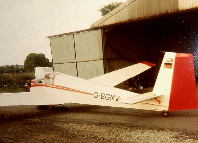
Mr Graham Frost, a great friend of this 'Guide' sent this picture he took in the late 1970s with his trusty Instamatic. It is of the Scheibe SF25B, G-BGMV. (ex- D-KEBG), which was registered to the Wolds Gliding Club from 03.10.79 until 31.05.91.
david fielder
This comment was written on: 2017-06-04 09:45:55Does anyone have a copy of the "wind rose" for RAF Pocklington please or advise on tracing it please
Reply from Dick Flute:
Hi David, I shall keep this request posted and hopefully somebody can help. It might be a good idea to post some contact details. Regards, Dick
Terry Clark
This comment was written on: 2018-10-09 02:09:59I understand the reason the 'main' runway was shorter then normal was because building commenced before 4 engined bombers came into service and the 'standard' 2000yd runway was specified when it was found Halifaxes were a bit 'tight' operating off the shorter spec runway.
We'd love to hear from you, so please scroll down to leave a comment!
Leave a comment ...
Copyright (c) UK Airfield Guide


