Rand Farm
RAND FARM: Private airstrip
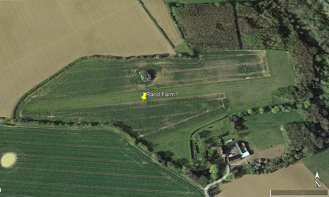
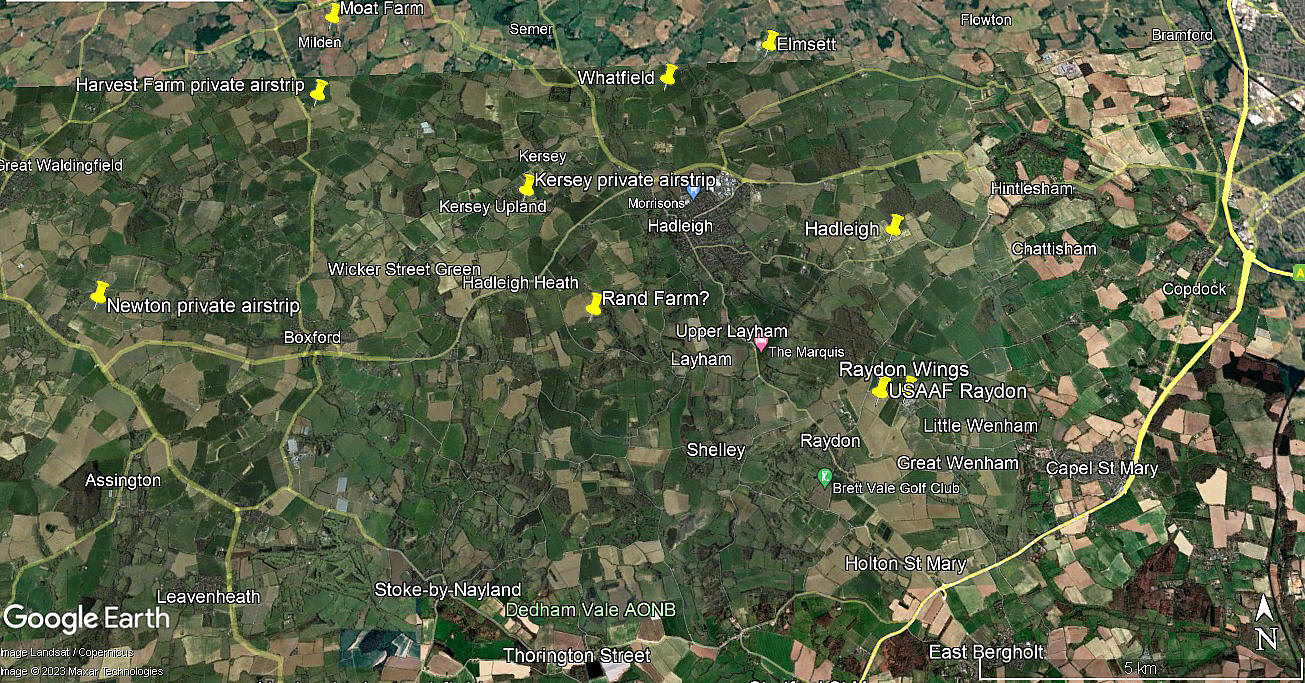
Note: The first three pictures were obtained from Google Earth ©. The local area view is from my Google Earth © derived database.
Location: About 1.5nm SW of Hadleigh town centre and roughly 9nm WSW of Ipswich town centre
Period of operation: Unknown? From the 1990s at least to -
Runway: 09/27 500 grass
NOTES: We have Mr Graham Frost, a great friend of this 'Guide', to thank for pointing out this location. But, we do not know what it is called? Graham thinks it might be RAND FARM, whereas I reckon it might be RANDS FARM as it is at the top of Rands Lane.
In the greater scheme of things this aspect is of no great importance as the purpose of this 'Guide' is to record the history of our aviation heritage, and the pictures serve this purpose well enough. Trouble being I need a name to list it as. Quite often something of a problem as so many locations are known by two, three or even more names! Hopefully I manage to provide a cross-reference in most cases.
As always, if anybody can kindly offer advice and information, this will be most welcome. Pictures are of course much appreciated.
We'd love to hear from you, so please scroll down to leave a comment!
Leave a comment ...
Copyright (c) UK Airfield Guide


