Rheydyn Coch flying sites
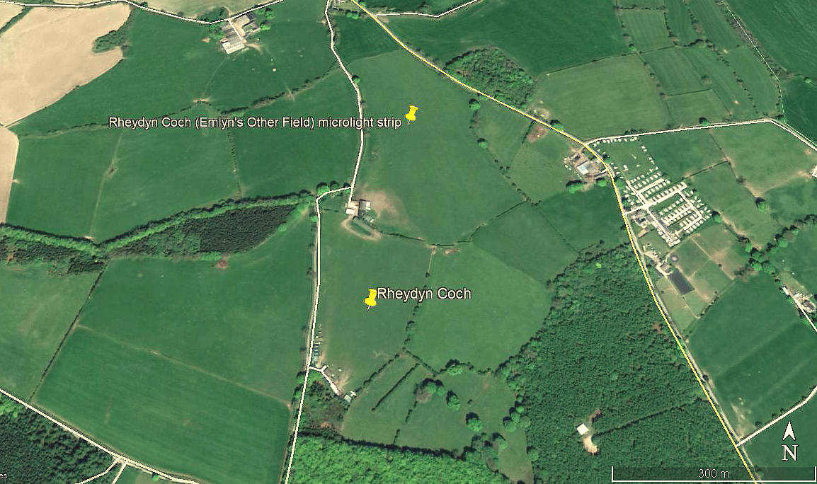
RHEYDYN COCH: Two adjacent flying sites
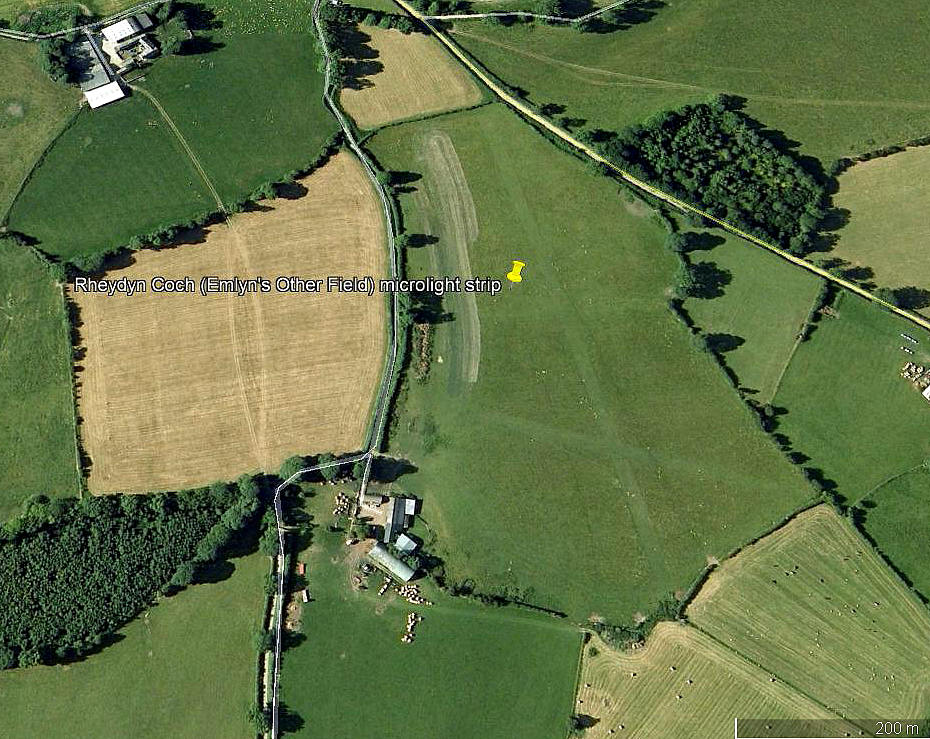
RHEYDYN COCH NORTH: Microlight airfield (Also known as EMLYN’S OTHER FIELD)
Note: Both of these pictures were obtained from Google Earth ©
Operated by: 2001: Mr Emlyn Jones
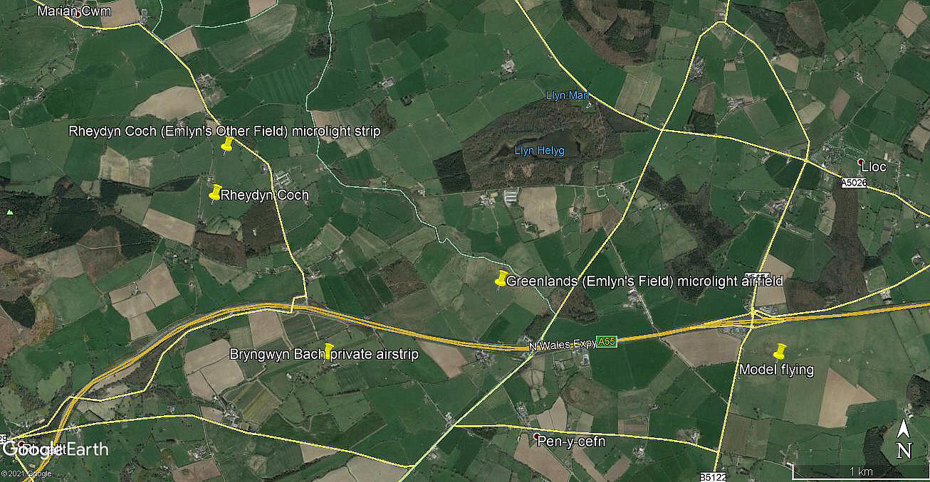
Location: N of the A55, roughly 3.5nm SSE of Prestatyn town centre
Period of operation: 1990s to -
Runways: 2001: 11/29 302x9 grass 18/36 402x9 grass
2006: 10/28 270 grass 16/34 410 grass
NOTES: One pilots guide mentioned a few years ago that the runways are unmarked, pilots are to identify them by witness marks left by previous aircraft. As the 2006 picture above clearly shows, this was not always the case - the two runways being very easy to see.
What is most unusual is that with nearby GREENLANDS (EMLYN'S FIELD) and also BRYNGWYN BACH - there are, or at least have been, four airstrips which are very close together - a most unusual arrangement.
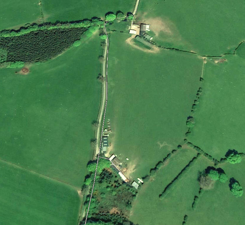
RHEYDEN COCH SOUTH: Private landing area
Note: These pictures were also obtained from Google Earth ©
Location: Immediately S of the location listed above. (In the next field)
Period of operation: ?
Landing area: Very roughly N/S with a maximum run of 260 metres.
NOTES: Experience has taught me to be very wary of jumping to conclusions. However, it does seem to appear that this location may well be operated by Mr Dick Davison, who has owned the Piper PA-18 Super Cub G-BVRZ since 2002. I have found a mention of it being based here in 2007. But, the aeroplane in the 2016 picture above does not seem to resemble a Super Cub? It looks too 'close-coupled' - but it is a fuzzy image.
As always in this 'Guide', if anybody can kindly offer advice, this will be most welcome.
We'd love to hear from you, so please scroll down to leave a comment!
Leave a comment ...
Copyright (c) UK Airfield Guide


