Rhigos
RHIGOS: Gliding site
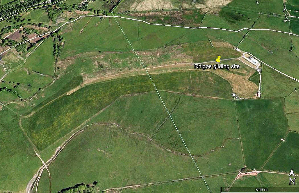
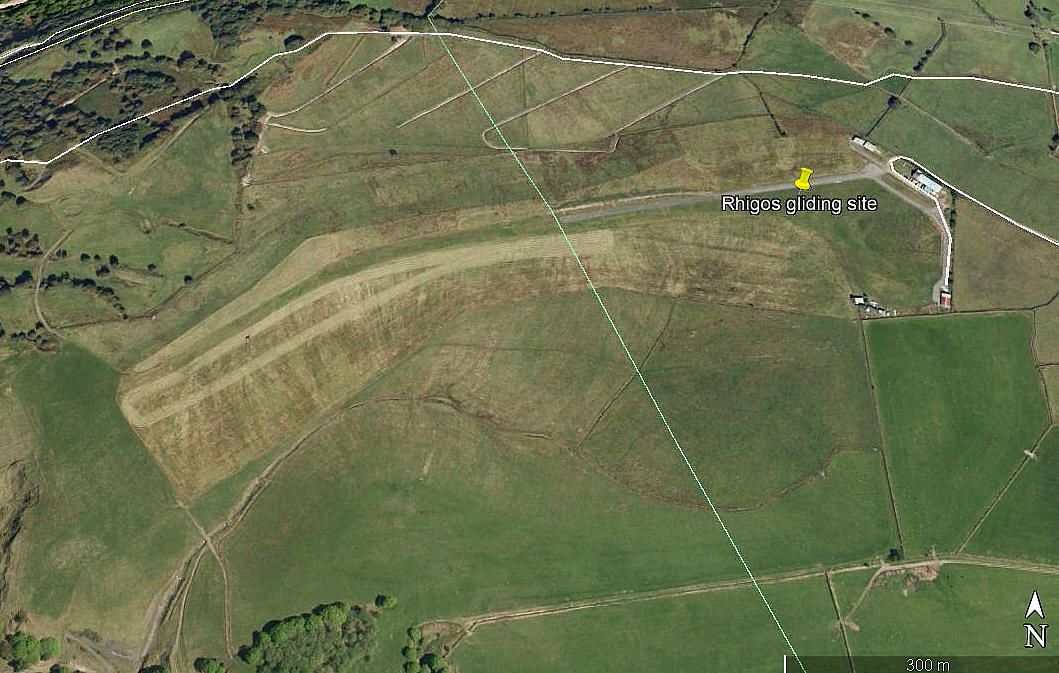
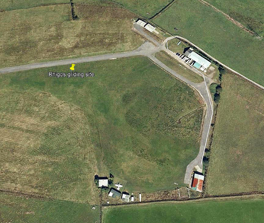
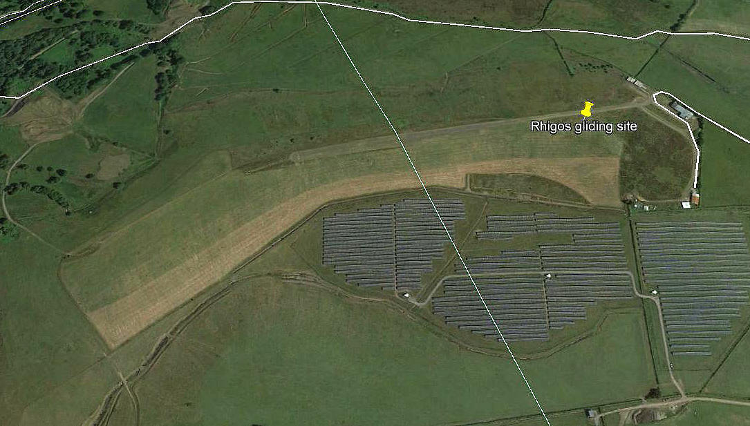
Note: All four of these pictures were obtained from Google Earth ©
Operated by: 1980/2000: Vale of Neath Gliding Club
Location: 8nm SW of Merthyr Tydfil according to one flight guide. Another airfield guide published in the 1980s says it is one mile south of the A465 and half a mile West of Rhigos
Period of operation: 1980s (?) to -
Runway: 1990/2000: 09/27 550 grass
2005: The AAIB report EW/C2005/08/07 states the runway is 900 metres long, roughly E/W, curved, narrow and drops off steeply each side
2012: The AAIB report EW/G2012/10/03 reports: 08/26 730 x 6 gravel
This just goes to show just how confusing written reports can be. Thanks to Google Earth being available, in late 2019 I took another look. And, as you can see, a much clearer picture of the site emerges. The main gliding area which has a 20° 'dog-leg' is certainly not "narrow". The main landing distances within the area, in a straight line are: 08/26 700 metres, and 06/24 480 metres
In about 2010 a 'hard' runway was added running along the north side of the site. 08/26 605
This may well explain why I once thought that a private airstrip existed nearby. (See below).
NOTES: The ‘Barmy Army’ local government brigade of extremist idiots have of course flourished and blossomed in South Wales inventing a myriad quagmire of ‘false’ counties to suit their devious aims and spurious political agendas. Faced with this nightmare scenario they have created, I have no idea where to place this flying site in the proper history of the UK and therefore readily admit to being defeated.
A brief look at any modern map will reveal the utter nonsense of their thinking, the damage done, and the mayhem caused by these sad, deluded, stupid, bigoted and very small-minded people, (not that I am biased of course), who have forced through in this part of the UK their efforts to totally destroy the history of the region, the cultural identity, and for that matter any semblance of an established and cohesive society I suspect. Are they are satisfied with the result?
A PRIVATE STRIP NEARBY?
I have also listed RHIGOS in response to the AAIB report EW/G97/12/14 assuming this incident occurred at this gliding site involving a Jodel D117 G-AWWI? Or is there a private airstrip nearby?
LATER INFO
In June 2022 I was kindly contacted by Mr Phil Thomas. He tells us that gliding has now ceased here and it is planned to change the name of Vale of Neath Gliding Club to Vale of Neath Aero Club.
We'd love to hear from you, so please scroll down to leave a comment!
Leave a comment ...
Copyright (c) UK Airfield Guide


