


Ringstead
RINGSTEAD: Private airstrip/airfield
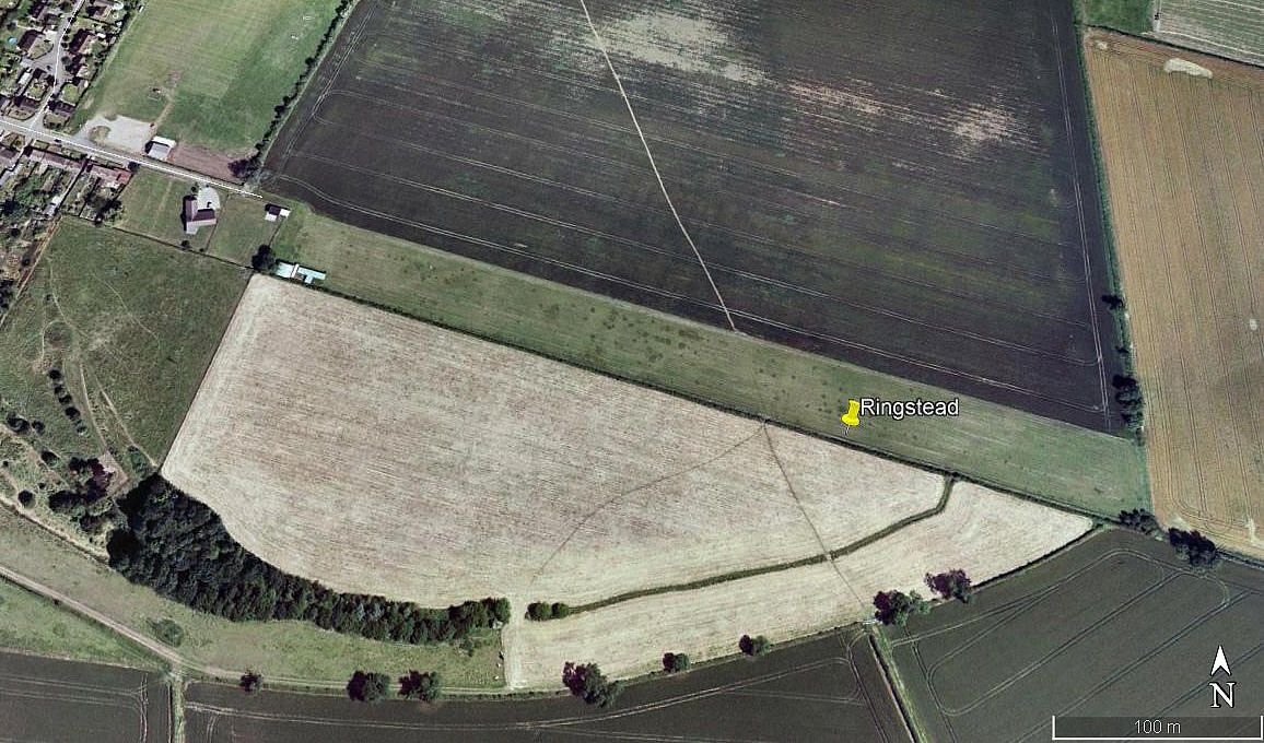
Aerial view 2006
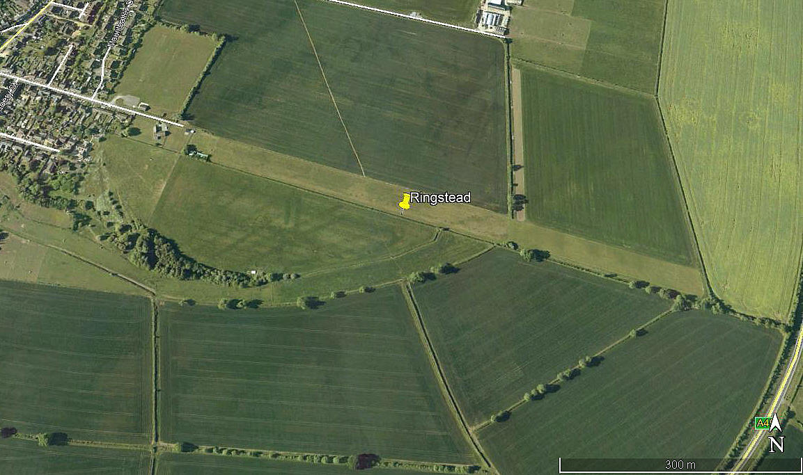
Aerial view 2010
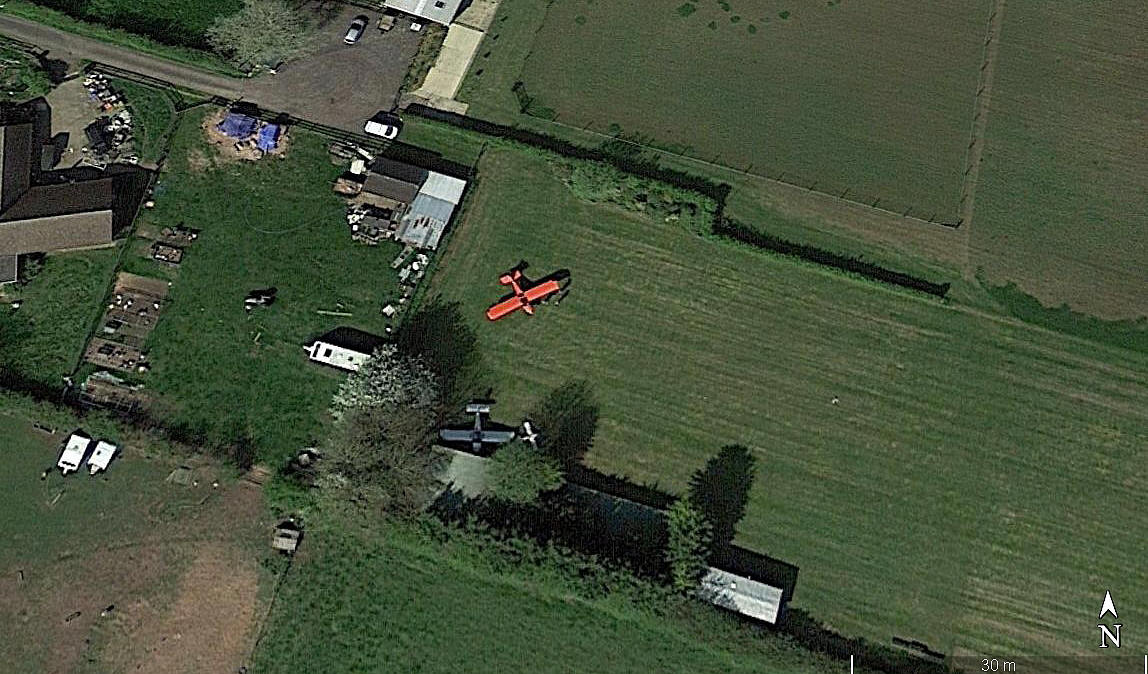
Aerial detail 2017
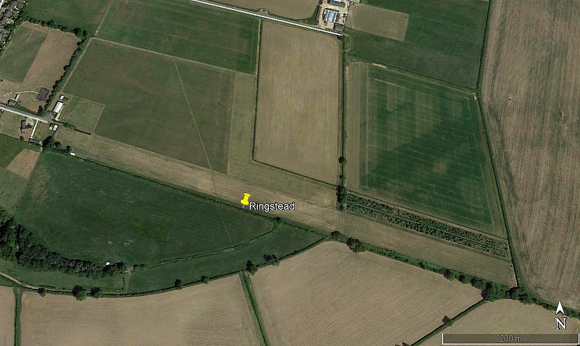
Aerial view 2017
Note: All four of these pictures were obtained from Google Earth ©
Location: Just W of the A45, just E of Ringstead village, 2nm S of Thrapston town centre
Period of operation: Early 2000s (?) to -
Runway(s): 2006: 11/29 475 grass 2010: Extended to 730 metres
2017: 11/29 730 grass ? 18/36 335 grass
NOTES: It certainly looks like a N/S runway has possibly been added in recent years? Or, it could simply be way the field has been mowed?
As always in this 'Guide', if anybody can kindly offer advice, this will be much appreciated.
We'd love to hear from you, so please scroll down to leave a comment!
Leave a comment ...
Copyright (c) UK Airfield Guide

