Ringstone Edge Moor
RINGSTONE EDGE MOOR: Gliding site (Aka BARKISLAND)
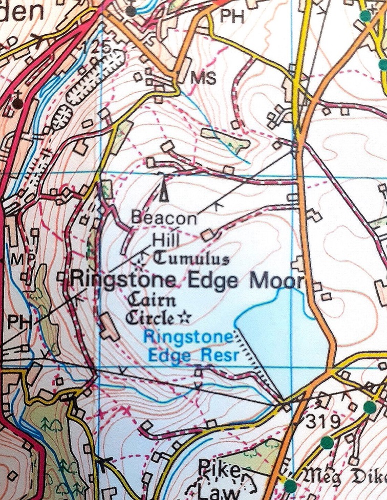
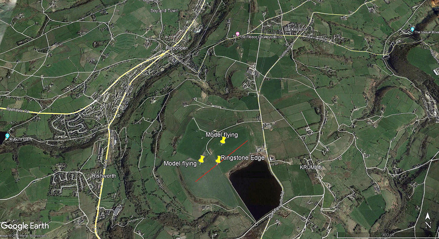
The map was kindly provided by Mr Graham Frost. The local view is from my Google Earth © derived database.
Operated by: Halifax Gliding Club
Location: Just W of Saddleworth Road, about 0.75nm SSE to SE of Ripponden town centre. Roughly 5nm SW of Halifax town centre
Period of operation: Unknown? Almost certainly from 1969 to 1971 at least?
NOTES: We have Mr Graham Frost, a great friend of this 'Guide', to thank for pointing out this location.
We do not know for certain the exact location, but, judging from the contours on the map, I think this is most likely? It seems to afford a fairly level area with a landing area, roughly SW/NE of around 650 metres.
One aspect that initially confused me, is why was it also referred to as BARKISLAND when Ripponden was closer? I now think that the map provides the likely answer as the only decent road to the site, Saddleworth Road, runs south from Barkisland.
It appears that the Halifax Gliding Club had three aircraft, one of which appears in an accident report. This is the Slingsby T.21 BGA1521, (ex WB948), which crashed here and written off 06.04.69.
Another aspect of this location is that, since 1973, it has been used for model flying by the West Yorkshire Model Flying Club, see the RINGSTONE listing. If anybody can kindly offer advice and information, this will be much appreciated.
We'd love to hear from you, so please scroll down to leave a comment!
Leave a comment ...
Copyright (c) UK Airfield Guide


