Now having 7,000 + listed!

Probably becoming the most extensive British flying sites guide online...?

portfolio1 portfolio2 portfolio3 portfolio4

Heading 1

This is an example of the content for a specific image in the Nivo slider. Provide a short description of the image here....

Heading 2

This is an example of the content for a specific image in the Nivo slider. Provide a short description of the image here....

Heading 3

This is an example of the content for a specific image in the Nivo slider. Provide a short description of the image here....

Heading 4

This is an example of the content for a specific image in the Nivo slider. Provide a short description of the image here....

small portfolio1 small portfolio2 small portfolio3 small portfolio4
themed object
A Guide to the history of British flying sites within the United Kingdom
get in touch

Rockwood Farm


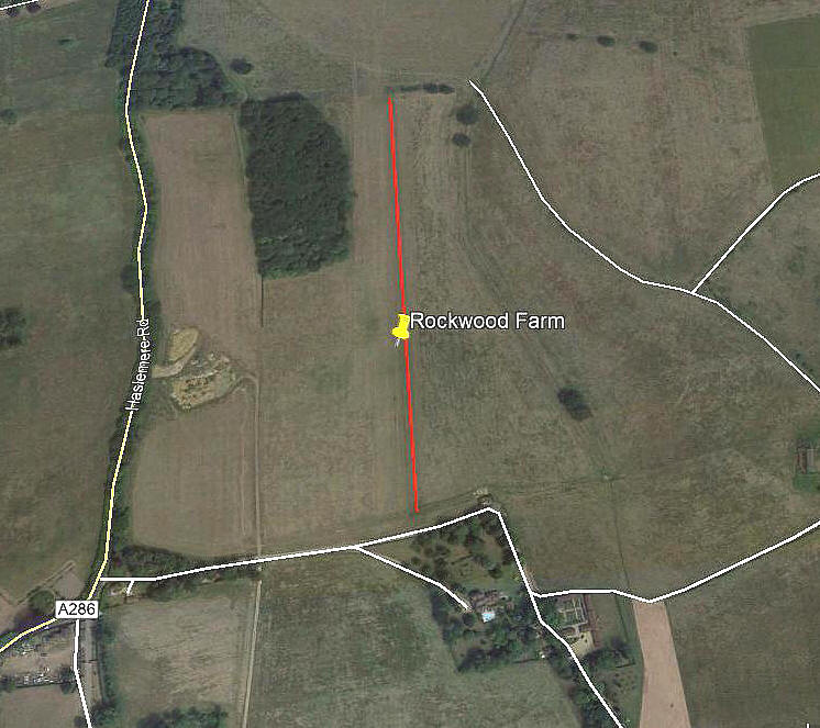
ROCKWOOD FARM:   Private airstrip

Aerial view
Aerial view

Note:  This picture (2018) was obtained from Google Earth ©


Location: Just E of the A286, just NNE of Brook and roughly 4nm NNE of Haslemere town centre 

Period of operation:  ?


Runway:  18/36   585   grass


NOTES:  Terry Clark who is a good friend and contributor to this 'Guide' sent me some information from an estate agents web-site in early February 2019. The blurb mentioned that the farm has an airstrip and hangar - which was marked on a map of the site.

Looked at on Google Earth the airstrip is not particularly visible, so my 'red line' on the picture only gives my estimation based on the map. If correct it would appear that this strip can probably be easily lengthened. And, vague signs appear to indicate it once was?

If anybody could kindly offer more advice, this will be most welcome.


We'd love to hear from you, so please scroll down to leave a comment!


Leave a comment ...


Name
 
Email:
 
Message:


Copyright (c) UK Airfield Guide


slide up button