


Runnymede
Note: This map only gives a general position within the UK.
RUNNYMEDE: Temporary joy riding venues
Operated by: Henderson Flying School and Skyways
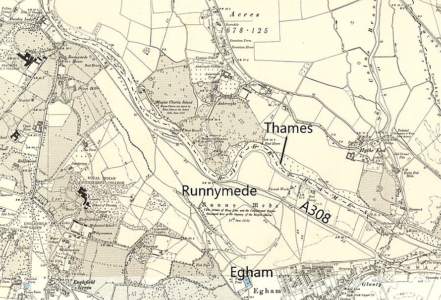
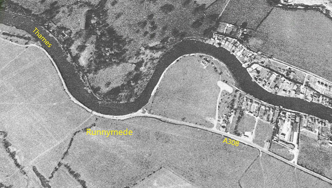
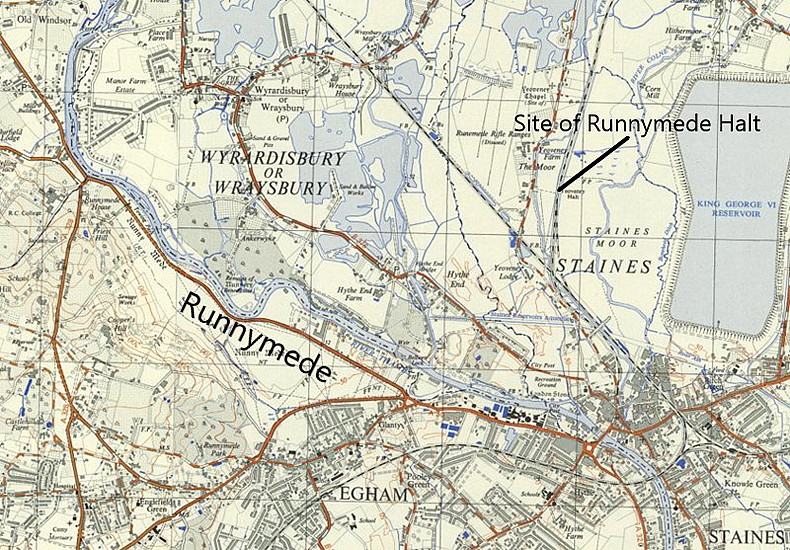
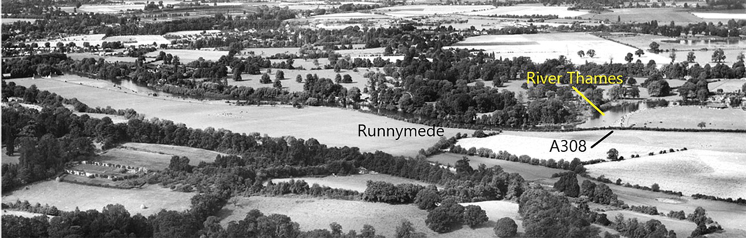
Location: First site, W of Staines, NW of Egham. 2nd site NNE of Egham and NNW of Staines
Period of operation: 1928 and 1929
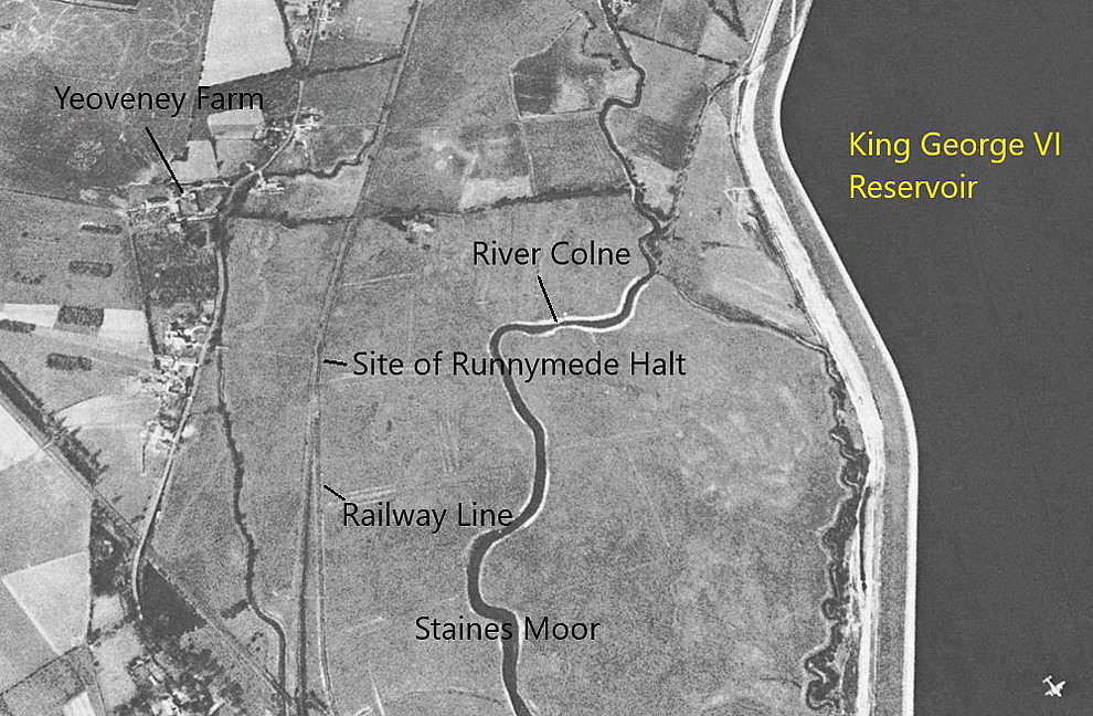
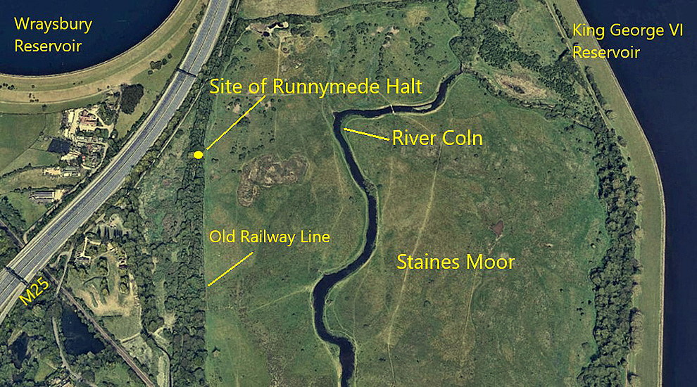
NOTES: I would appear that two sites were being used here? It was not usual in those days for two operations to share the same site, and it appears that one of these companies was using a site west of Egham alongside the River Thames, and the other a site on Staines Moor adjacent to the Runnymede Halt station. Probably used by Skyways?
A MICHAEL T HOLDER GALLERY
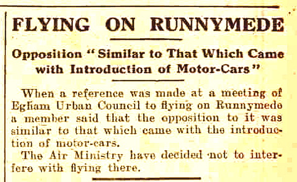
Note: The newspaper article was published in the Daily Mirror on the 24th August 1928.

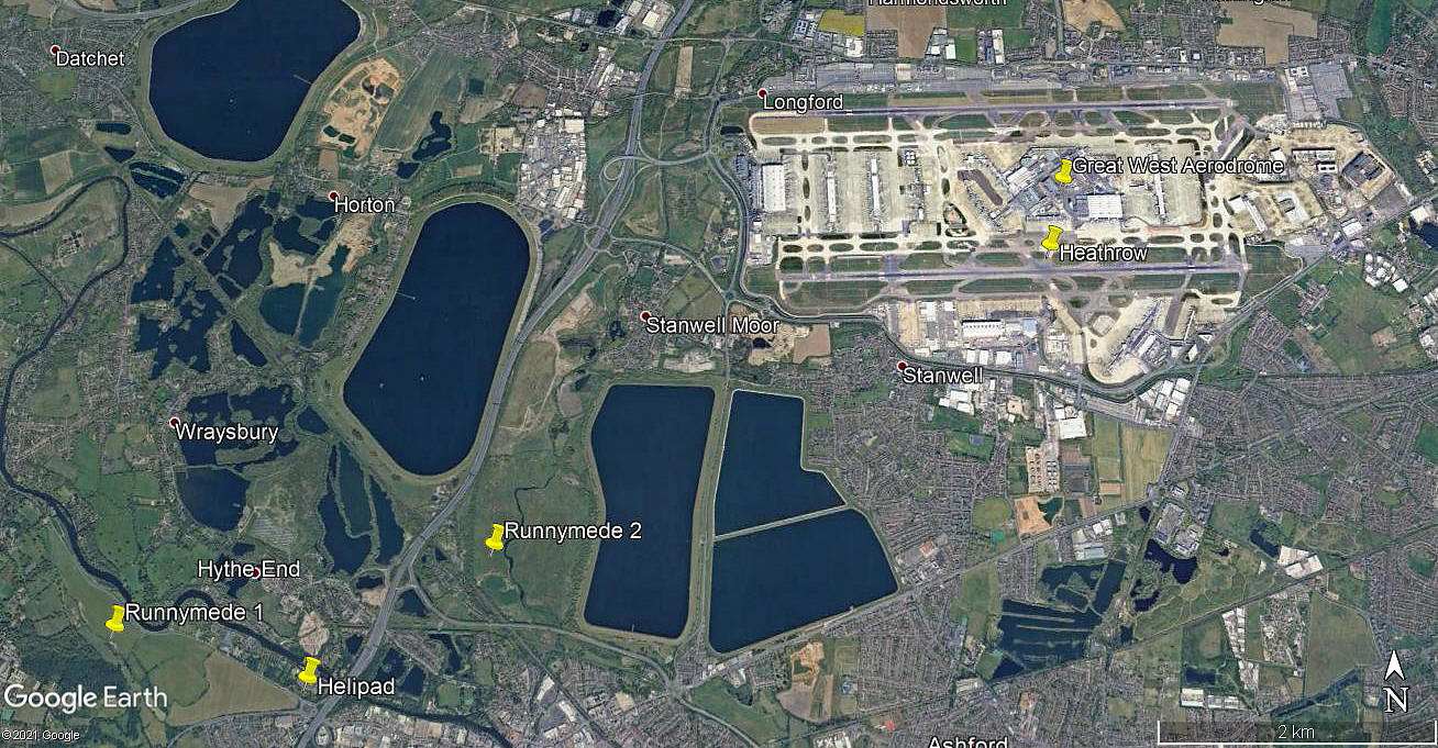
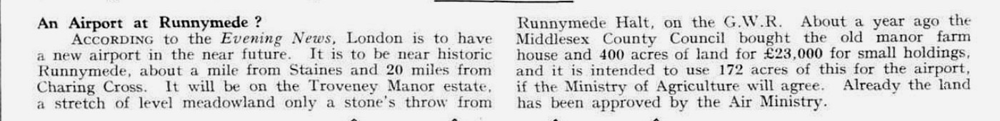
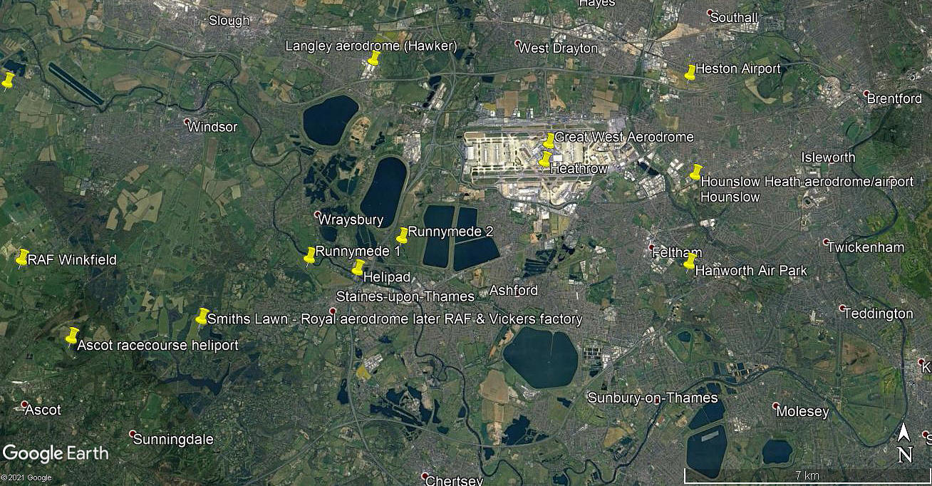
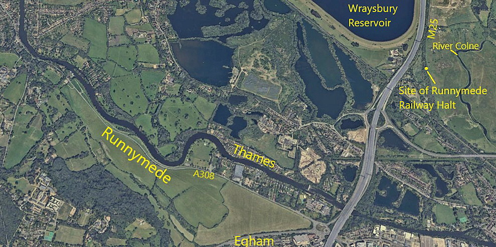
The article in Flight magazine was published on the 4th March 1932. And what a revelation that is! An airport of 176 acres. Quite enough in those days of course. By comparison it appears that HEATHROW today occupies 3000 acres. I have added the two Google Earth © pictures of a local area view and an area view;
NOTES: For years, especially since starting work on this ‘Guide’ in around 1997 or so, I couldn’t figure out why Runnymede hadn’t been used as a flying site. I’d known the area since I was about eight years old and it seemed ideal. Then, in December 2011 I discovered an autobiography by Don Robertson, ‘The Urge To Fly’, and on page 15 discovered this nugget. Don was learning to fly at the Henderson Flying School at BROOKLANDS in 1928.
“On weekends we used to fly over to a field by the river at Runnymede, taking up joyriders at 5s a head. My job was to sell tickets but it was well worth it as I was getting two cross-country flights free.”
As an aside, having researched the joy-riding operators for many years, it would appear that the standard fare for a 'quick flip', usually barely more than an extended circuit, was five shillings. And, this seemed to remain the case from the 1920s through to the 1930s. I suppose that over this period of time the novelty value wore off to some extent, so the solution for the operators was to reduce the time spent in the air?
We'd love to hear from you, so please scroll down to leave a comment!
Leave a comment ...
Copyright (c) UK Airfield Guide

