Now having 7,000 + listed!

Probably becoming the most extensive British flying sites guide online...?

portfolio1 portfolio2 portfolio3 portfolio4

Heading 1

This is an example of the content for a specific image in the Nivo slider. Provide a short description of the image here....

Heading 2

This is an example of the content for a specific image in the Nivo slider. Provide a short description of the image here....

Heading 3

This is an example of the content for a specific image in the Nivo slider. Provide a short description of the image here....

Heading 4

This is an example of the content for a specific image in the Nivo slider. Provide a short description of the image here....

small portfolio1 small portfolio2 small portfolio3 small portfolio4
themed object
A Guide to the history of British flying sites within the United Kingdom
get in touch

Strathbeg


STRATHBEG: Military Seaplane Station

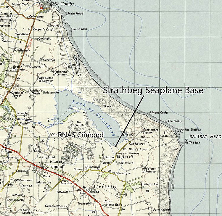
Local map
Local map
Google ground view
Google ground view
Local area map
Local area map
Google Earth © detail

Note:  All four of these items were kindly provided by Mr Michael T Holder, a great friend of this 'Guide'.


Military users: RNAS/RAF Sub-Station to PETERHEAD


Location: SE end of Loch of Strathbeg, S of Back Bar, just E to SE of RNAS CRIMOND, N of the A90 and Blackhill, about 7nm NNW of Peterhead

Period of operation: 1917 to 1919


Site area: 28 acres


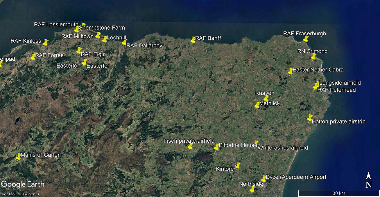
Area view
Area view


Note: I have added this area view. Interesting I think, to see how close the WW1 seaplane station was to the WW2 airfield at CRIMOND. 


We'd love to hear from you, so please scroll down to leave a comment!


Leave a comment ...


Name
 
Email:
 
Message:


Copyright (c) UK Airfield Guide


slide up button