Tolpuddle flying sites
Note: This map only gives the position of Tolpuddle village within the UK. If anybody knows of a more exact location, this advice will be most welcome.
TOLPUDDLE: Military (secret) airfield
Operation by: RAF clandestine operations for the S.O.E. (Special Operations Executive)
Location: Nr Tolpuddle village which is just south of the new A35 about 7nm NE of Dorchester
Period of operation: WW2 only?
NOTES: It appears that Westland Lysanders were based here during WW2 to ferry and supply secret agents (and light equipment) to and from enemy held territory. Apparently the Miles Monarch G-AFJU, (which had been impressed into military service), was used to ferry the Lysander pilots into and out of TOLPUDDLE.
This information came from a fairly reliable source but I have been unable to find anything else to corroborate and expand on this - any ideas?
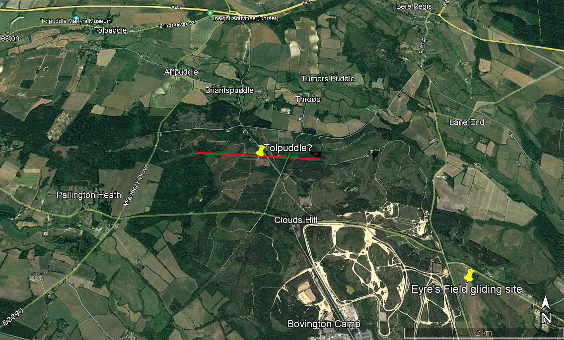
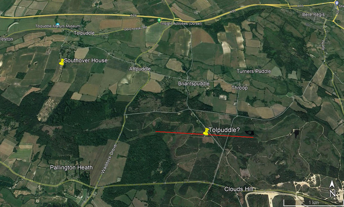
Note: This is probably pure fantasy on my part, but, could this feature be evidence of the TOLPUDDLE WW2 airfield? Putting two and two together, and probably making five or even six, although only used by Lysanders, or so it seems, SOE operations did include Short Stirlings. So, although doubtful at best, if this is evidence, might a strip have been laid out to accomodate these? Stranger things have happened. Should this most unlikely situation prove to be the case (?), the strip would have been; 09/27 1750 grass
TOLPUDDLE: Private airstrip
NOTES: We have Mr Graham Frost, a great friend of this 'Guide' to thank for this information. Mr H R A Kidston had the Miles M65 Gemini 3A, G-AKHC, registered to him from 10.12.47 until 09.09.49. His address was Southhover House, Tolpuddle, and it appears he based it here? If anybody can kindly confirm this, this advice will be most welcome.
Roy Rigby
This comment was written on: 2019-10-23 16:28:02You ask about the location of the Tolpuddle secret airfield, from which Lysanders flew. I noticed what looked like an airfield on Google Earth whilst researching a potential holiday cottage let location. I have spent hours on Google Earth looking for WW2 airfields as my father was an RAF Warrant Officer in the war and I like looking for places he may have been. Try looking at Google Earth and, using the ruler, describe a line 2.22 miles long running southeast of Tolpuddle village toward Bovington army camp. There is the unmistakable image of a grass airfield about 3/4 of a mile northwest of Bovington camp. Hope this is what ypou were seeking.
Dick Flute
This comment was written on: 2019-10-23 19:58:25Hi Roy, I have had a good look at Google Earth images and cannot find the airstrip. This said, I very much doubt and evidence remained after WW2. Regards, Dick
Michael T Holder
This comment was written on: 2020-05-20 23:30:04On another web site a grass strip is reported at grid ref 790952. This is close to track which runs northerly out of Tolpuddle up to Hill Barn. The field is on the western side of the track. If you look at the contours on an OS map they show this field is pretty flat and suitable for take off and landings. The original barns are shown to be located in the next field to the north. The present barns and buildings are further south, perhaps built on the hard standings laid by the RAF for a small hangar for a Lysander and a few domestic buildings.
We'd love to hear from you, so please scroll down to leave a comment!
Leave a comment ...
Copyright (c) UK Airfield Guide


