West Meon flying sites
Note: This map shows the location for The West Meon Hut public house.
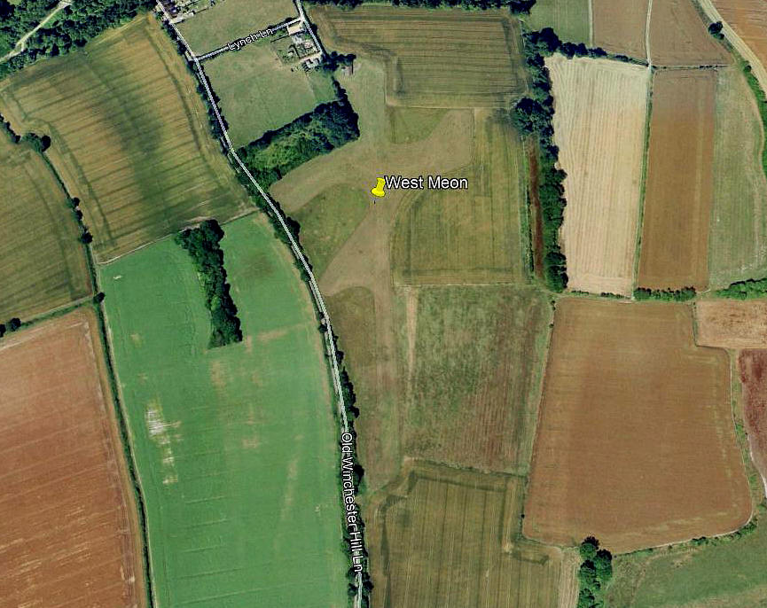
WEST MEON: Private airstrip (Aka THE STABLES?)
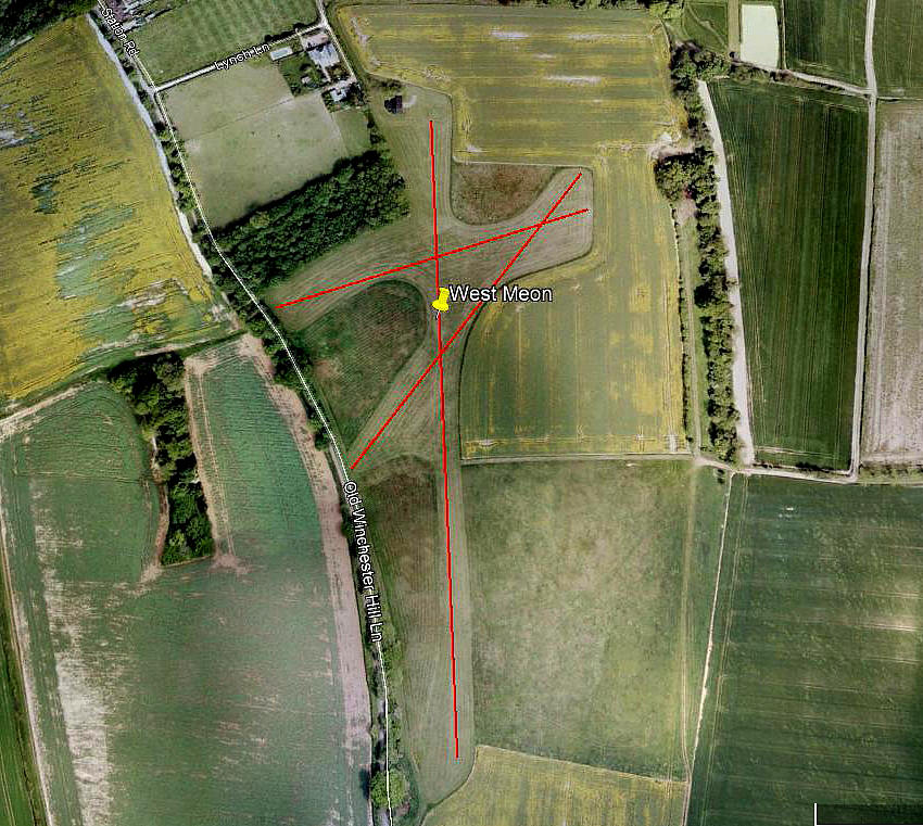
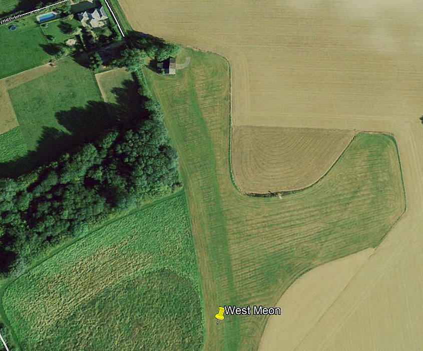
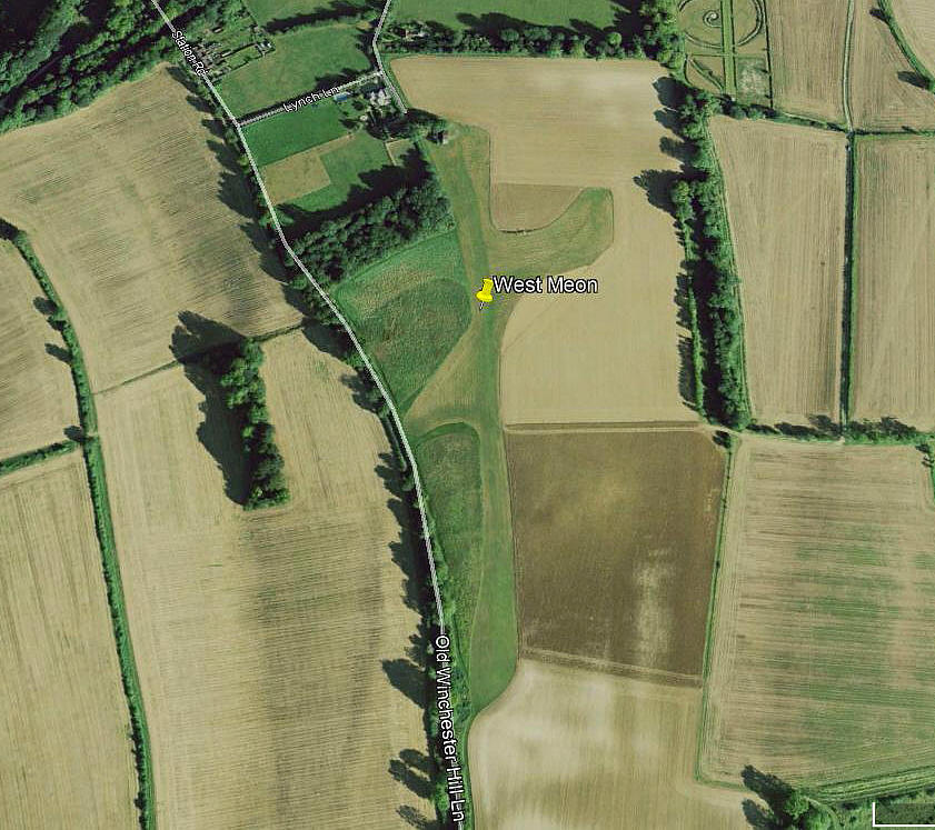
Note: All four of these pictures were obtained from Google Earth ©
Location: Just SE of West Meon on the A32/A272 junction, about 5.5nm WNW of Petersfield
Period of operation: 1990s to mid 2000s only?
Runway: 06/24 350 grass (According to the AAIB report)
Looking at Google Earth pictures and using their measure, in 2005 at least, it appears to show three possible runways - almost certainly two.
These being: 18/36 450 grass 02/22 270 grass
And possibly a curved 230 metre runway orientated roughly 07/25 to 06/24. Presumably for use in high winds.
NOTES: My initial info source was the AAIB report EW/G2005/08/04, and it appears this strip was the probable base for Maule M6 Super Rocket N6130X in 2005?
We have to thank Mr Graham Frost, a great friend of this 'Guide', for pin-pointing this location, when he sent me a Google Earth picture dated 2008 in February 2021.
It is so interesting how technology has progressed, and, it must be said, how I have struggled to catch up! This 'Guide' was launched in 2016, or thereabouts, so when I looked for evidence of this airstrip - there was nothing to be seen. I took me a while to discover that images on Google Earth could be obtained by using the history button. So sad that these, generally speaking only go back to 1999 or thereabouts. Wouldn't it be so wonderful to go back to around, say, 1850?
Still, even given twenty years or so, (said in 2021), Google Earth has been a tremendous asset in so many ways. Incidentally, the Google Maps reference for this airfield is: 51.006540 -1.080381
WEST MEON: Private helicopter landing area
Operated by: 2001: The West Meon Hut public house
Location: Junction of A32 and A272, in/near West Meon, 5.5nm WNW of Petersfield
Landing area: 3 acres grass, NE of pub
Chris
This comment was written on: 2020-11-09 16:53:20There's a substantial private strip a couple of km north-east of West Meon Hut at 51.05ºN 001.06ºW. It calls itself East Tisted and is open to visitors strictly PPR.
Dick Flute
This comment was written on: 2020-11-09 19:47:24Hi Chris, I think you will find I have this strip listed as West Tisted. Can you kindly confirm it really is called East Tisted? Best regards, Dick
Chris
This comment was written on: 2020-11-11 13:43:39Dick, it seems to go by either name effectively being in the middle of nowhere! There's another farm strip close east of Corhamton Golf Club.
We'd love to hear from you, so please scroll down to leave a comment!
Leave a comment ...
Copyright (c) UK Airfield Guide


