Westbury-sub-Mendip
WESTBURY-sub-MENDIP: Private airfield and helipad
Operated by: Mr John Lloyd & Sons
Helicopter operator: 1986: Somerset Helicopters
Location: S of A371, SW of Westbury-sub-Mendip, 3nm WNW of Wells
Period of operation: From 1980s to -
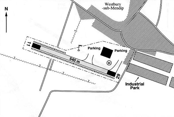
Notes: This map is reproduced with the kind permission of Pooleys Flight Equipment Ltd. Copyright Robert Pooley 2014.
Runway: 1990/2000: 11/29 540x20 grass
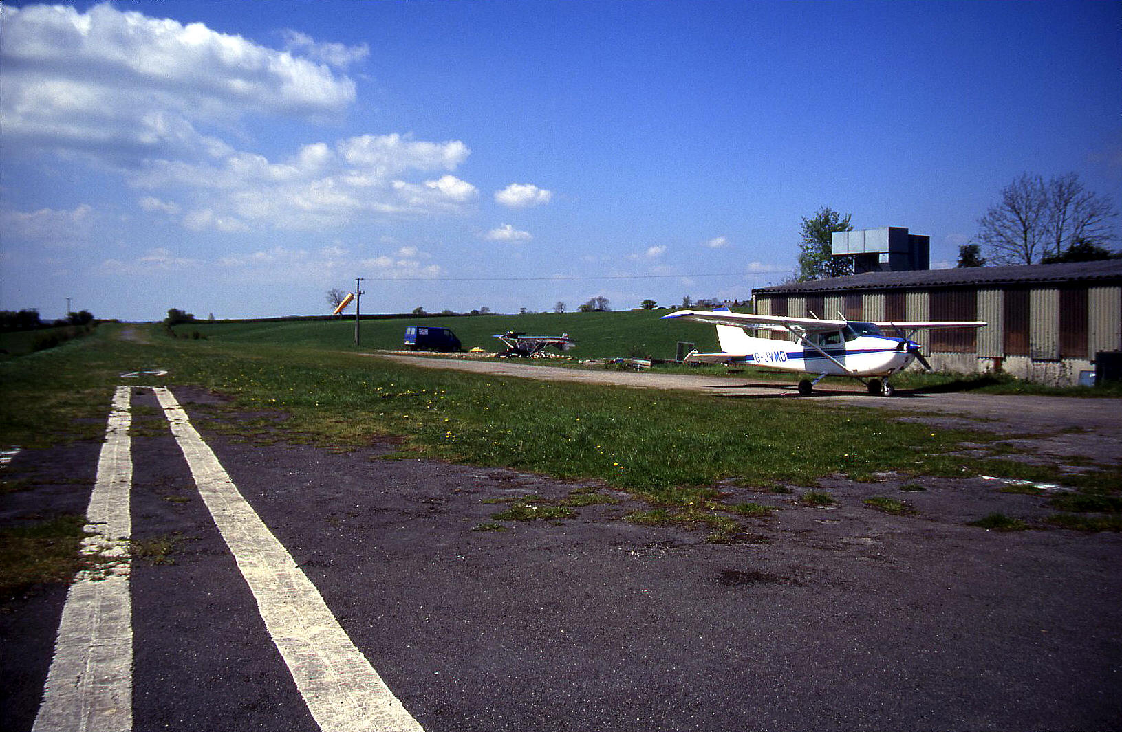
(Actually also with something like broken asphalt and various kinds of wild flowers like buttercups when I visited)
NOTES: This is one of the most unusual and demanding airfields I have visited and the details given in most flight guides give no idea of what to expect. At least one highly experienced pilot has come to grief here, badly damaging his Tiger Moth.
Take the 2000 edition of Pooleys for example. (As you can tell in this 'Guide' I am a huge fan of Pooleys). It correctly says that it uses a disused railway but fails to mention, (I’m certain this isn’t in any way their fault incidentally), that the original hedges and telephone posts still existed and that a small cutting had been filled in creating a slight ‘ski-jump’ affair towards the western end. And, unlike the map provided, the runway has a bend in it!
It was at the western end when taxying to take-off incidentally, that I seriously doubted I could safely turn our Cessna 172 which can ‘turn on a sixpence’. I did manage it, but by heck it was tight. At this end the runway is very narrow indeed bounded by high hedges, and widens out at the eastern end. The 20 metre wide notation in the flight guide is totally misleading. and in fact, on arriving I had some difficulty actually identifying the runway even when circling overhead and looking at it!
After landing here with a wild and ragged crosswind incidentally, my wife bless her, (who’d remained totally silent throughout the approach), then asked me where we should have landed! She simply could not believe we had landed on the correct airstrip!
I will never forget our visit; it’s one of those, “I did it and survived”, places with no room at all for error which we are often blessed with in the UK. I’ve been lunching out on the experience ever since. Perhaps the flight guides should give a warning, “NOT FOR USE BY THE FAINT HEARTED!”
mike mears
This comment was written on: 2021-01-31 09:34:09Now appears to have another industrial unit where the aircraft parked and the strip is fenced off. Change occurred between 2005 and 2009. (Using Google earth history photos)
We'd love to hear from you, so please scroll down to leave a comment!
Leave a comment ...
Copyright (c) UK Airfield Guide


