Westray
WESTRAY: Civil airport and other earlier sites
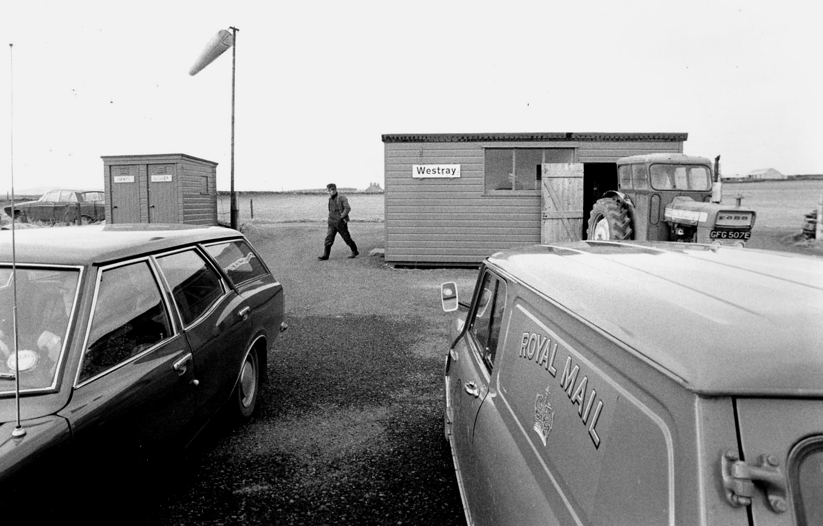
I assume the picture copyright for the first picture, from the John Stroud Collection and purchased by me from the Aviation Picture Library, is the Highlands & Islands Development Board?
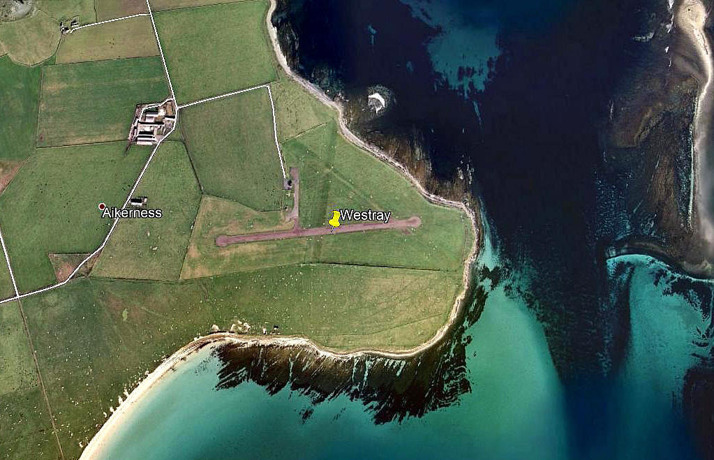
The second picture (2009) was obtained from Google Earth ©
A MICHAEL T HOLDER GALLERY
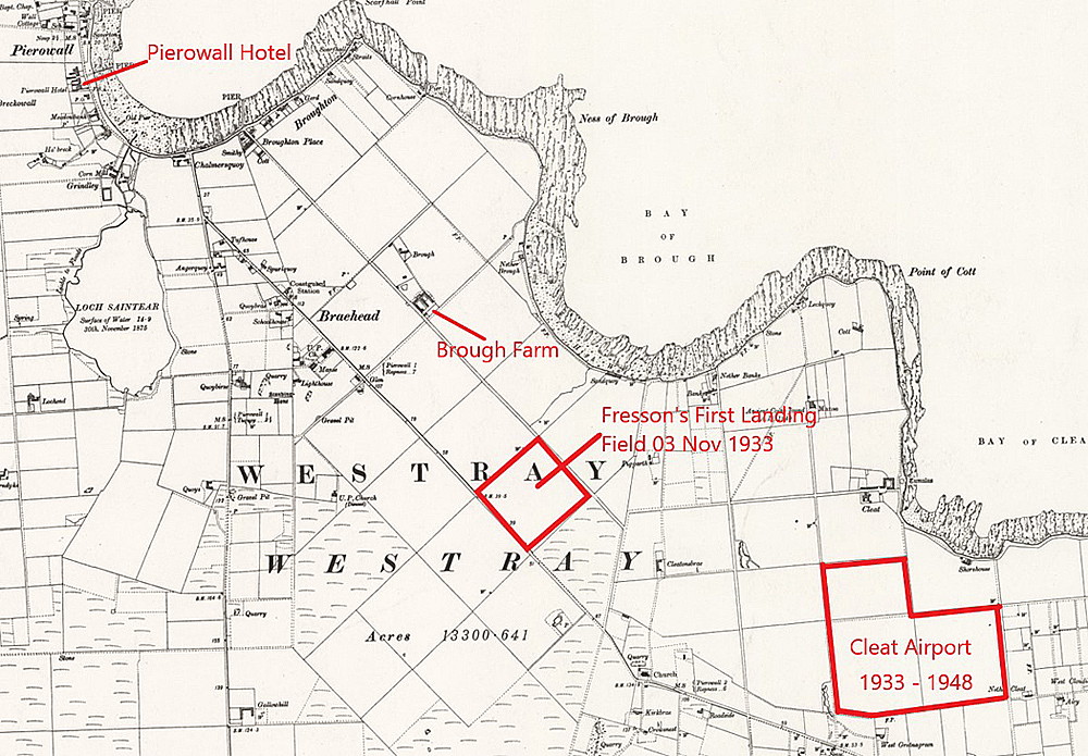
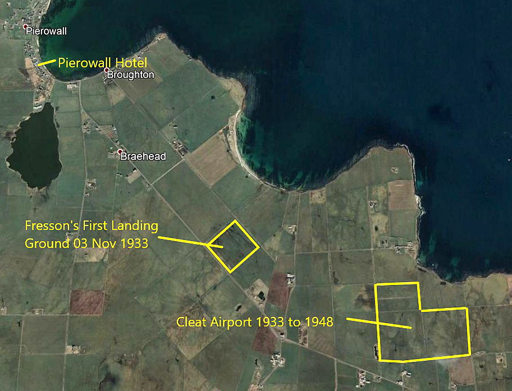
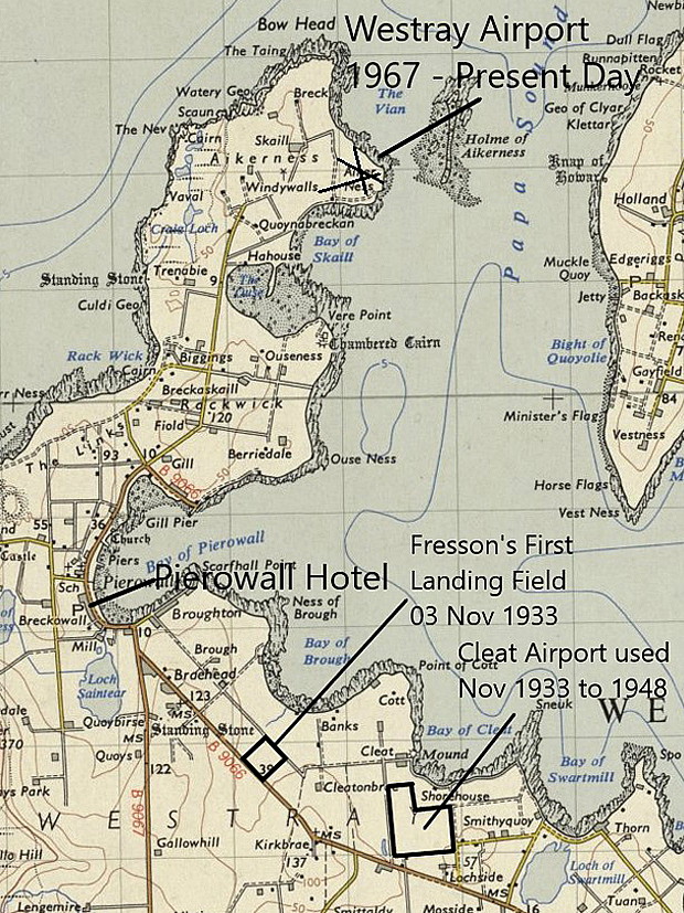
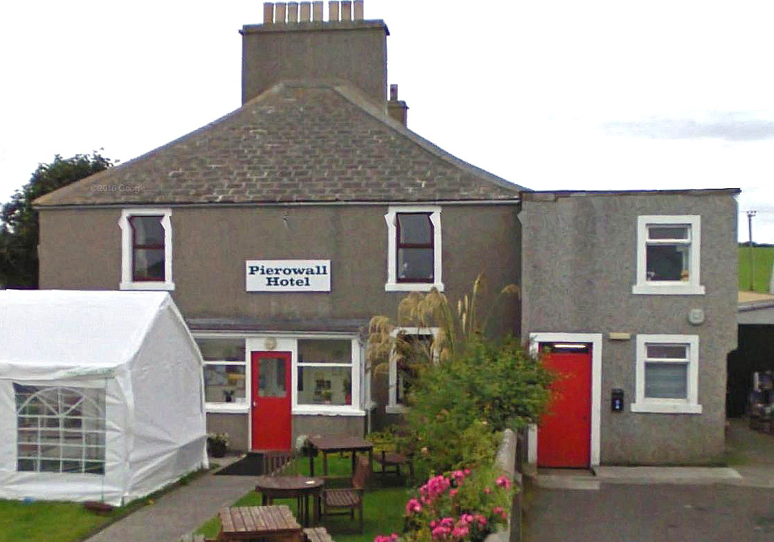
NOTE: Mike Holder has found that E.E. Fresson, in his book, claims that on the 3rd November 1933 he undertook a charter to fetch two passengers from Westray and take them to Wick. He found a field from the air - just south of Brough Farm - and then flew over the Pierowall Hotel where they were staying to attract their attention. They were told to watch where he descended to land and follow by car to the landing field. They duly turned up with two dogs and two guns. All were duly stowed on board and they took off for Wick.
A further recce determined that CLEAT was a better location and this was turned into a small airport and used from 1938 to 1948 at West Gretnagreen Farm. After WW2 a site near Pierowall was discarded in favour of a site at the northen end of the island at Skaill next to Aiker Ness - the location for the later airport.
Operated by: 1930s: Highland Airways
1980s to 2000: Orkney Islands Council
Location: 1.5nm N of B9066, at north end of Westray island, 2nm NNE of Rackwick, 24nm N of KIRKWALL
British airline users: Pre 1940: Highland Airways
Post 1945: Loganair
Period of operation: 1950s to -
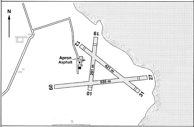
Note: This map is reproduced with the kind permission of Pooleys Flight Equipment Ltd. Copyright Robert Pooley 2014.
Runways:
1990: 10/28 520x18 grass 13/31 410x18 grass 01/19 260x18 grass
2000: 09/27 535x18 grass 13/31 421x18 grass 01/19 291x18 grass
2001: 09/27 467x18 hard 13/31 421x18 grass 01/19 291x18 grass
NOTES: In 2000 scheduled air services were operating, (presumably when the weather and/or winds allowed?), from Monday to Saturday. Runway 09/27 was described as being hardcore
In 1997 the only GA type based here was the M.S. 880B Rallye Club G-AXHI.
As mentioned for PAPA WESTRAY this end of the two mile sector constitutes the shortest airline sector in the world and is recognised as such in the Guinness Book of Records. By my reckoning it is certainly also the airport with the shortest runway?
We'd love to hear from you, so please scroll down to leave a comment!
Leave a comment ...
Copyright (c) UK Airfield Guide


