Weybourne
WEYBOURNE: Military aerodrome later private airfield (also known as MUCKLEBURGH)
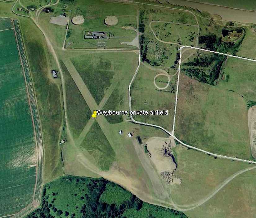
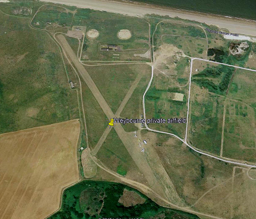
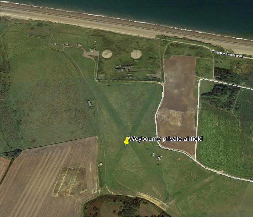
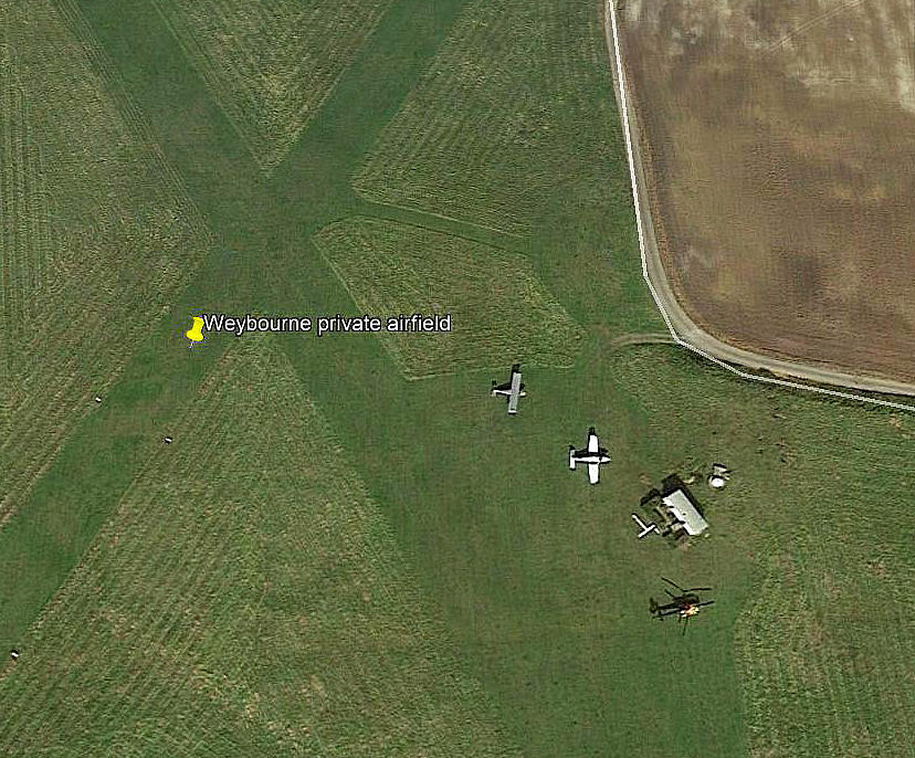
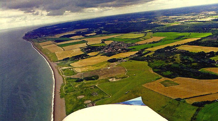
Notes: These pictures were obtained from Google Earth ©
Operated by: 2000: Muckleburgh Estates
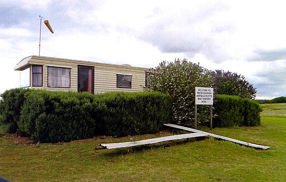
Note: These two pictures by Martin Ferid were scanned from an article in the March edition of Light Aviation magazine.
Location: 3nm W of Sheringham
Period of operation: 1930s? to present day?
Runways: 1999: 16/34 370 grass 03/21 330 grass
Note: As the 1999 picture above shows, the runways are not well defined, so these dimensions are only estimates.
2000: 16/34 610x40 grass 03/21 370x32 grass
2001: 16/34 617x32 grass 03/21 380x32 grass
Note: A look at Google Earth in 2016 showed the following:
2007: 15/33 710 grass 03/21 315 grass
NOTES: I was very surprised to discover this aerodrome wasn’t listed amongst the 653 WW2 aerodromes in the famous ‘Military Airfields in the British Isles’ book by Steve Willis and Barry Hollis.
During WW2 it was used as a AA (Anti-Aircraft) training school using radio controlled and catapult launched DH.82A Tiger Moths known as “Queen Bees” for target practise and was apparently also the smallest runway used by the RAF in WW2 but I have yet to discover these dimensions.
The RAF also used Westland Wallaces, Henleys and Miles Magisters at various periods. If correct, presumably the runway, or runways, were extended at some point during WW2.
It now houses Britain’s largest private military collection with 15 tanks in working order and 3500 exhibits. Model flying also takes place here, (in recent times only?)
A BONE OF CONTENTION
Not at all unsurprising in my experience, (and as mentioned elsewhere in this 'Guide'), some GA Pilot Flight Guides, as noted by the AAIB, tend to have both inaccurate and sometimes conflicting information.
So why, I wonder, does it appear that the Trade Descriptions Act seems not to apply to these publications? As the AAIB once remarked concerning an accident here, “One guide referred to Runways 16/34 and 03/21 as being 610m and 370m long, the other referred to Runways North/South and East/West, these being 550m and 380m long.” A runway being 16/34 is pretty wide of the N/S mark but describing a 03/21 runway as being E/W is a disgrace and the fools responsible should be reprimanded. Or at least beheaded in public? Why did we cease that fine tradition?
A SURPRISING RESPONSE?
Many years ago I contacted a newly launched Flight Guide publisher to tell them that one of the airfield maps, (at least), was seriously inaccurate and had safety implications. I knew this because I had recently landed there. Their attitude was, I think, quite astonishing. They asked, “Who the hell do you think you are, you are not a flying instructor.” Perhaps not surprising then to later learn that particular Guide did not survive very long.
ANOTHER ASPECT
I once had a conversation with somebody involved in publishing one of the best known and well regarded Pilot Flight Guides. He admitted that obtaining up to date and accurate information was a constant headache and although requests for updated information was regularly requested these were often ignored by the airfield operators. The lesson being for pilots - beware of published information.
Being a bit pedantic, I invariably made a phone call to an airfield, (especially one not visited before), to confirm that the information I had was correct - and this was confirmed. Only to arrive a few hours later to discover this information was incorrect!
LAST BUT CERTAINLY NOT LEAST
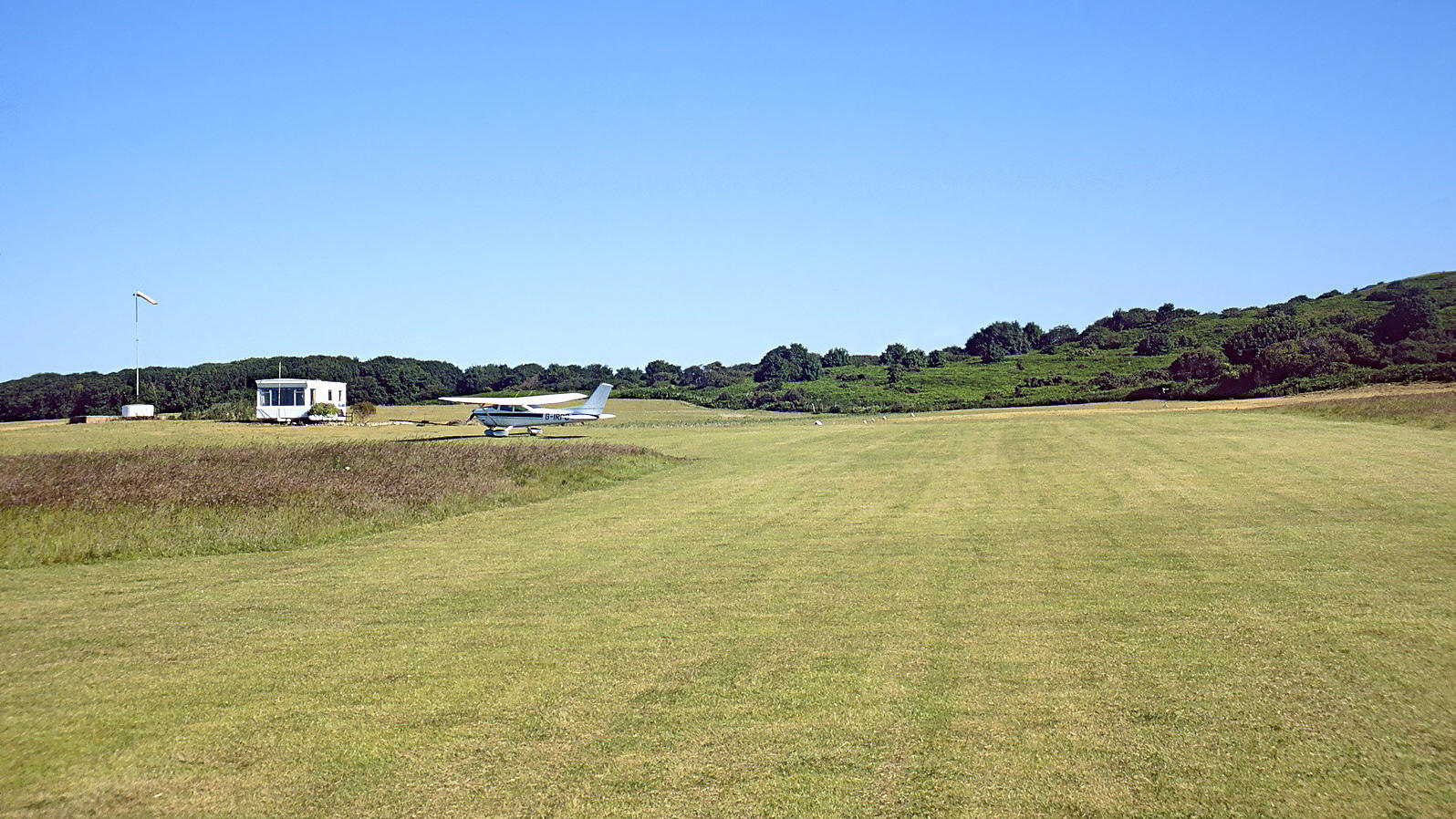
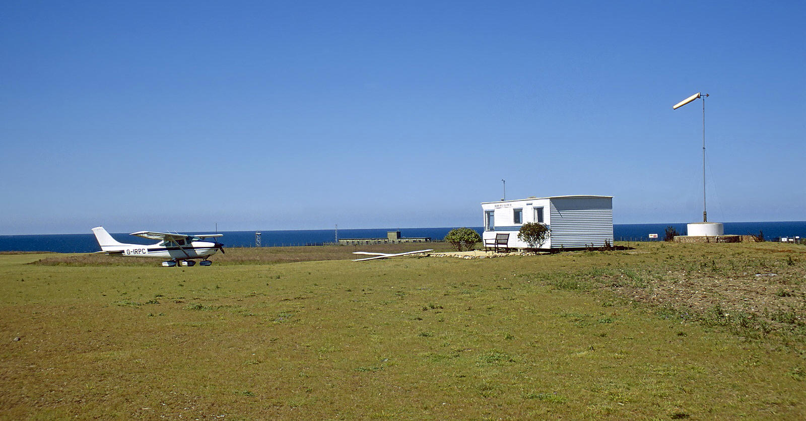
In December 2021 I was kindly contacted by Mr Martin Pole who sent these two lovely pictures. He had flown, with passengers, the Cessna 182Q Skylane, G-IRPC, from TOP FARM on the 25th June 1999. The atmosphere captured here so beautifully, is redolent of just what a privilege it can be, on a summers day to be flying a light aircraft.
Eric V West
This comment was written on: 2019-03-24 04:25:59From 1953 to 1958 my father was CSM of the REME unit based at Weybourne Camp, under the command of one Major Wally Gates, an Australian. One of the tasks they had was the repair and maintenance of Radioplane AQ190 series drones which were launched from the airfield. These were launched from three sites Weybourne, Stiffkey and by the US Army at Langham, although Stifkey and Langham ceased using the drones after 1945. Weybourne had a mobile catapult for launching the drones, which was still being used occasionally up to the time we left in April 58.Stiffkey used the unique ''Stiffkey Whirlygig'' and a circular runway! . The drones were repaired in their own maintenance shed within the camp, which from Google Earth seems to still be there. There is a large open area, with equipment parked on it and the sheds immediately North of this were where these aircraft were maintained. As a matter of interest, the sheds to the South were the radar maintenance facility. The admin block where Dad's Office was, stood at the southern edge of the square, but has now gone.
Reply from Dick Flute:
Dear Eric, Many thanks indeed. Such a fabulous addition to this web-site and very much appreciated. During the last twenty years researching the subject I am still constantly amazed at how much history, (quite recent history really), seems to be already buried away. Bless you for opening this subject up. My best regards, Dick
We'd love to hear from you, so please scroll down to leave a comment!
Leave a comment ...
Copyright (c) UK Airfield Guide


