


Windrush
WINDRUSH: Military aerodrome much later private airstrip

Military user: WW2: RAF Flying Training Command 23 Group
2 SFTS [Base BRIZE NORTON] (North American T.6 Harvards & Airspeed Oxfords)
6 SFTS [Base SOUTH CERNEY] (Airspeed Oxfords & Avro Ansons)
15 SFTS [Base KIDLINGTON] (North American T.6 Harvards & Airspeed Oxfords)
Location: S of A40, SSW of Windrush, 4nm WNW of Burford
Period of operation: Military: 1940 to 1945 (Listed as disused in 1985 - but see comment below)
Runways: WW2: Steel matting 01/19 914 grass 07/25 990 grass
1999: 04/22 grass
2006: 02/20 690 grass
NOTES: I have found a couple of references to WINDRUSH later becoming a private airstrip and indeed it was marked on the 2003 ‘half-mil’ scale Aeronautical Chart. (It was still marked in 2006 and 2009 too). However having flown very close by a couple of times in recent years I have never actually seen it despite looking very hard. This is of course not at all unusual as many small grass aerodromes can be the very devil to spot even when intending to land there! Even when nearly overhead and actually looking down on them. See comment below for one explanation.
Then, in 2023, Mr Graham Frost, a great friend of this 'Guide', helped me to pin it down. Just on the west side of the WW2 aerodrome.
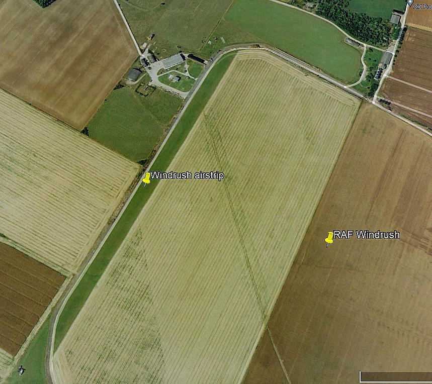
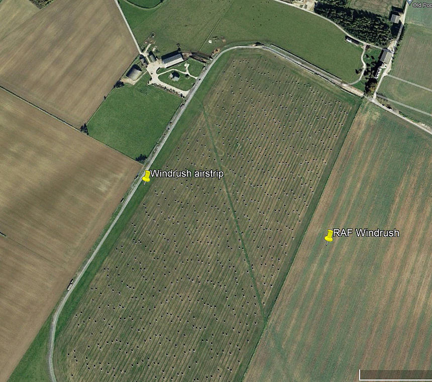


The first three pictures were obtained from Google Earth ©. The area view is from my Google Earth © derived database.
NOTES: As always, if anybody can kindly offer advice and information, this will be most welcome. Pictures are of course always much appreciated.
mark peters
This comment was written on: 2016-04-19 17:09:16Still used i was in there 17/04/16, i very nice farmer Roy Limbrick. Grass cut in July after silage cut then N/S strip kept cut.
Reply from Dick Flute:
Hi Mark, Many thanks for the info, much appreciated. Regards, Dick
We'd love to hear from you, so please scroll down to leave a comment!
Leave a comment ...
Copyright (c) UK Airfield Guide

