


Worksop
WORKSOP: Military aerodrome
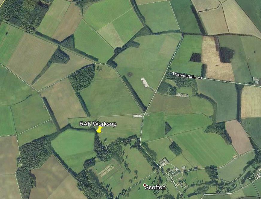
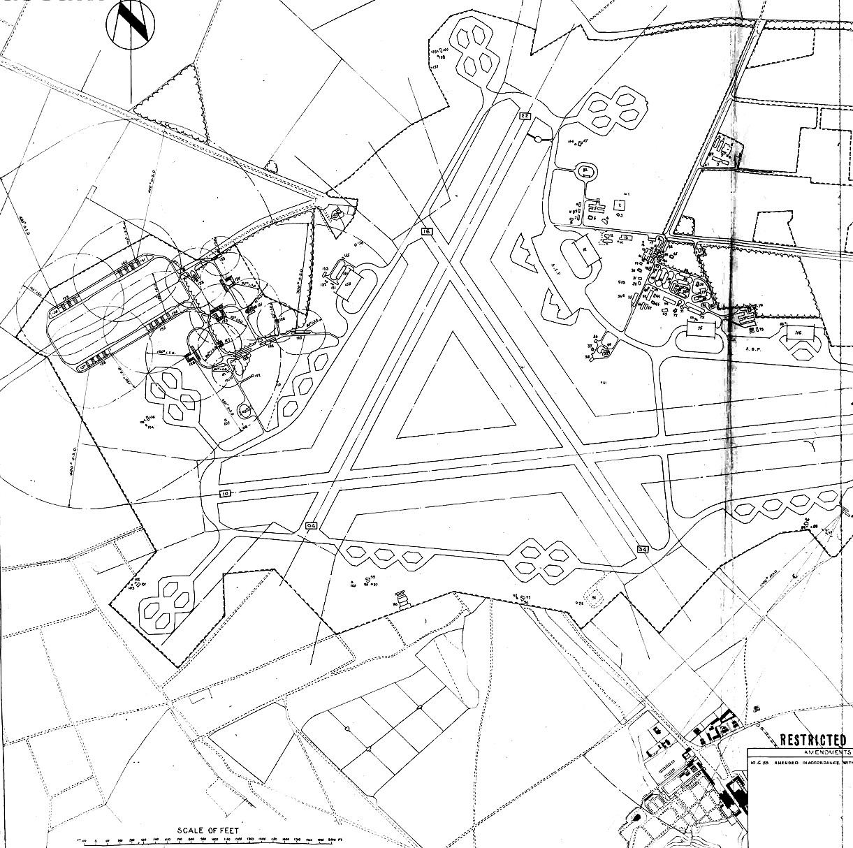
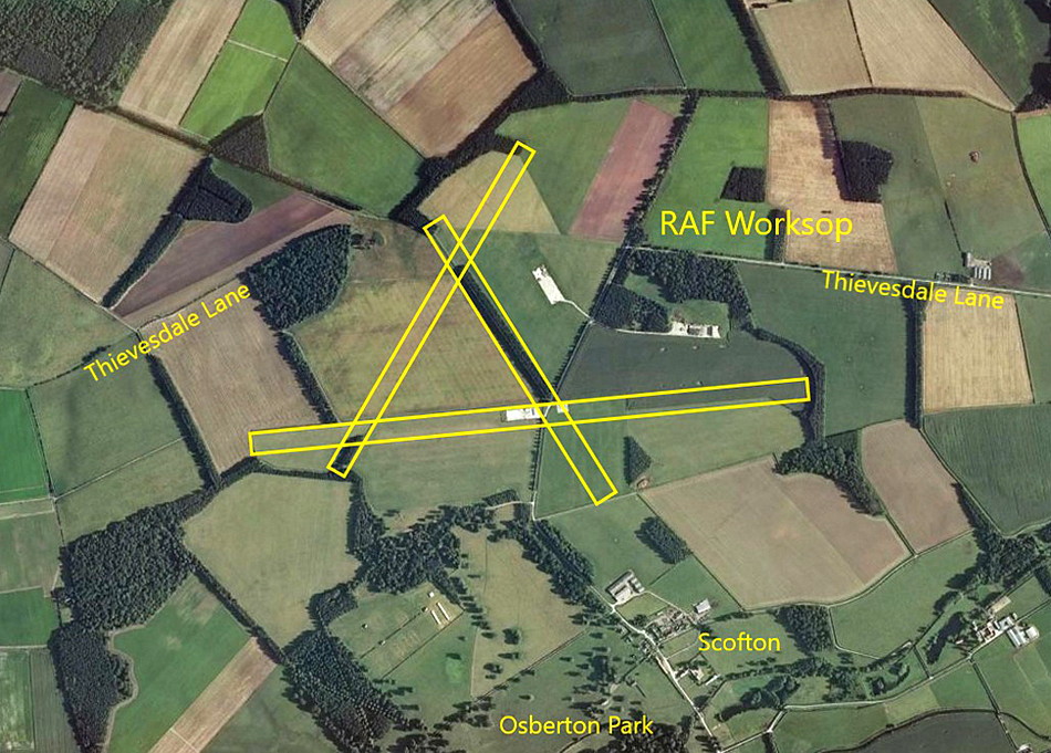
Note: The first picture (2011) was obtained from Google Earth ©. The airfield map was kindly provided by Mr Adie Platts.
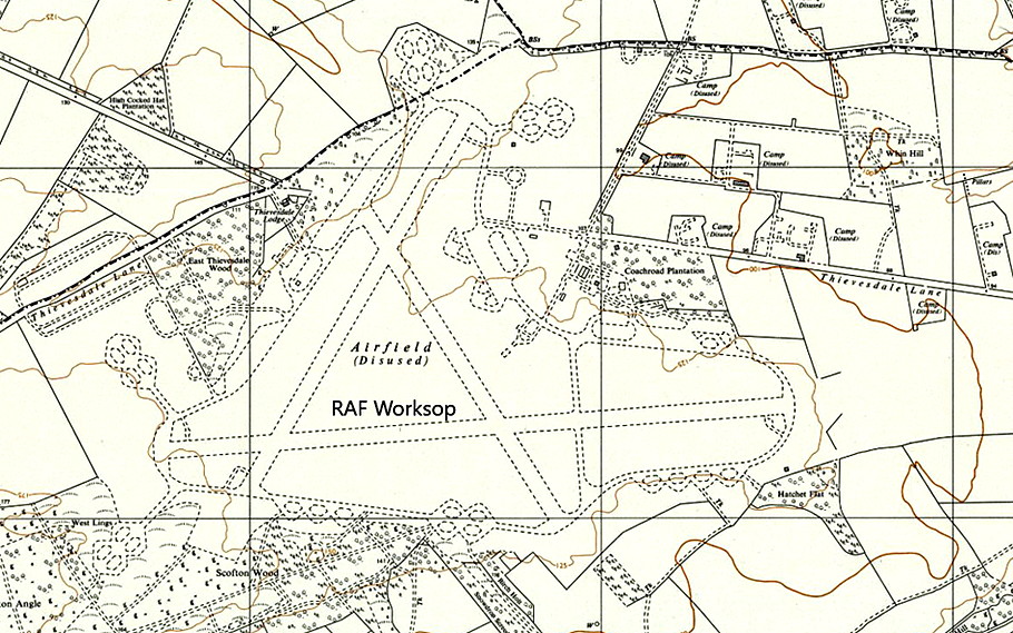
If you compare the first picture with the map of the WW2 airfield, a number of defining features can still be seen.
Military user: WW2: RAF Bomber Command 91 Group
18 OTU [Operational Training Unit] (Miles Martinets, Airspeed Oxfords, Curtiss P-40 Tomahawks & Vickers Wellingtons)
Bomber Command CNVTS (Central Night Vision Training School) Possibly using Avro Lancasters? The type was seen here. Also, Bristol Beaufighters were seen here, so perhaps they were involved?
Post WW2:
211 AFS [Advanced Flying School], renamed 211 FTS [Flying Training School] (de Havilland Vampires & Gloster Meteors)
616 Sqdn [Royal Auxiliary Air Force] (Gloster Meteors)
A MICHAEL T HOLDER GALLERY
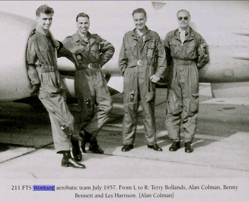

Note: The picture of the aerobatic team in July 1957, is from Meteor Boys by Steve Bond. The newspaper article was published in the Nottingham Evening Post on the 27th March 1958.
Mike Holder, a great friend of this 'Guide', has kindly added the runway layout to the Google Earth © view.
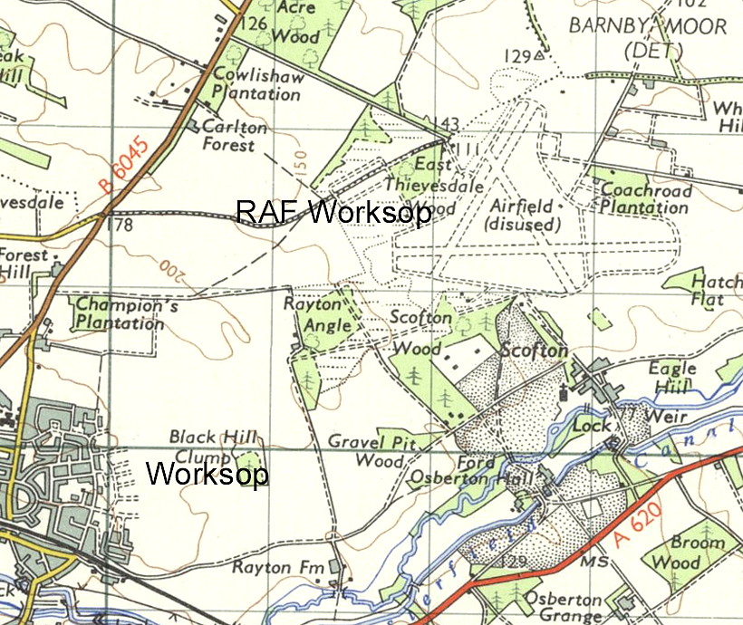
Location: W of A1, N to NNW of Scofton, WNW of Ranby, 2.5nm ENE of Worksop
Period of operation: 1943 to 1960
Note: The airfield was first closed in 1948, but was reactivated in August 1952 to aid flight training for the Korean war.
Runways: WW2: 04/22 1280x46 hard 10/28 1829x46 hard
16/34 1079x46 hard
NOTES: I have been informed that after WORKSOP closed for military use, the Foljambe family who owned the Osberton Estate on which the airfield was built, used part of the airfield, (presumably the 10/28 runway?), to fly up to their other estate in Scotland. Can anybody kindly confirm this, and hopefully add additional information? The aircraft type, (especially the registration), would be much appreciated.
We'd love to hear from you, so please scroll down to leave a comment!
Leave a comment ...
Copyright (c) UK Airfield Guide

