Campbeltown
CAMPBELTOWN: AN OVERVIEW
In late February 2024, mainly due to Mr Mike Holder, a great friend of this 'Guide', sending me a considerable amount of extra information including maps, photos, press articles etc, it was clearly time to try and sort all my listings out of these two locations. The main problem being that over the years I had accumulated information from various sources, with different place names, and made a variety of listings to reflect this. I shall retain these listings simply because others may have found them too, so decide to look them up.
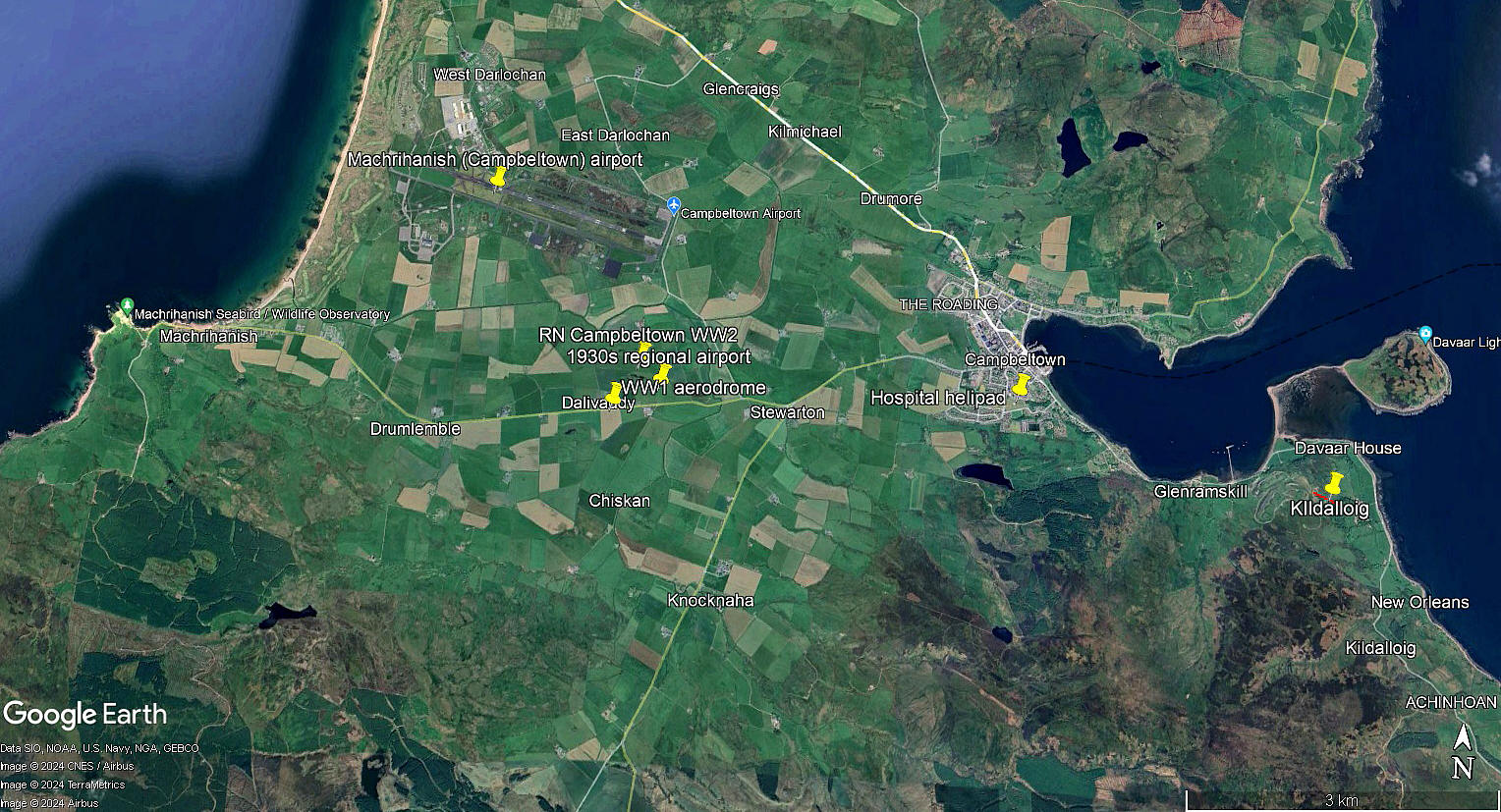
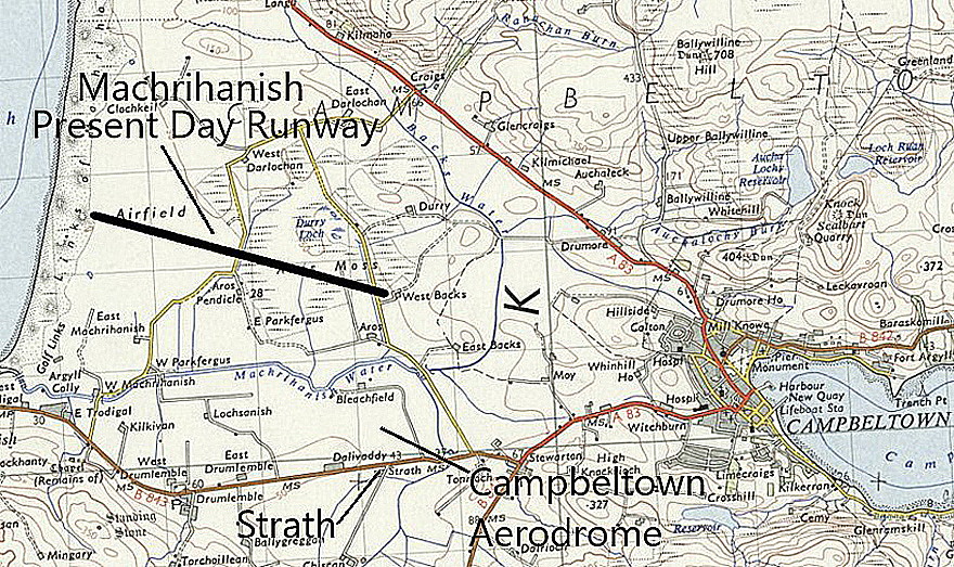
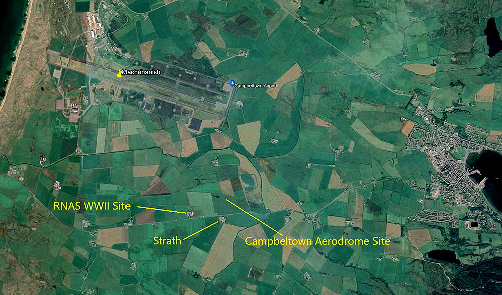
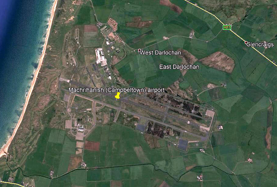
This picture is from my Google Earth © derived database and clearly shows the relationship between the WW1 military aerodrome and airship sub-station, (To LUCE BAY), the 1930s civil aerodrome/airport, the two WW2 military establishments and the current airport.
So, to simplify matters, (and I am not joking!), here is how the story goes - I hope:
WW1: RN Air Station known as MACHRIHANISH
1930s: CAMPBELTOWN civil aerodrome/airport. Aka DALIVADDY, KINTYRE, MACHRIHANISH and STRATH FARM
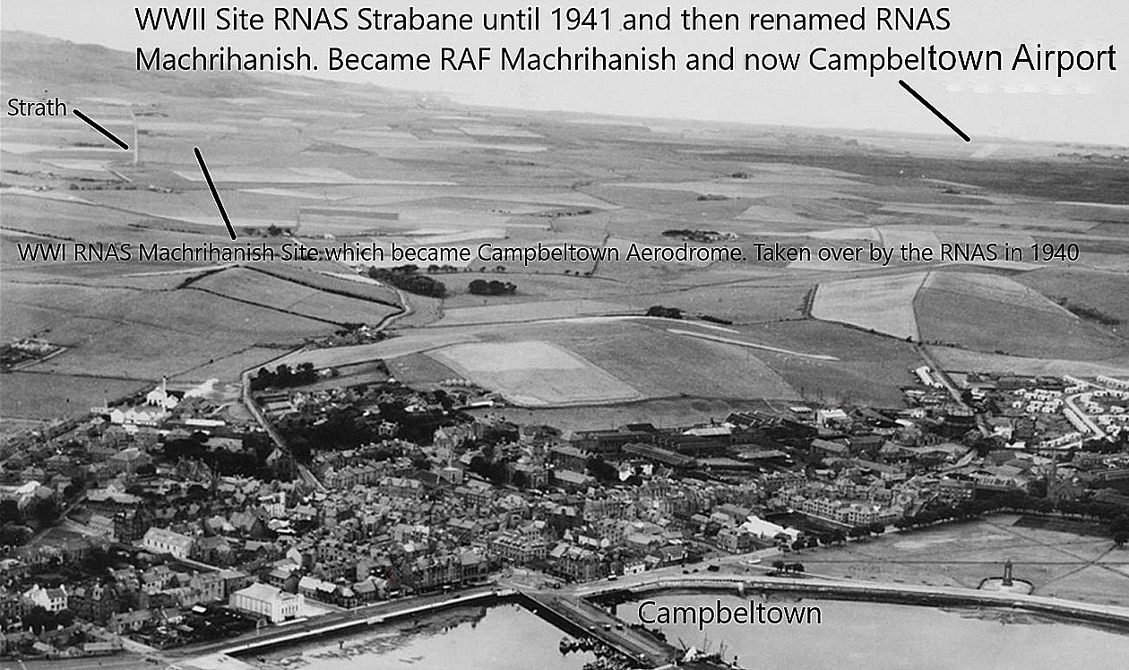
WW2: The RN Air Station was known as RNAS CAMPBELTOWN. The new aerodrome to the NW was originally known as RNAS STRABANE, then RNAS MACHRIHANISH, later RAF MACHRIHANISH.
Post WW2: The RAF Air Base retained the MACHRIHANISH name until it closed in 1996. Reverting to civil use it was renamed CAMPBELTOWN. This said, a civil airport terminal opened in November 1963.
Note: Due to its then very long runway, it was nominated as a diversion airfield for the U.S. Space Shuttle.
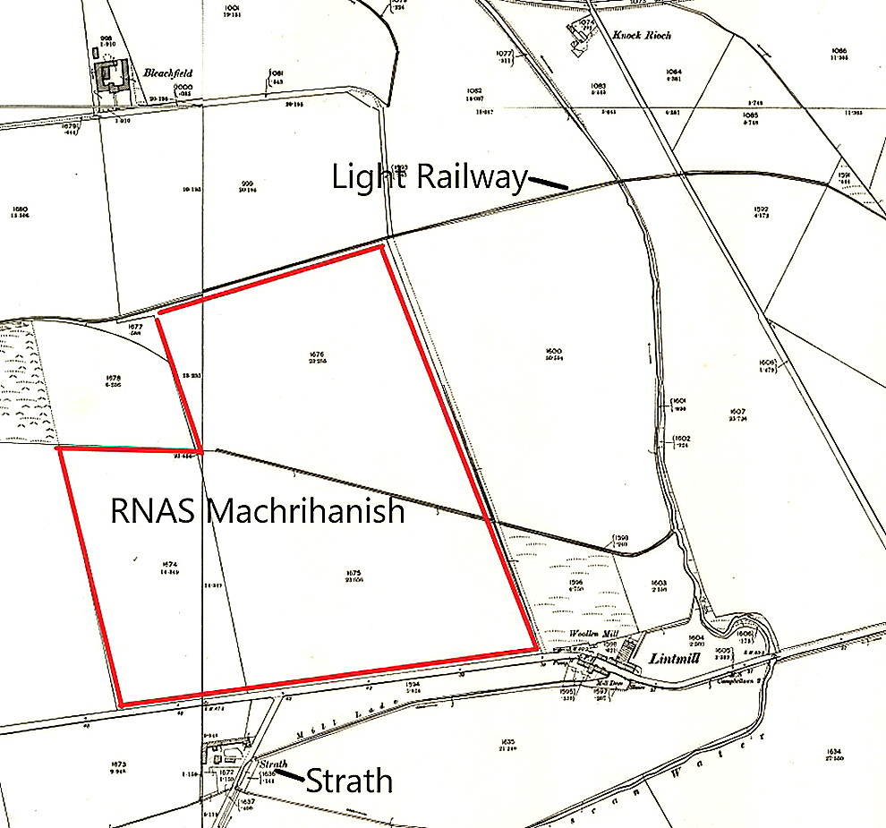
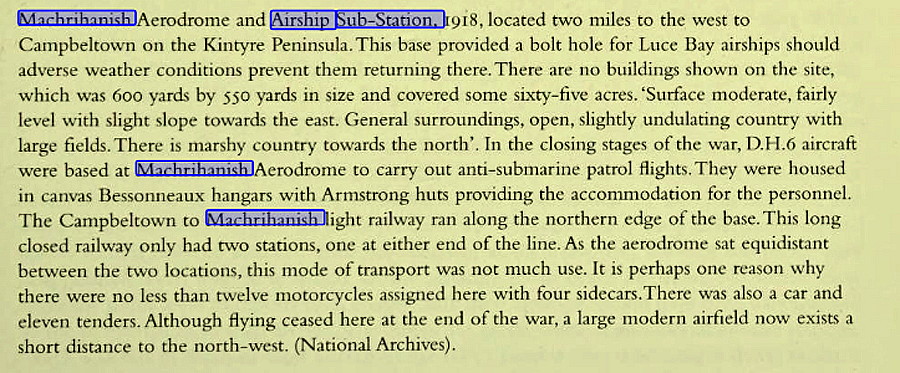
WW1: RNAS MACHRIHANISH
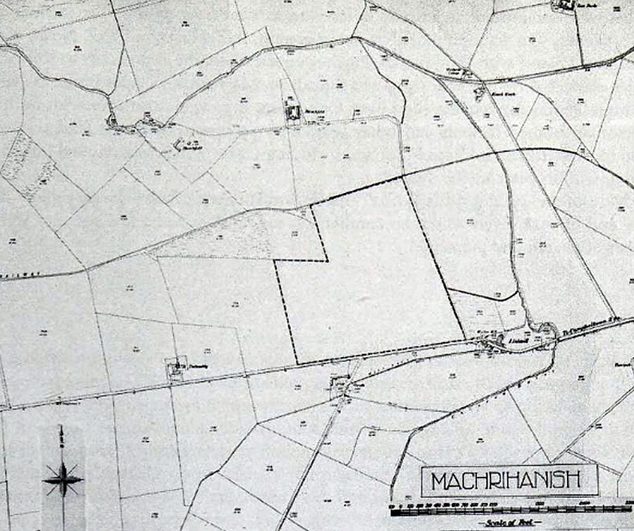
The excerpt is from Scottish Aerodromes of the First World War, as is the third map item.
THE 1930s CAMPBELTOWN AERODROME/AIRPORT
Also known as DALIVADDY, KINTYRE, MACHRIHANISH and STRATH FARM, this was, it seems, first opened in 1933 and basically an extended area, to the west, of the WW1 site.
A MICHAEL T HOLDER GALLERY
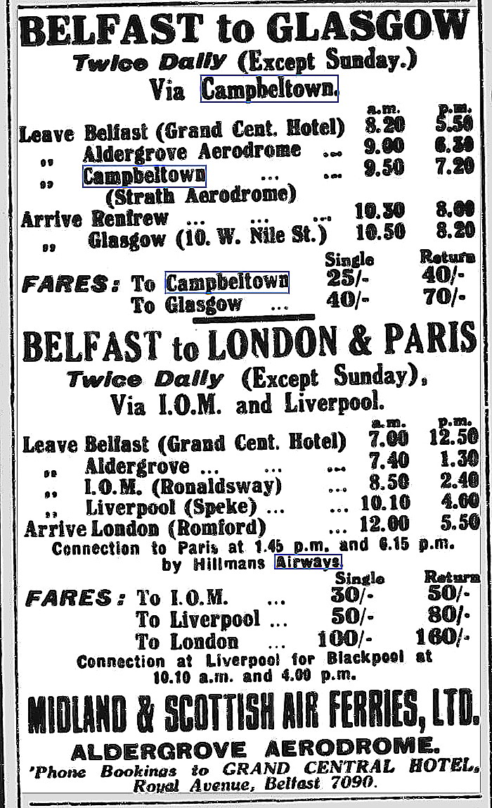
This advert showing the timetable for Midland and Scottish Air Ferries was published in the Northern Whig on the 9th July 1934.
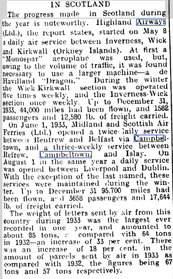
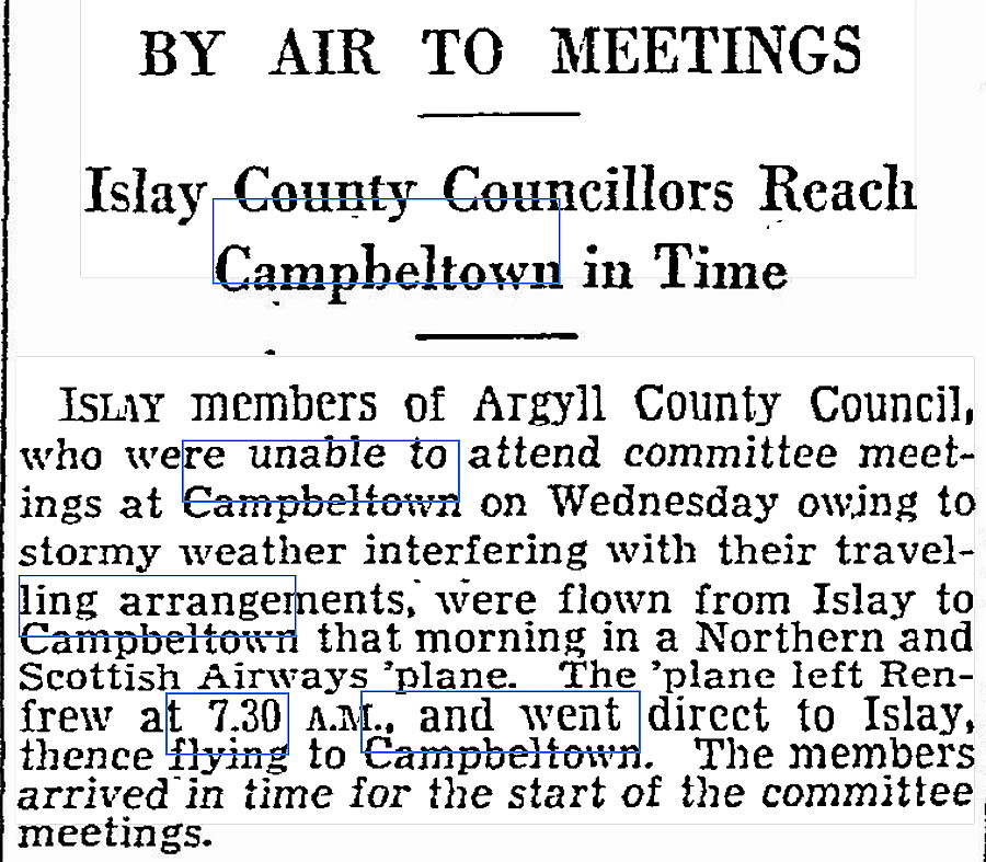
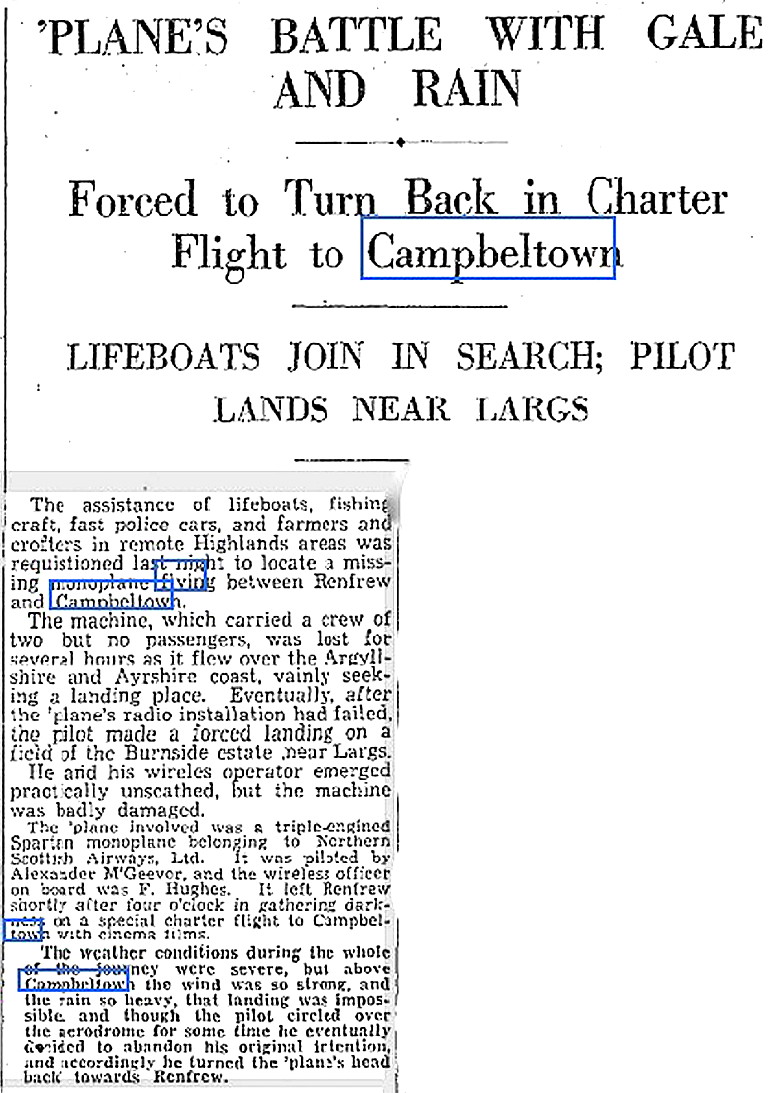
Article One was published in the Linlithgowshire Gazette on the 7th September 1934. The short article was published in The Scotsman on the 12th April 1935,
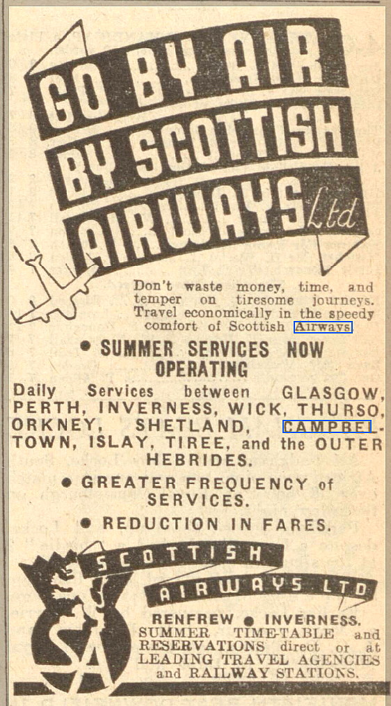
Article Two, concerning the Air Pageant due to be held from the 18th to the 24th July, was published in The Scotsman on the 12th July 1937. The advert was published in the Dundee Courier on the 15th May 1939.
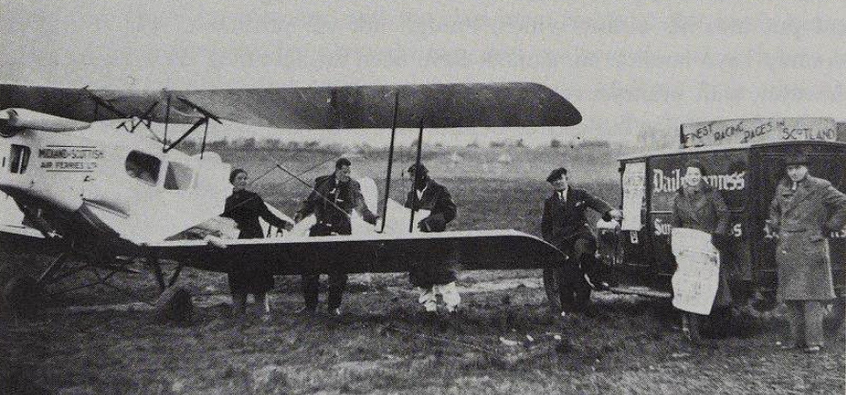
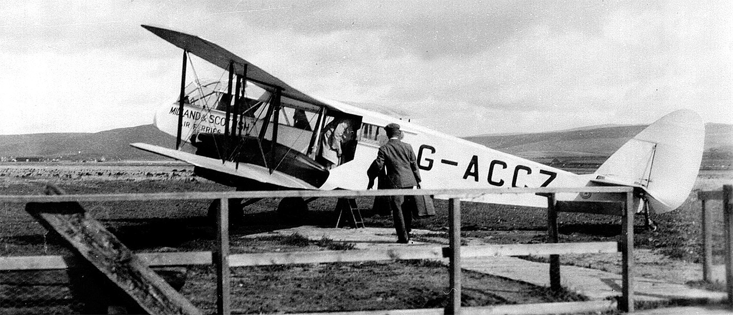
The photo shows the de Havilland DH84 Dragon 1, G-ACCZ, of Midland & Scottish Air Ferries ready to depart. This was, at that time, the latest 'state-of-the-art' regional airliner. This example was registered 11.05.33 and was impressed into military service 01.07.40 as AW154. Apparently scrapped in December 1942.
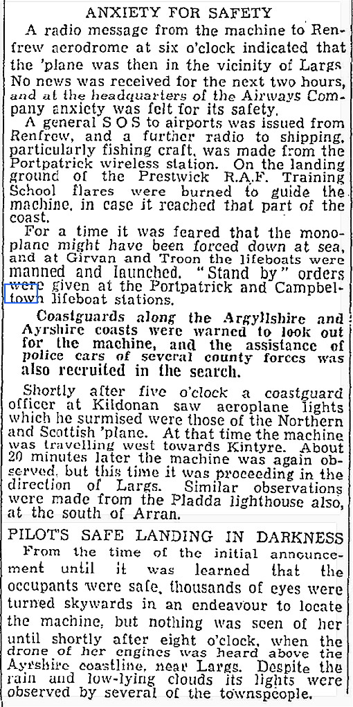
This article in three parts was published in The Scotsman on the 15th January 1938.Our weather has not changed at all in well over one hundred years, (though might be a tad warmer on average of course).
I will maintain that flying in Scotland is the most demanding weather alongside anywhere in the world for airlines. It can get much worse elsewhere - but airports get closed. The way Scottish airports remain open throughout the year, (give or take a day or two perhaps at some locations), really is a great example of everybody involved being dedicated to their tasks.
SOMETHING OF INTEREST
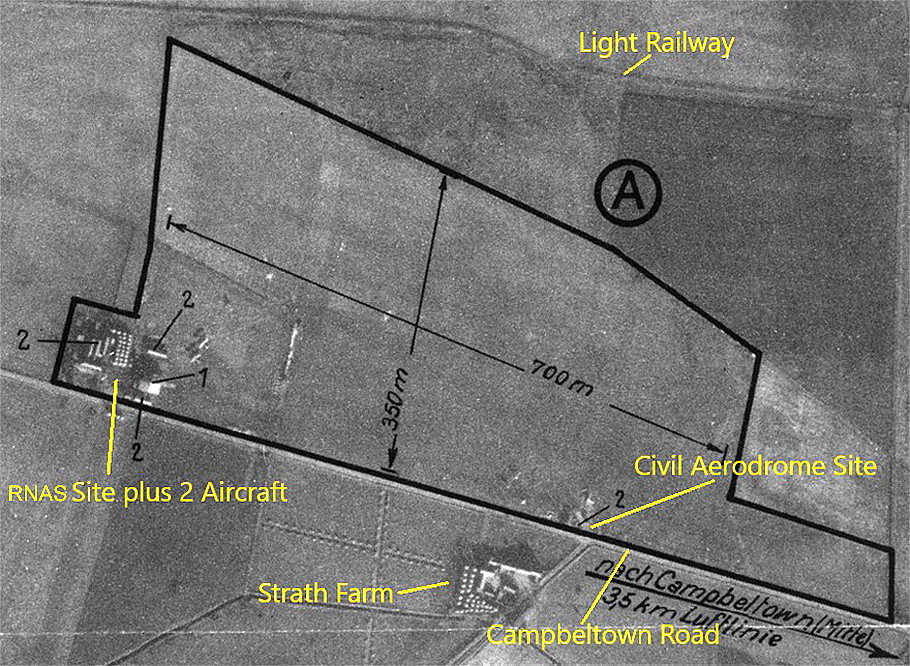
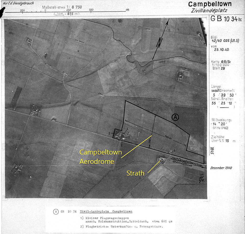
I find it very interesting that even in October 1940, when the so called 'Battle of Britain' had been won in the south and south east of England, (10th July to 31st October), Luftwaffe photo-recce flights were still taking place all across the U.K. As these pictures prove.
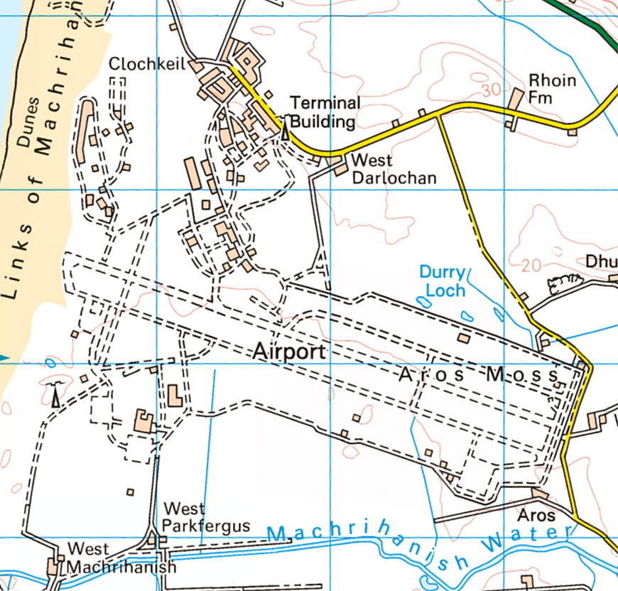
CAMPBELTOWN: Civil regional airport (Aka MACHRIHANISH)
(See also MACHRIHANISH for WW2 details.)
Note: This picture (2007) was obtained from Google Earth ©
Operated by: From WW2: Royal Air Force
'V' Bomber dispersal airfield
1990: Royal Air Force
2000: Highlands & Island Airports
Airline users: Pre 1940: Midland & Scottish Air Ferries, Midland & Scottish Airways, Northern & Scottish Airways
Note: These were from the other location - see above.
Post WW2: British European Airways, Flybe & Loganair
Location: S of A83, 3 nm WNW of Campbeltown
Period of operation: WW2 to present day (see below)
Note: In 1993 Pooleys listed this airport as MACHRIHANISH as it was still operated by the Royal Air Force.
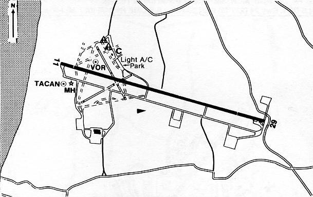
Of interest to somebody such as myself, attempting to be an 'anorak', is that the other WW2 runways, although disused, still feature, more or less, up until the early 1990s..
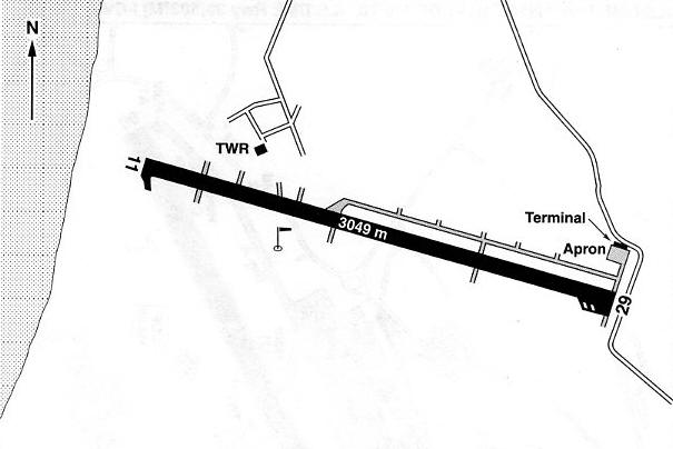
Note: These maps are reproduced with the kind permission of Pooleys Flight Equipment Ltd. Copyright Robert Pooley 2014.
Runways: Originally grass airfield Max. landing run: 777 grass
1965: 12/30 3049x46 hard 16/34 904x27 hard
Note: It was stated in a Pooleys publication in 1965 that although permanently withdrawn from use, the runways 03/21 917x27 hard, and 07/25 943x27 hard, could be used either in an emergency, or to suit operational requirements.
1990/2000: 11/29 3049x46 hard
NOTES: From just June to September 1933 Midland & Scottish Air Ferries operated a RENFREW-CAMPBELTOWN-ISLAY service using DH.84 Dragons. Typically many airlines in those days only offered seasonal services when the weather was liable to be favourable for VFR only flights.
POST WW2
After closing at the end of WW2 the airfield was reactivated for the Korean War from 1950 until 1953. Was operational from 01.12.51 until 01.12.52, and used by the R.N. Fleet Air Arm for training before taking to sea on a carrier. Closed again until major reconstruction took place from 1960 until 1962 with the original four runways being replaced by a single E/W runway of 10,000ft (3048m). Used by RAF Avro Vulcans until May 1963 when it was transferred to RAF No.18 (Maritime) Group.
In 1968 it was given over to the U.S. Navy, Naval Aviation Weapons Facility for atomic bomb storage although it appears that no atomic weapons were actually off-loaded here. Other U.S. Units used the site until it began being wound down. There is a substantial amount of information available especially on the inter-web.
We'd love to hear from you, so please scroll down to leave a comment!
Leave a comment ...
Copyright (c) UK Airfield Guide


