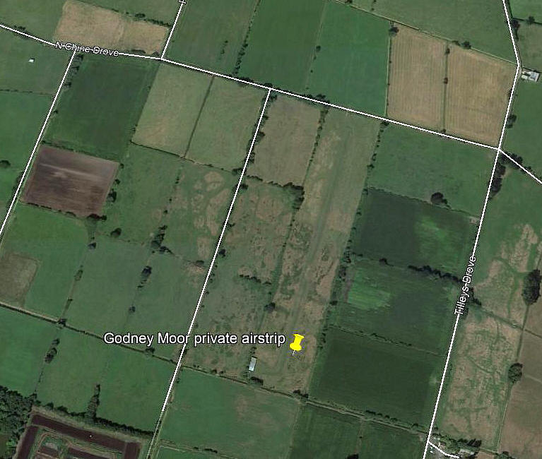
Godney
Note: I still find this rather confusing. Is the airstrip clearly seen on Google Earth really the same as GODNEY MOOR and BROOK FARM? If anybody can kindly help to resolve this, the advice will be most welcome.
GODNEY: Private airstrip (Aka GODNEY MOOR and BROOK FARM?)
Note: Image from Google Earth.
Operated by: Presumably….Last Refuge Ltd?
Location: Roughly 3nm NNW of Glastonbury, NNW of Lower Godney village and pretty much S of Panborough on the B3139.
Period of operation: 2000s only?
Runway: 01/19 600 grass
NOTES: Locating this strip was an interesting case. In the end resolved by a combination of notes from various sources and Google Earth. But, I must point out I do not hunt down private airstrips, simply noting their existence and, if enough information in the public domain presents itself, then I give a rough location.
THE DISCOVERY
My first mention of GODNEY in this research contained these notes: The base for Cessna 182 G-ASXZ which is used by Last Refuge for making some extraordinary films? Google up ‘Last Refuge’ and take a look - but don’t expect to find out exactly where their strip is.
I first discovered the existence of this quite extraordinary concern when noting that G-ASXZ flown by Adrian Warren had booked in at the PFA Flying For Fun Rally in 2006 from GODNEY.
A BIT OF RESEARCH
After just a little research I discovered that Last Refuge was based in Batch Farm, Panborough on the B3139, roughly 4nm W of Wells, and a look at the map revealed that the villages of Lower Godney and Upper Godney were situated south of Panborough. So, QED, this strip must be in this vicinity?
I’m pleased to say this guess was pretty much spot on.
MORE CONFUSION
Then I came across the AAIB report EW/G2012/03/13. The report states that the Pioneer 200 G-CEVJ crashed on approach to land at “Godney Moor Airfield”. Further research indicated this was Brook Farm, near Glastonbury. So, time to go to Google Earth and try and pinpoint this strip.
SOMETHING TO BE BORNE IN MIND
As a general note: It is a fact of life that despite many private strip operators wanting desperately to ‘hide’ their strips, they are very difficult if not impossible to hide. When flying around at low level in a light aircraft they do tend to stand out and when ‘Google Earth’ became available everybody can now pinpoint most of them.
We'd love to hear from you, so please scroll down to leave a comment!
Leave a comment ...
Copyright (c) UK Airfield Guide


