Kinloss
KINLOSS: Military aerodrome later also civil airport
Note: These pictures were obtained from Google Earth ©
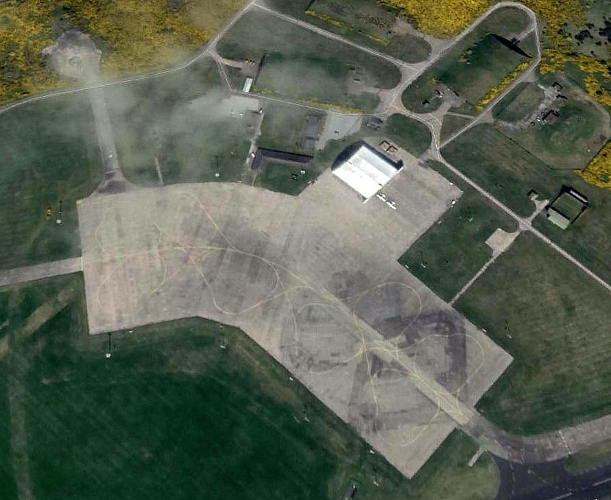
The six Nimrods are clear enough on the second picture, but what are the two aircraft on the other apron to the south?
Military users: WW2: RAF Bomber Command 91 Group
EFTS (Airspeed Oxfords)
19 OTU (Vickers Wellingtons & Armstrong-Whitworth Whitleys)
45 MU (Maintenance Unit)
RAF Coastal Command
115 Sqdn (Vickers Wellingtons)
Note: These two pictures from postcards were kindly sent by Mike Charlton who has an amazing collection. See www.aviationpostcard.co.uk
I imagine they were taken in the 1960s, but if anybody can kindly offer advice, this will be most welcome.
Post 1945: RAF School of Maritime Reconnaissance
'V' Bomber dispersal airfield
OTU (Operational Training Unit)
42(R) (Avro Shackleton T.4s)
120 Sqdn (Avro Lancaster GR.3s, later Avro Shackletons then BAe Nimrods)
42, 201 & 206 Sqdns (BAe Nimrods)
663 VGS (Volunteer Gliding Squadron)
This picture was kindly sent by Mike Holder, a great friend of this 'Guide', and pictured fourth up the steps on the left. This was taken as the crew ascended into the last Nimrod Mk.1 flight, (XV261), from here on the 11th October 1982. Their destination was St MAWGAN in CORNWALL.
1998 snapshot: RAF Maritime Patrol
120 Sqdn 8 x Nimrod MR 2
201 Sqdn 8 x Nimrod MR 2
206 Sqdn 7 x Nimrod MR 2
RAF Operational Conversion Unit
42 (R) Sqdn (NOCU) 3 x Nimrod MR 2
Note: Are these two light aircraft, parked with military precision, and pictured from Google Earth ©, Grob Tutors? Can anybody kindly offer advice?
British airline users: Post 1945: Business Air
Flying club/school: Moray Flying Club
Gliding: 1981 Fulmar Gliding Club
Pollution control: Post 1945: Harvest-Air (see SOUTHEND for a fuller history)
Location: E of B9011, N of B9089, NNW of Kinloss village, 2nm NE of Forres, 8nm W of Elgin
Period of operation: 1939 to -
Runways: WW2: 08/26 1829x46 hard 02/20 1280x46 hard
14/32 1280x46 hard
2000: 08/26 2311x46 hard
Note: This picture from Google Earth © clearly shows a parallel runway, north of 08/26 and marked out to 1720 metres. Once a taxiway it was not marked out in 2009, but marked as disused in 2014. Can anybody kindly offer an explanation? My first impression was that the idea might be to save taxying time for example to light aircraft based here - but they certainly wouldn't need a runway anywhere near this long.
NOTES: It is claimed that during WW2 the OTU (Operational Training Unit) had some sixty serious accidents here, (or at least by aircraft on training flights), and I believe most of these involved fatalities?
In his excellent book Spitfire Voices, Dilip Sakar quotes from the 1939 diary of Pilot Officer Laurie Whitbread: 12th June, "Someone's going to get hurt before long. Oxford aircraft not being maintained in good condition. Petrol gauge and undercarriage lights all wrong. Not good enough."
In 1939, despite getting new fighters such as the Hurricane and Spitfire, which the 'upper' officers in the RAF had no idea how to use, the state of the RAF as a whole was pretty abysmal in most regards. The arrival of WW2 caught them 'with their pants down' by and large.
In 1960 the RAF Maritime OTU were operating Shackleton T.4s here
During 1977 at least it seems that a Fournier RF3 G-ATBT operated by the Fulmar Flying Group was operating here. For a period Harvest Air had DC-3s and Islanders based here on Oil Pollution Control duties.
We'd love to hear from you, so please scroll down to leave a comment!
Leave a comment ...
Copyright (c) UK Airfield Guide


