


Otterburn Camp
Note: This map shows the location of OTTERBURN CAMP.
OTTERBURN RANGES & CAMP: Military airstrip(s)?

Aerial view 2006

Aerial view 2018
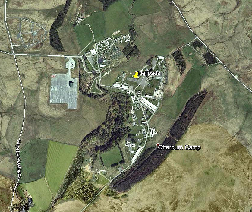
Arial overview
Note: These three pictures were obtained from Google Earth ©
Military users: Used by Army AOP Austers in WW2, and many other types since it seems. The Camp itself in more recent years has several helipads.
Location: Otterburn village is on the A696, about 30nm NW of Newcastle-upon-Tyne. The ranges are now part of the SPADEADAM WRDA/AIAA.
A look at Otterburn Camp on Google Earth (image date 2009) shows two roughly 'dumb-bell' shaped areas, (hard), marked with an 'H' pretty much in the centre of the camp. There are four 'hard' circular areas nearby, presumably also for use by helicopters.
We'd love to hear from you, so please scroll down to leave a comment!
Leave a comment ...
Copyright (c) UK Airfield Guide

