Now having 7,000 + listed!

Probably becoming the most extensive British flying sites guide online...?

portfolio1 portfolio2 portfolio3 portfolio4

Heading 1

This is an example of the content for a specific image in the Nivo slider. Provide a short description of the image here....

Heading 2

This is an example of the content for a specific image in the Nivo slider. Provide a short description of the image here....

Heading 3

This is an example of the content for a specific image in the Nivo slider. Provide a short description of the image here....

Heading 4

This is an example of the content for a specific image in the Nivo slider. Provide a short description of the image here....

small portfolio1 small portfolio2 small portfolio3 small portfolio4
themed object
A Guide to the history of British flying sites within the United Kingdom
get in touch

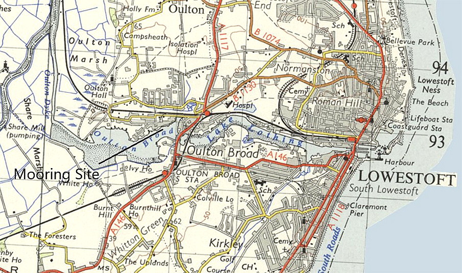
Oulton Broad


OULTON BROAD:   Temporary water landing site

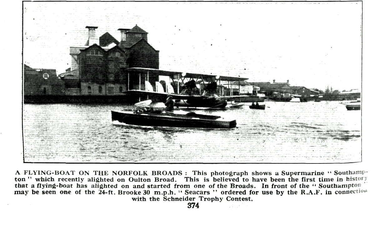
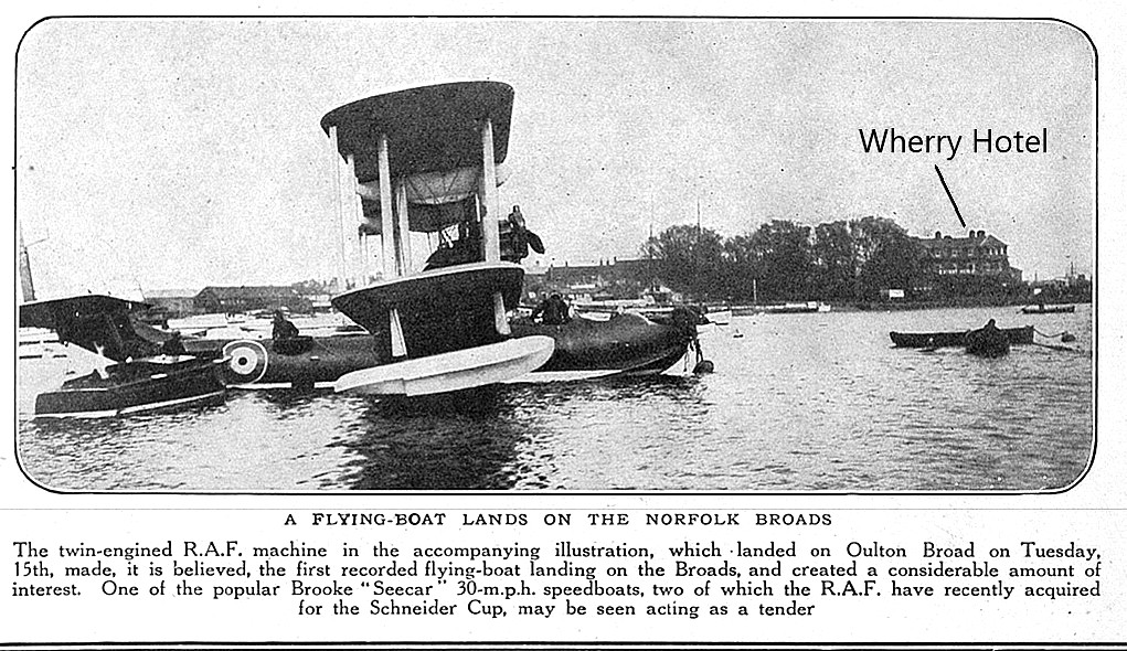
It appears that a Supermarine Southampton flying boat landed on OULTON BROAD on the 7th May 1929. Claimed to be the first flying boat to land on a Norfolk Broad. But, we need to be a tad careful here, without too much doubt seaplanes had alighted on the Broads well before? For those not familiar with the subject, a seaplane is a land-plane equipped with floats, whereas a flying boat is an aeroplane in which the lower part of the fuselage comprises the 'boat', or hull.

Location:  Just W of Lowestoft town centre

Period of operation:  There appears to be some amount of question about this, but, most probably the 7th May 1929.

NOTE:  What we don't know, is where it flew from? My guess, and it is just a guess, perhaps from FELIXSTOWE?


A MICHEAL T HOLDER GALLERY

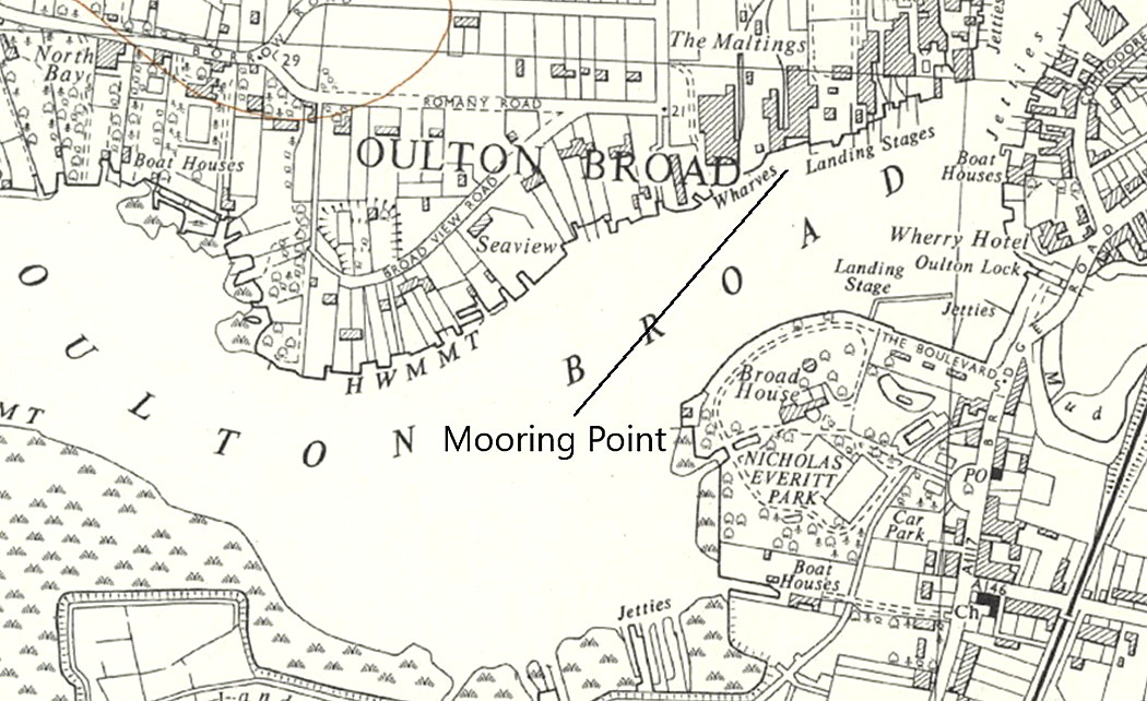
Local map c.1956
Local map c.1956
Picture in<em> Flight</em> magazine
Picture in Flight magazine
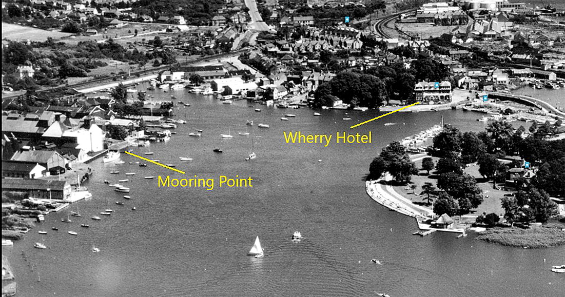
Aerial photo 1951
Aerial photo 1951
Google Earth © view
Google Earth © view

Note: The second item was published in Flight magazine on the 9th May 1929.


Picture in <em>Tatler</em>
Picture in Tatler
Aerial photo c.1945
Aerial photo c.1945
Local area map
Local area map
Area view
Area view


The fifth item, a picture in Tatler magazine, was published on the 22nd May 1929.


I have added the eighth item from my Google Earth © based database.

As always in this 'Guide', if anybody can kindly offer more advice and information, this will be most welcome.


We'd love to hear from you, so please scroll down to leave a comment!


Leave a comment ...


Name
 
Email:
 
Message:


Copyright (c) UK Airfield Guide


slide up button