


Park Farm Oast
PARK FARM OAST: Private airstrip
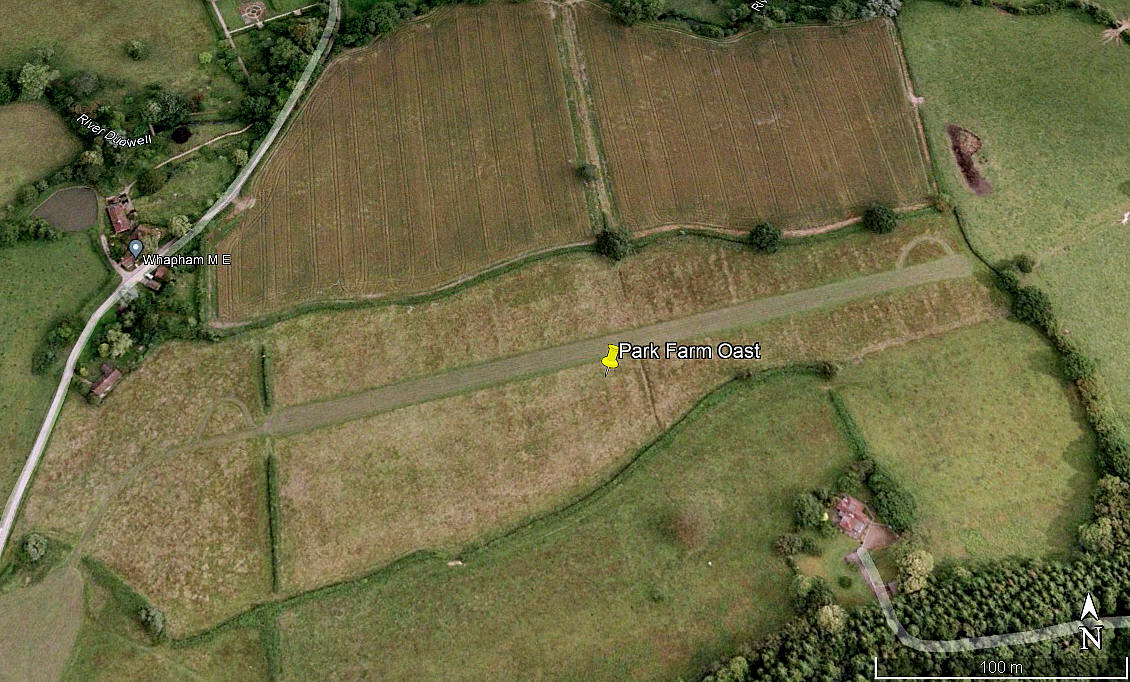

Note: The first three pictures were obtained from Google Earth ©. The area view is from my Google Earth © derived database.
Location: Just SSW of Burwash village on the A265. About 12nm NW of Hastings town centre
Period of operation: Unknown? Certainly in or around the first decade of the 21st century
Runway: 08/26 320 grass
NOTES: We have Mr Graham Frost, a great friend of this 'Guide', to thank for pointing out this location.
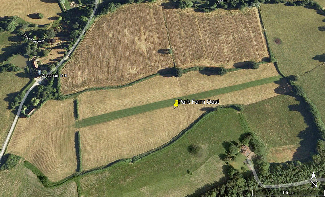
The 2015 picture above is included for two reasons. Firstly to amply illustrate how often it is difficult to identify a known flying site using Google Earth images that mostly date back to the start of the 21st century. The second reason being that, almost certainly in this case(?), evidence of even a private grass airstrip can be still be seen years after it ceased to be used.
It is of course well known that archealogists often use aerial photography in drought conditions to identify sites going back to thousands of years ago. When flying around the UK years ago in similar drought conditions, I was sometimes amazed to see a few WW2 airfields, usually invisible from the air, appearing with a remarkable degree of detail. Not just runways either - taxiways, aprons, dispersal areas etc, all quite clearly seen.
Graham also tells us that the Rans S6-116 Super Coyote, G-BUWK, was based here. It was registered from April 1993 to May 2021 to Mr Richard Warriner. However, sadly, the information on the British register in 2023 shows the addressee status as deceased. Which may well help to explain why the strip appears to have been unused in recent years.
We'd love to hear from you, so please scroll down to leave a comment!
Leave a comment ...
Copyright (c) UK Airfield Guide

