Phoenix Farm
PHOENIX FARM: Private airstrip and helipad
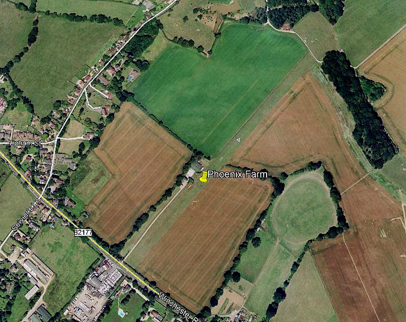
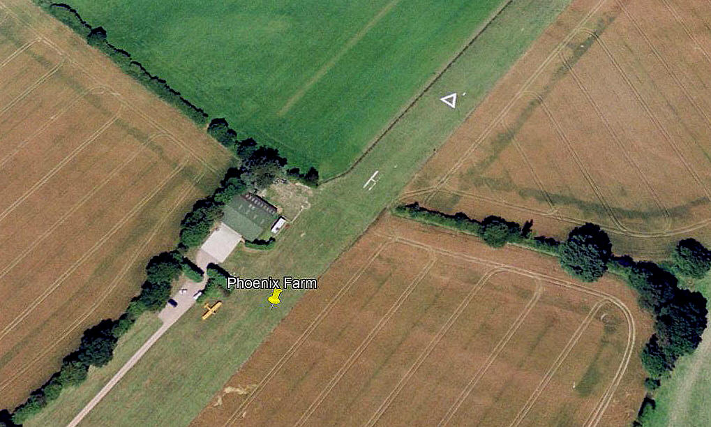
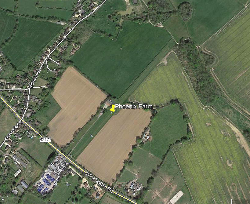
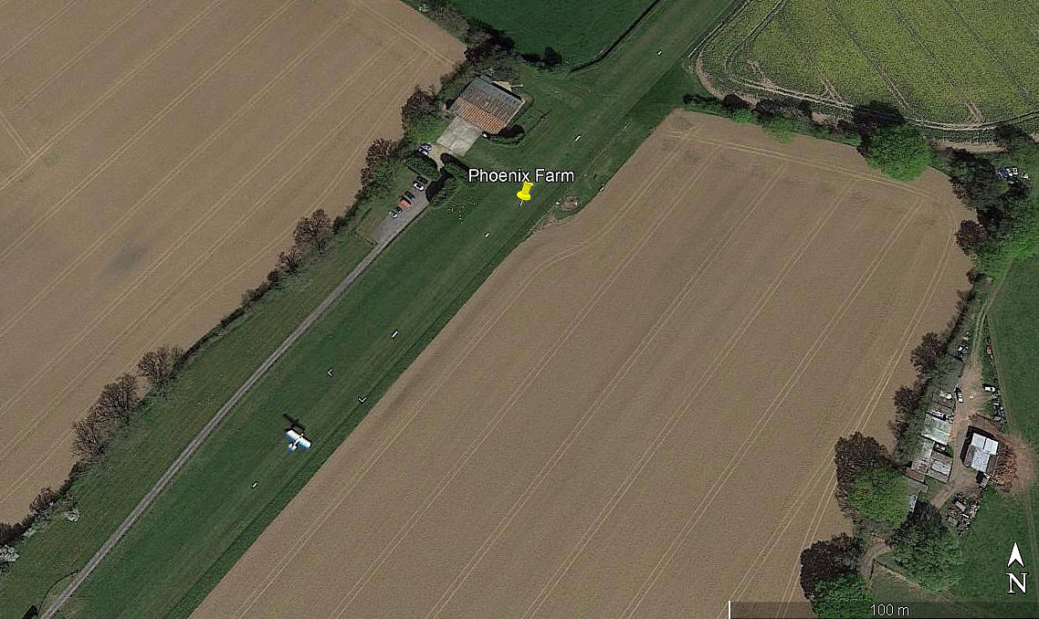
Note: All four of these pictures were obtained from Google Earth ©
Operated by: Mr John Woodhouse up till about 2000?
Later Mr R Lamplough
Flying School: Solent Flight (Ikarus C42s)
Maintenance & Restoration: Classic & Vintage Aircraft Services
Location: S of Lower Upham, about 2nm WNW to NW of Bishops Waltham, roughly 4nm ENE of EASTLEIGH
Period of operation: 1990s (?) to -
Runway: 04/22 500 grass
In 2007 04/22 listed as being 648m and an AAIB report in 2012 claims 04/22 was now 570m. But, another later AAIB report, EW/G2015/01/01 states the 04/22 runway was now 648 metres long.
If looked at on Google Earth the runway does appear to be around 600 metres long. However, closer inspection shows, on the 2018 picture, that the 'marked' runway was 04/22 at 465 metres. The detail picture in 2000 shows a 'helipad' marked on the runway.
NOTES: It seems Mr Woodhouse operated a commercial helicopter operation based here for many years.
I must confess that I hadn't looked at this listing for several years, and it was a bit untidy - to say the least. Thanks to Mr Jay Dillon contacting me in April 2019, (see 'Comments' below), I have had another look, made several changes and added the pictures. Just one point, ROUGHAY FARM is about 0.5nm north of PHOENIX FARM - not west.
Jay Dillon
This comment was written on: 2019-04-21 15:16:14Re my previous comment about Roughay and Phoenix being different strips - I think Roughay is the first runway you list on a different bearing with a "?"!
Jay Dillon
This comment was written on: 2019-04-21 15:18:45(In case you didn't get it) Roughay Farm is half a mile West of Phoenix Farm (aka Lower Upham Airfield) and a different strip)
Jay Dillon
This comment was written on: 2019-04-21 15:20:47Re Roughay/Phoenix Farm & Lower Upham Airfield - see aviation-safety.net/wikibase/wiki.php?id=33582 for example
We'd love to hear from you, so please scroll down to leave a comment!
Leave a comment ...
Copyright (c) UK Airfield Guide


