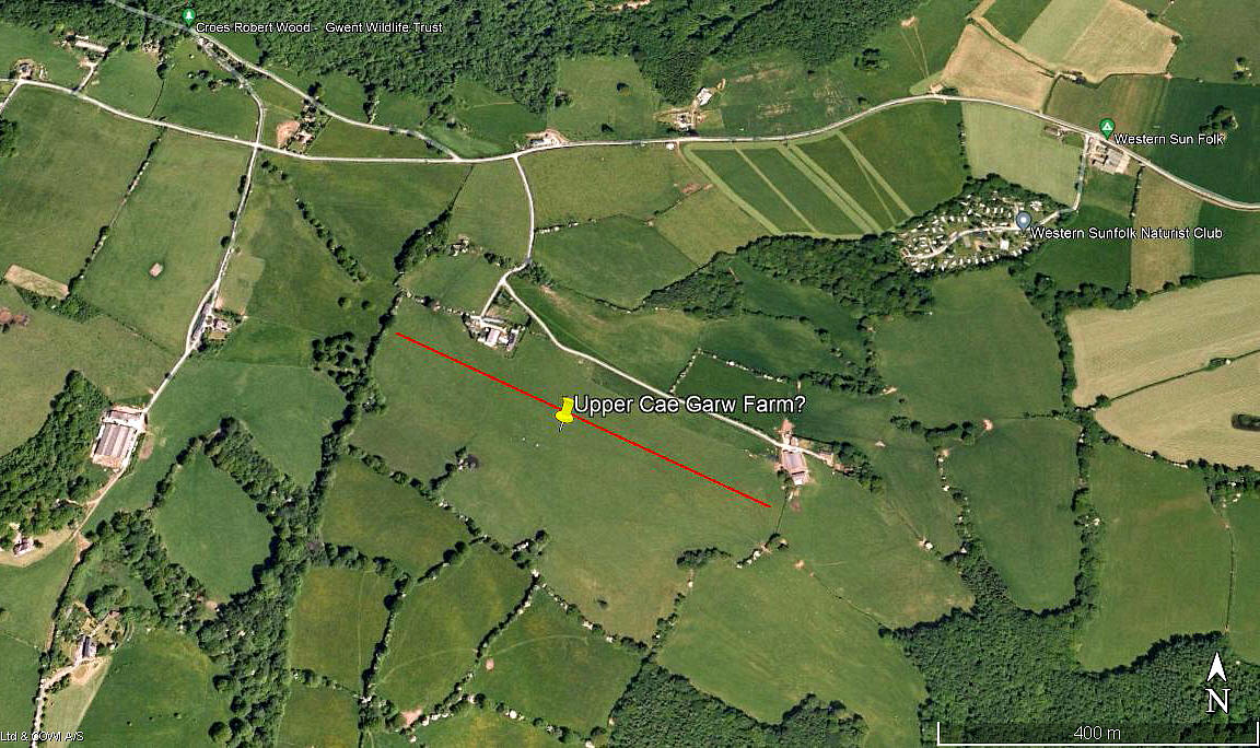
Upper Cae Garw Farm
Note: This map only shows the position of Trelleck village within the UK. A good look at Google Earth (image 2014) does not appear to show an obvious airstrip in the vicinity. But, see my notes below, was there ever a strip here? Any advice will be most welcome.
UPPER CAE GARW FARM: Private airstrip?
Note: The first two pictures were obtained from Google Earth ©. The area view is from my Google Earth © derived database.
Location: W of Trelleck village which is on the B4293, about 4.5nm S of Monmouth
NOTES: Yet again this information comes from Ron Smiths excellent book British Built Aircraft Vol.5. It was here that Speedtwin Developments Ltd developed the Philips ST1 Speedtwin G-DPST which was first displayed publicly in 1992 and the development, despite a serious crash, is still ongoing. But, is this still the case? (Note written in 2016).
A QUESTION?
My question is of course, did Speedtwin Developments actually have an airstrip here? I suspect they might have, it seems to make sense, but can anybody kindly offer advice?
Looking at Google Earth images, the only field I can find that seems large enough is marked on the first picture above. It would allow, for example, a runway of just over 500 metres orientated roughly E/W. This is of course just conjecture.
What might well be a source of rumour and, possibly, speculation - is that the Speedtwin G-DPST was registered to Susan Elizabeth Philips from May 1996 to May 2000 - at this address. Which of course is no proof at all the aircraft was based here. Or at least in a flyable condition. It is very often a problem in trying to produce a 'Guide', to try and provide proof.
We'd love to hear from you, so please scroll down to leave a comment!
Leave a comment ...
Copyright (c) UK Airfield Guide


