Hadleigh flying sites
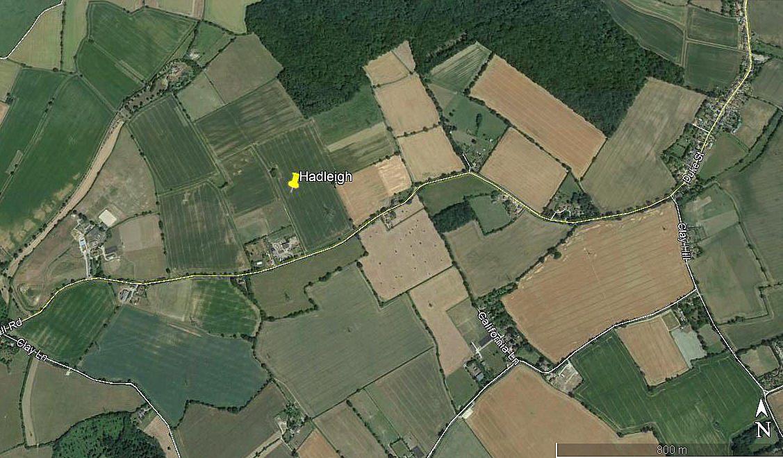
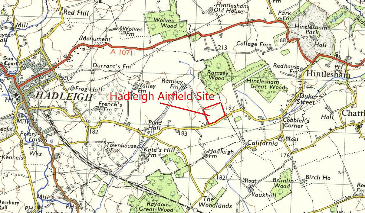
Note: This map gives the location of the WW1 aerodrome. Which, in 1927, became a civil aerodrome.
HADLEIGH: Gliding site
NOTES: Listed in 1975. See ELMSETT
HADLEIGH: Military aerodrome
Note: This picture was obtained from Google Earth © and I have the Airfields of Britain Conservation Trust to help me pinpoint this location.
Military users: RFC/RAF (Royal Flying Corps / Royal Air Force)
51 [Home Defence} Sqdn (1916 to 1917) (Royal Aircraft Factory B.E.2 and B.E.12 types)
Home Defence Flight Station RFC/RAF (Royal Flying Corps/Royal Air Force 1917 to 1918)
Location: Hadleigh is on the B1070, S of the A1071, 10nm NNE of Colchester
Period of operation: Military: 1916 to 1919? Civil: 1927 to ?
Site area: 80 acres 640 x 503
NOTES: Incredible though it might seem HADLEIGH, (presumably this site?), was, according to Graham Smith in his excellent book ‘Taking To The Skies’ accorded international Air Port status by being Customs Approved in 1919. For me he passed the ‘Litmus test’ by including CRICKLEWOOD (LONDON) which very few writers and historians include. HOUNSLOW HEATH (LONDON) was the first in April 1919. Following on was LYMPNE and DOVER, (presumably SWINGATE?), in KENT. However, I cannot find any evidence that HADLEIGH was ever used as a Customs Airport.
Other airport sites were nominated at that time it seems, (but perhaps not Customs approved? These were Bristol (FILTON), Sheffield (where?), Liverpool (NORTH SHOTWICK), Doncaster (where?), Newcastle (where?) and Edinburgh, (presumably TURNHOUSE?)
It might well be wondered why HADLEIGH had been nominated? Probably the main reason was that London in those days was almost entirely coal powered and the dense ‘fog’ produced drifted east with the prevailing sou-westerly winds. When a high pressure system came along this produced a ‘smog’ when visibility was reduced to barely a few metres at best. As a lad I can recall being barely able to see my outstretched hand in the worst ‘smogs’ so getting to or from school required remembering the route very exactly. (We walked in those days of course even from the age of five).
This is why the first Air Ports were established either West, North or South or well East of central London. This said, they were all regularly often affected by fog/smog, especially in the winter months.
HADLEIGH: Civil aerodrome (From 1927. On the same site as the WW1 aerodrome)
A PICTURE GALLERY
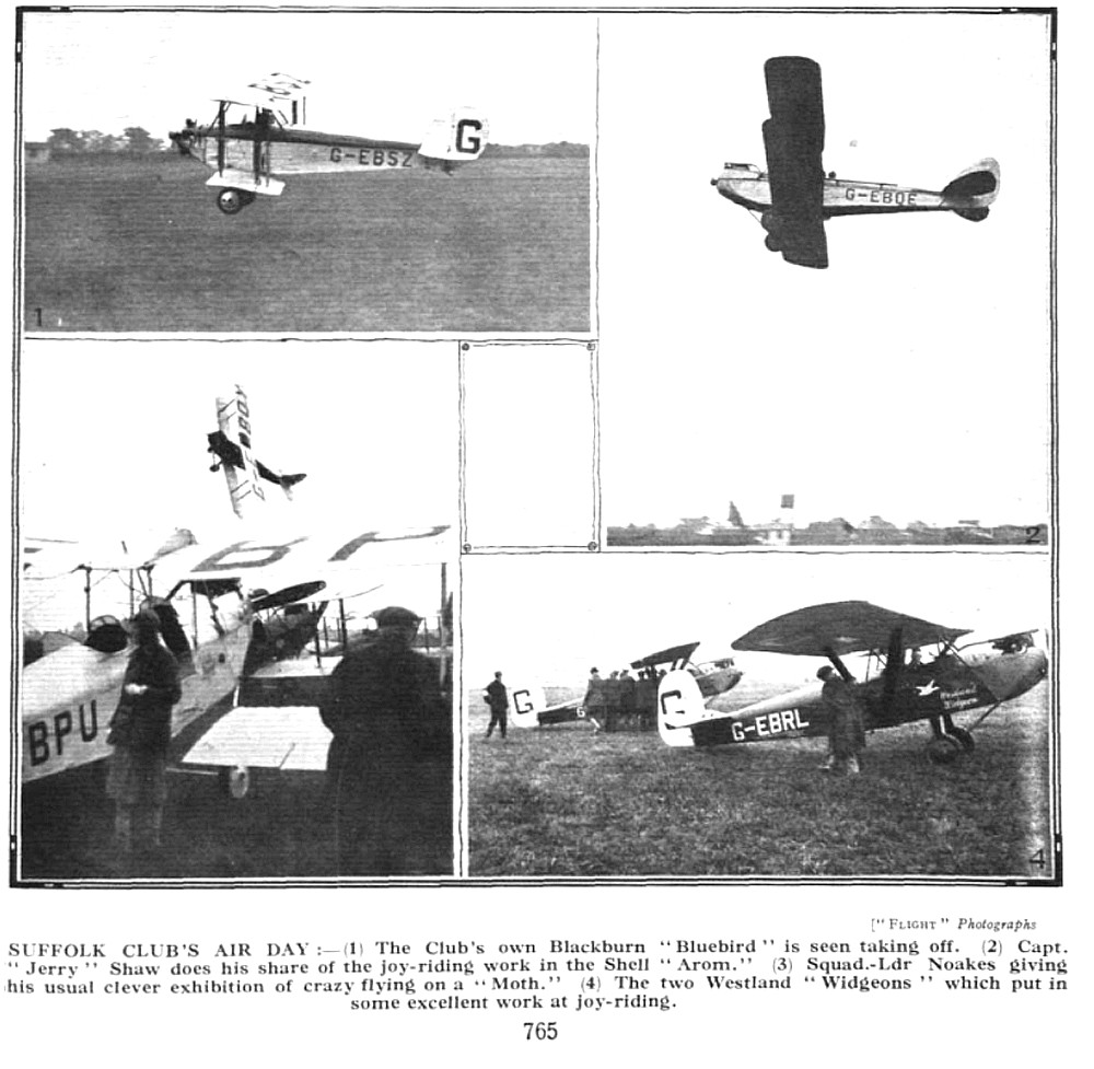
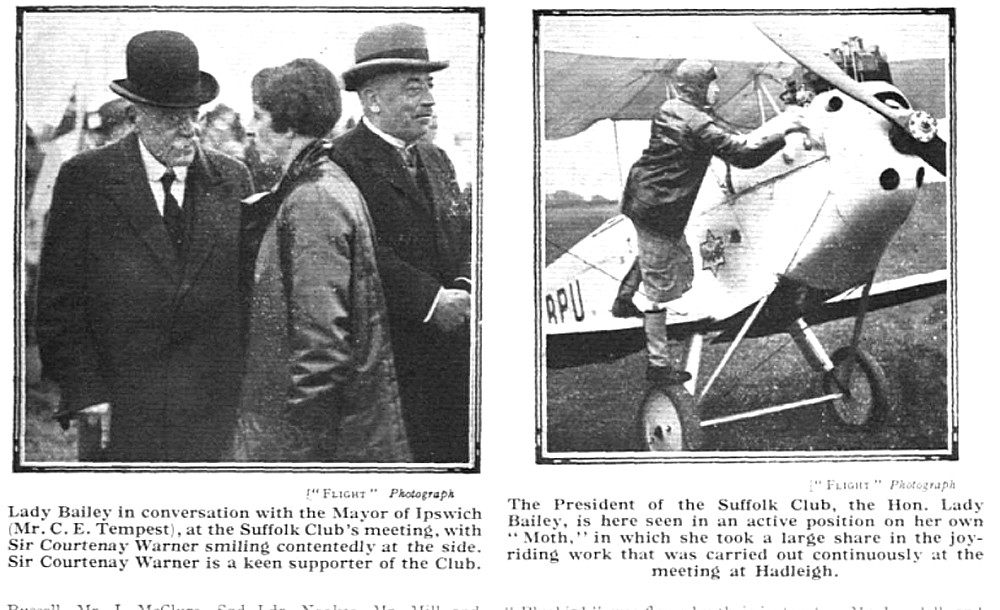
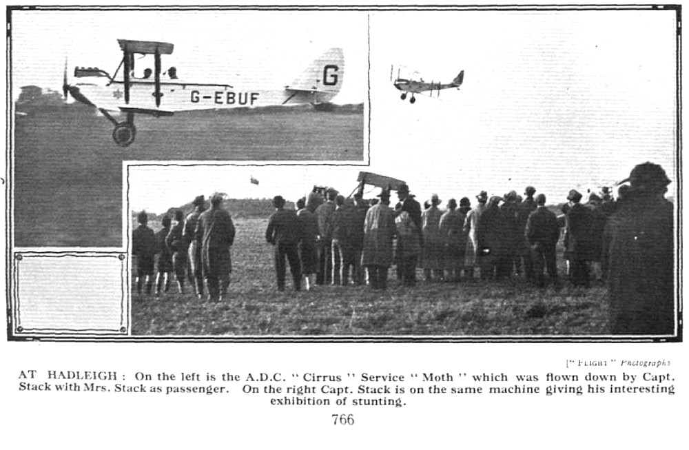
Mr Michael T Holder, a great friend of this 'Guide', tracked down these pictures published in Flight magazine on the 3rd November 1927. They were taken at the Suffolk & Eastern Counties Aeroplane Club's Air Day held on the 30th October. Without any doubt they illustrate the immense impact the de Havilland DH60 Moth, which first flew on the 22nd February 1925, was already having. The type totally dominated this event, with examples seen in these pictures being: G-EBPU (DH60 Moth), G-EBQE (DH60 Moth), G-EBQY (DH60 Moth), G-EBUF (DH60X Moth) and G-EBUR (DH60X Moth).
The other two types pictured are the Blackburn L.1A Bluebird II G-EBSZ and the Westland Widgeon III G-EBRL. It would appear that this event celebrated the opening of the Club and the aerodrome.
A LATER ASPECT
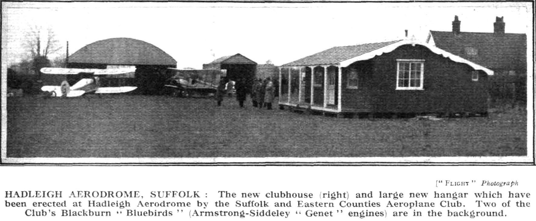
Note: These two pictures from Flight magazine, the two maps and the ground view picture, (also from Flight magazine), were also kindly provided by Mike Holder. The Rally was held over the 31st August and Ist September 1929.
Operated by: Suffolk & Eastern Counties Aeroplane Club
Location: As per the WW1 aerodrome listed above probably?
Period of operation: 1927 to 1931 only?
NOTES: Two Blackburn Bluebirds, (the first G-EBRE, the second G-EBSZ), were registered to Suffolk & Eastern Counties Aero Club who operated them between 1927 and 1931 although one crashed. A history of the Suffolk and Eastern Counties Aeroplane Club was published in the February 2007 edition of Popular Flying magazine. Compiled by David J Keeble it is well worth reading. In 1931 they moved to IPSWICH
In 1929 an ‘Air Taxi’ service to Cambridge, (TEVERSHAM I’d imagine?), was started. New clubhouses at both ends served as ‘terminals’ but I imagine only one passenger could be carried? Such an arrangement was not too unusual in those days. This certainly gives a clue as to the state of the roads, (obviously no rail link existed?), as the point to point distance is only 35 miles
We'd love to hear from you, so please scroll down to leave a comment!
Leave a comment ...
Copyright (c) UK Airfield Guide


